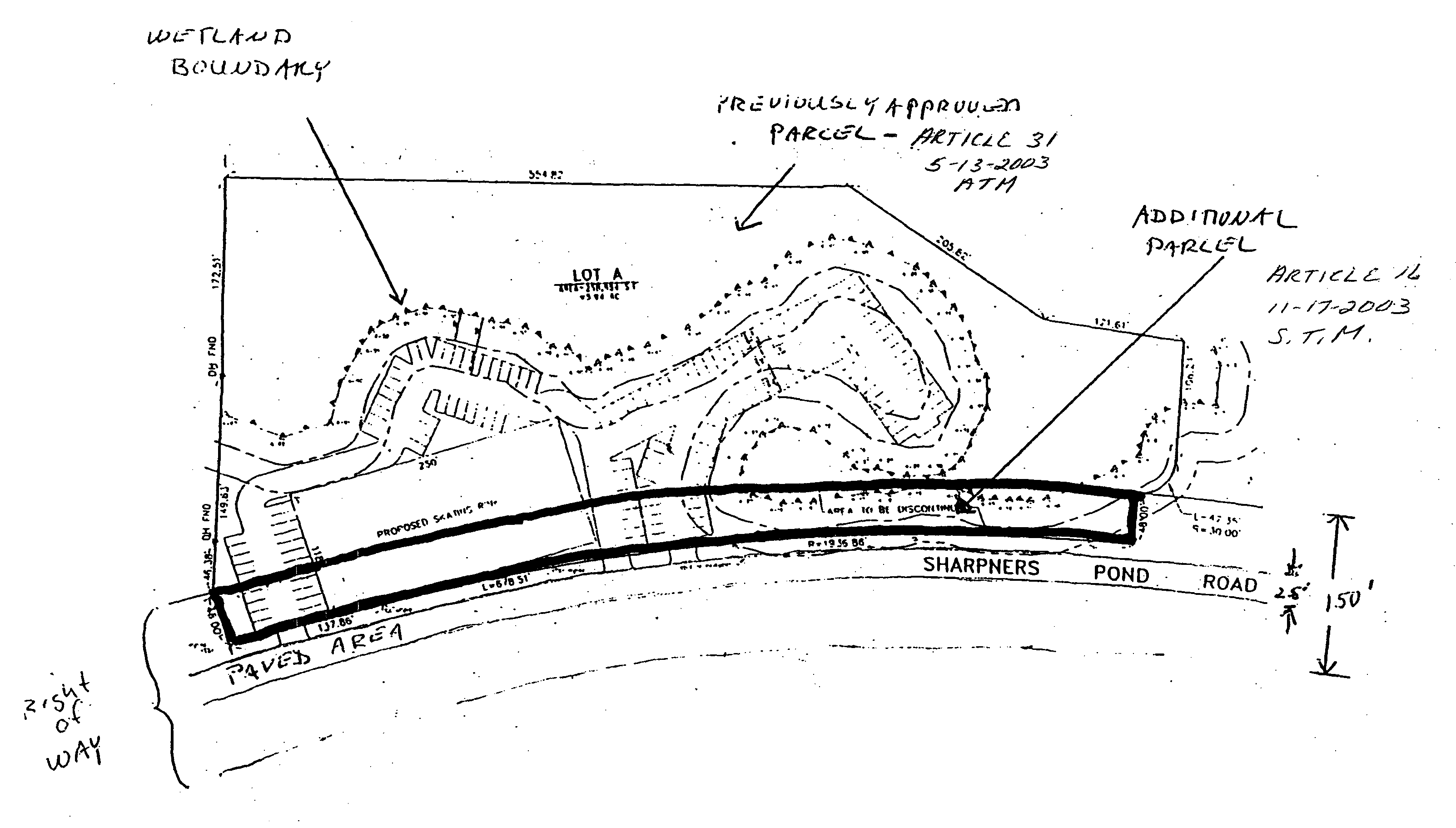
Beginning at the northwesterly corner at a point on a stone wall at land of the Town of�
North Andover at a point 46.36' southeasterly from a drill hole in a stone wall, said point being on the sideline of Sharpners Pond Road, running�
Northeasterly 137.86' along the sideline of Sharpners Pond Road along land of the Town of North Andover to a point of curvature, thence�
Northeasterly 695.33' along the sideline of Sharpners Pond Road along land of the Town of North Andover to a point of curvature, thence�
Southeasterly 48.00' into the right of way of Sharpners Pond Road to a point, thence�
Southwesterly 678.51'along a curve to the left of radius of 1936.86' along a line within the Sharpners Pond right of way to a point of curvature, thence�
Southwesterly 137.86'along a line within the Sharpners Pond Road right of way to a point, thence�
Northwesterly 48.00'along a line within the Sharpners Pond Road right of way to a point on a stonewall said point being the point of beginning.�
Said parcel contains 39,629 square feet land area; or take any action relative thereto.�


Parcel I: The land in North Andover, Essex County, Massachusetts with the buildings thereon, bounded and described as follows: Beginning at the northwest corner thereof by land now or formerly of Clinton C. Barker; thence running easterly by land now or formerly of said Barker to land now or formerly of Jacob Barker; thence southerly by land now or formerly of Mary E. Mason; thence westerly by land now or formerly of said Mason to Osgood Street; thence northerly by said street to the point of beginning. Said parcel containing two and one-half acres of land, more or less.�
Parcel II: A certain parcel of land with the buildings thereon, if any there be, situated in North Andover Essex County, Massachusetts on the east side of the road leading from North Andover to Haverhill, and bounded as follows: Beginning at the Southwest Corner of said road and by land of Mary Barker and running by the fence by said Mary Barker south seventy (70) degrees east, twelve (12) rods; thence by fence and stone wall south sixty-seven (67) degrees east, twenty nine (29) rods to a corner of the wall; thence turning and running northeast as the wall stands still by land of Mary Barker five (5) rods and twenty-one (21) links to a stake by the wall; thence turning and running Northwest in a straight line by land of Haseltine and Day to a stake by the above-named Haverhill road standing five (5) rods and twenty-one (21) links north from point of commencement; thence south by the east side of said road to a point of beginning, containing one and one-half acres, more or less.�
Excluded from the above-described parcels is that portion of the premises taken for the layout of Osgood Street in Book 933, Page 170.�
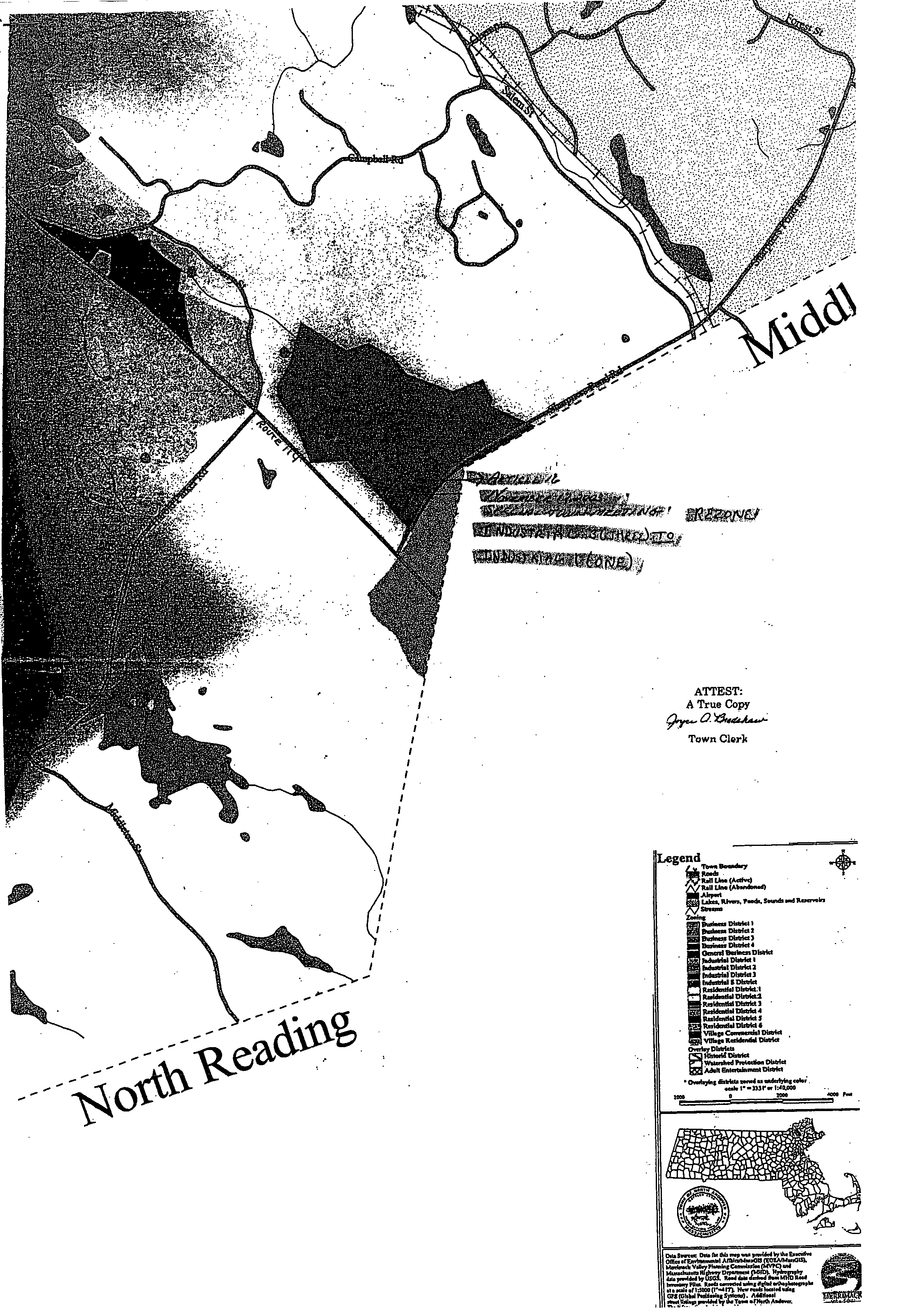
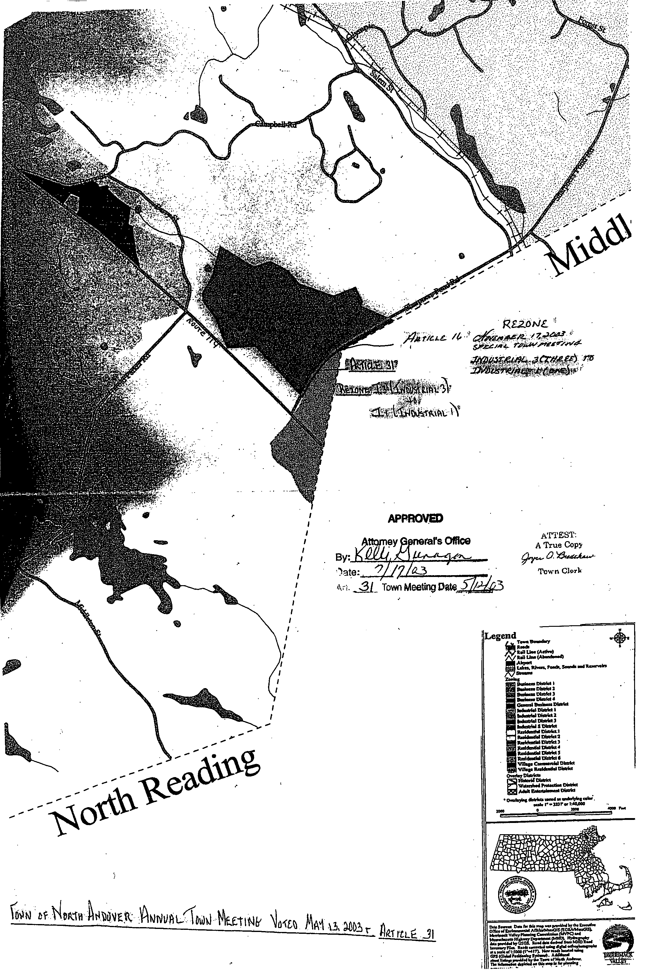
**Webmasters Note: The previous Articles of Case No. 2795 amend the zoning map which can be viewed at the zoning map link of the town page.�