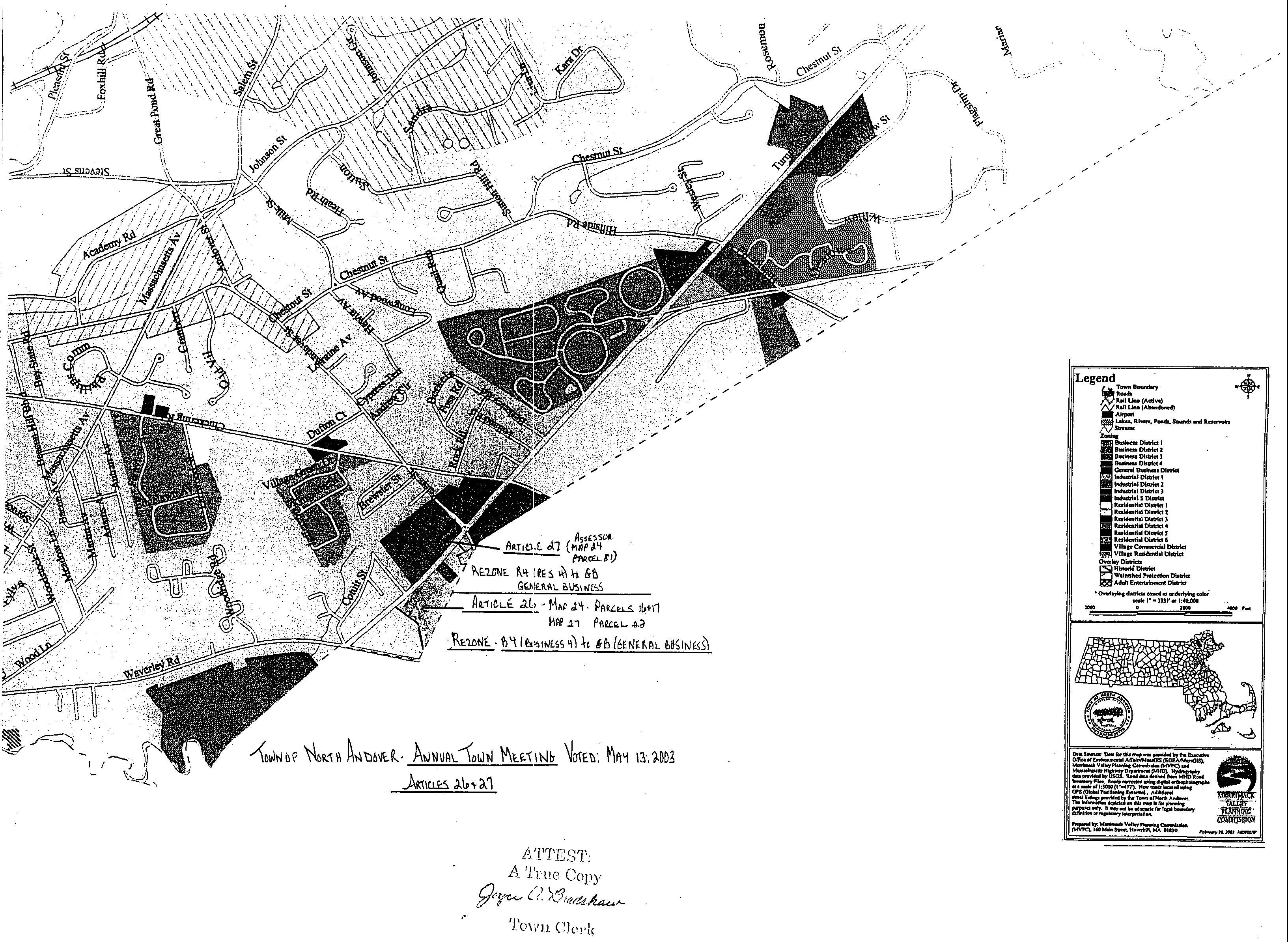
Legal Description - Assessor's Map 24 Parcel 16 - A certain parcel of land located north of Peters Street and west of Salem Turnpike in the Town of North Andover, in the County of Essex and the Commonwealth of Massachusetts bounded and described as follows:�
Beginning at a point on the southwesterly side of Salem Turnpike at a distance of one hundred fifty five feet, more or less, (155+/-) north of the northerly sideline of Peters Street and on the westerly sideline of Salem Turnpike and being the southeast corner of the parcel hereinafter described; thence �
S 64 26' 14" W a distance of one hundred fifty and seventy six hundredths feet (150.76') to a point; thence�
N 10 59' 19" W a distance of one hundred ninety and fifty hundredths feet (109.50') to a point; thence�
S 86 57'55"W a distance of one hundred fifty three and eighty hundredths feet (153.80') to a point; thence�
S 01 56' 15"E a distance of seventy and twenty hundredths feet (70.20') to a point; thence�
N 46 14'03"W a distance of one thousand three hundred fifty nine and nine hundredths feet (1,359.09') to a point; thence�
N 27 24'30"E a distance of one hundred ninety three and sixty five hundredths feet (193.65') to a point; thence�
S 82 13'58"E a distance of three hundred one and seventy two hundredths feet (301.72') to a point; thence�
N 02 08'43"E a distance of sixty and no hundredths feet (60.00') to a point; thence�
S 87 03' 15"E a distance of forty six and twenty nine hundredths feet (46.29') to a point; thence�
N 66 35'29"E a distance of two hundred forty eight and no hundredths feet (248.00') to a point; thence�
S 23 24'30"E a distance of one hundred twenty two and eighty six hundredths feet (122.86') to a point; thence�
S 23 24'30"E a distance of two hundred two and five hundredths feet (202.05') to a point; thence�
S 66 35'34"W a distance of two hundred fifty and no hundredths feet (250.00') to a point; thence�
S 23 24'30"E a distance of two hundred and no hundredths feet (200.00') to a point; thence�
N 66 35'30"E a distance of two hundred fifty two and twenty four hundredths feet (252.24') to a point; thence�
Southeasterly and curving to the left along the arc of a curve having a radius of four thousand sixty six and no hundredths feet (4066.00'), a length of five hundred ten and eighteen hundredths feet (510.18') to a point of tangency; thence�
S 32 30'00" E a distance of three hundred thirteen and forty two hundredths feet (313.42') to the point of beginning.�
The above described parcel contains 578,797 Sq. Ft. or 13.287 acres.�
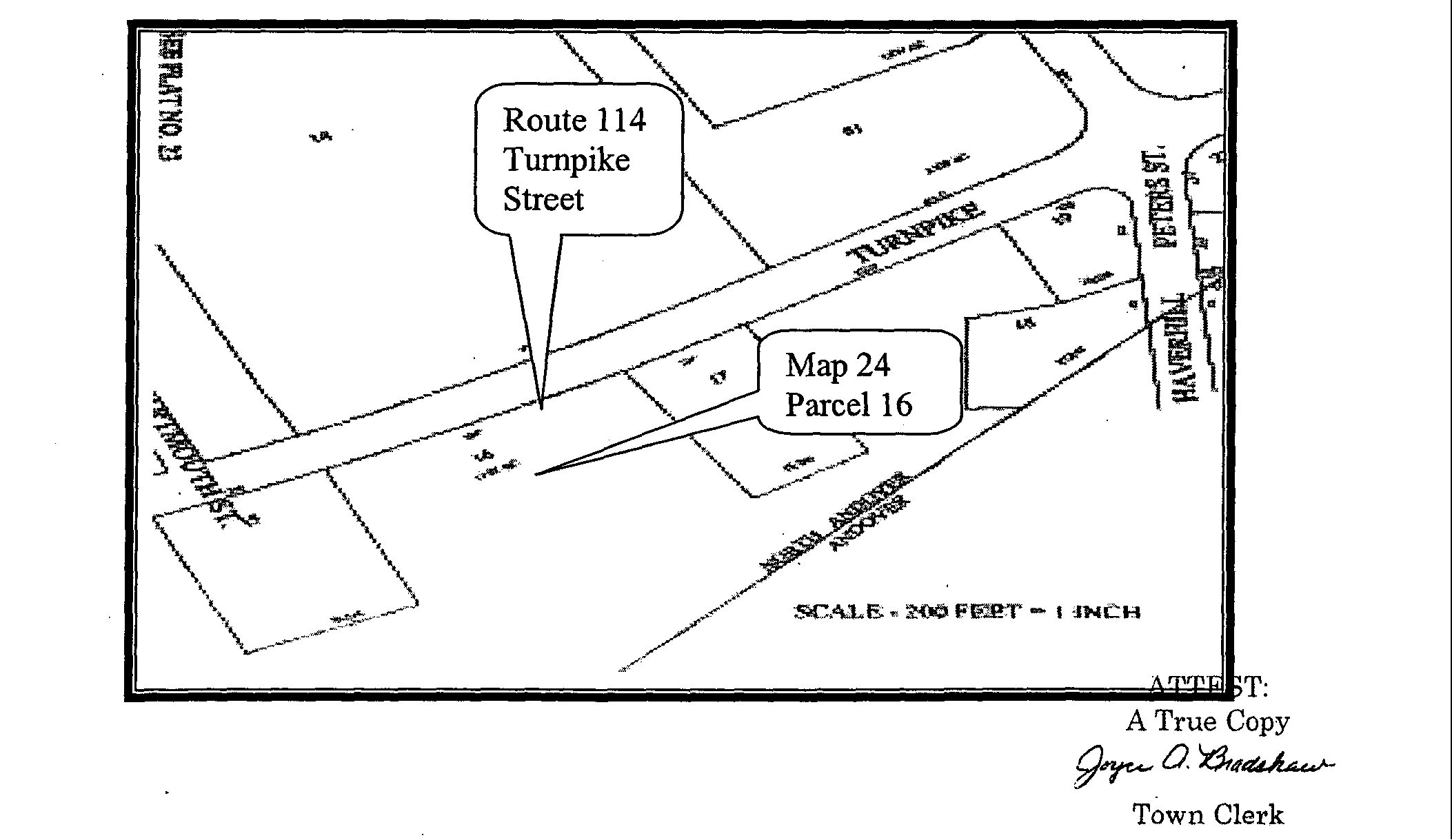
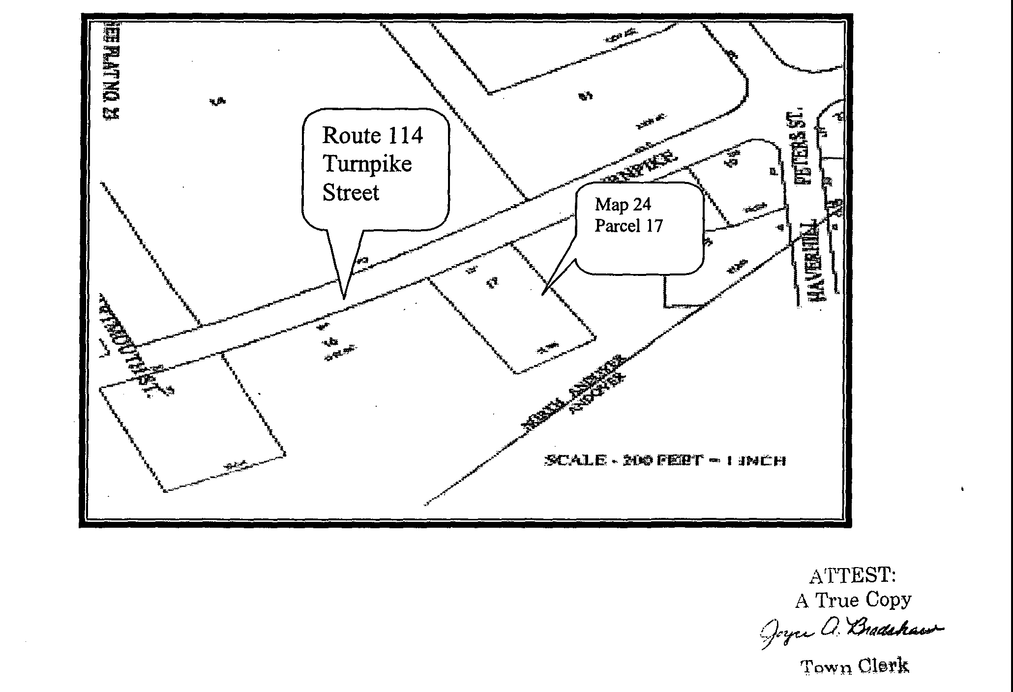
Legal Description - Assessor's Man 24, Parcel 17: A certain parcel of land located north of Peters Street and west of Salem Turnpike in the Town of North Andover, in the County of Essex and the Commonwealth of Massachusetts bounded and described as follows:�
Beginning at a point on the southwesterly side of Salem Turnpike at a distance of four hundred eighty feet, more or less, (4801) north of the northerly sideline of Peters Street and the westerly side of the Salem Turnpike and being the southeast comer of the parcel hereinafter described; thence�
S 58 40' 10"W a distance of two hundred fifty and no hundredths feet (250.00') to a point; thence�
N 31 19'50"W a distance of one hundred fifty and two hundredths feet (150.02') to a point; thence�
N 58 40' 10"E a distance of two hundred fifty and no hundredths feet (250.00') to a point; thence�
Southeasterly and curving to the left along the arc of a curve having a radius of four thousand sixty six and no hundredths feet (4066.00'), a length of one hundred fifty and three hundredths feet (150.03') to the point of the beginning.�
The above described parcel contains 37,436 Ft. or 0.859 acres of land in the Town of North Andover, Massachusetts.�
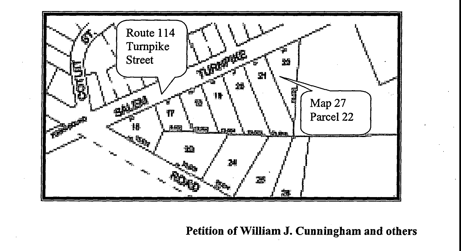
Legal Description - Assessor's Map 27 - Parcel 22: A certain parcel of land located south of Waverly Road and west of Salem Turnpike in the Town of North Andover, in the County of Essex and the Commonwealth of Massachusetts bounded and described as follows:�
Beginning at a point on the southwesterly side of Salem Turnpike at a distance of five hundred ninety feet, more or less (590'+/-) south of the southerly sideline of Waverly Road and on the westerly sideline of Salem Turnpike and being the northeast corner of the parcel hereinafter described; thence�
S 23 24'30" E a distance of one hundred twenty two and eighty six hundredths feet (122.86') to a point; thence�
N 87 03' 15" W a distance of two hundred seventy six and seventy six hundredths feet (276.76') to a point; thence�
N 66 35'29" E a distance of two hundred forty eight and no hundredths feet (248.00') to the point of beginning.�
The above described parcel contains 15,234 Sq. Ft. or 0.350 acres in the Town of North Andover; or take any other action relative thereto.�
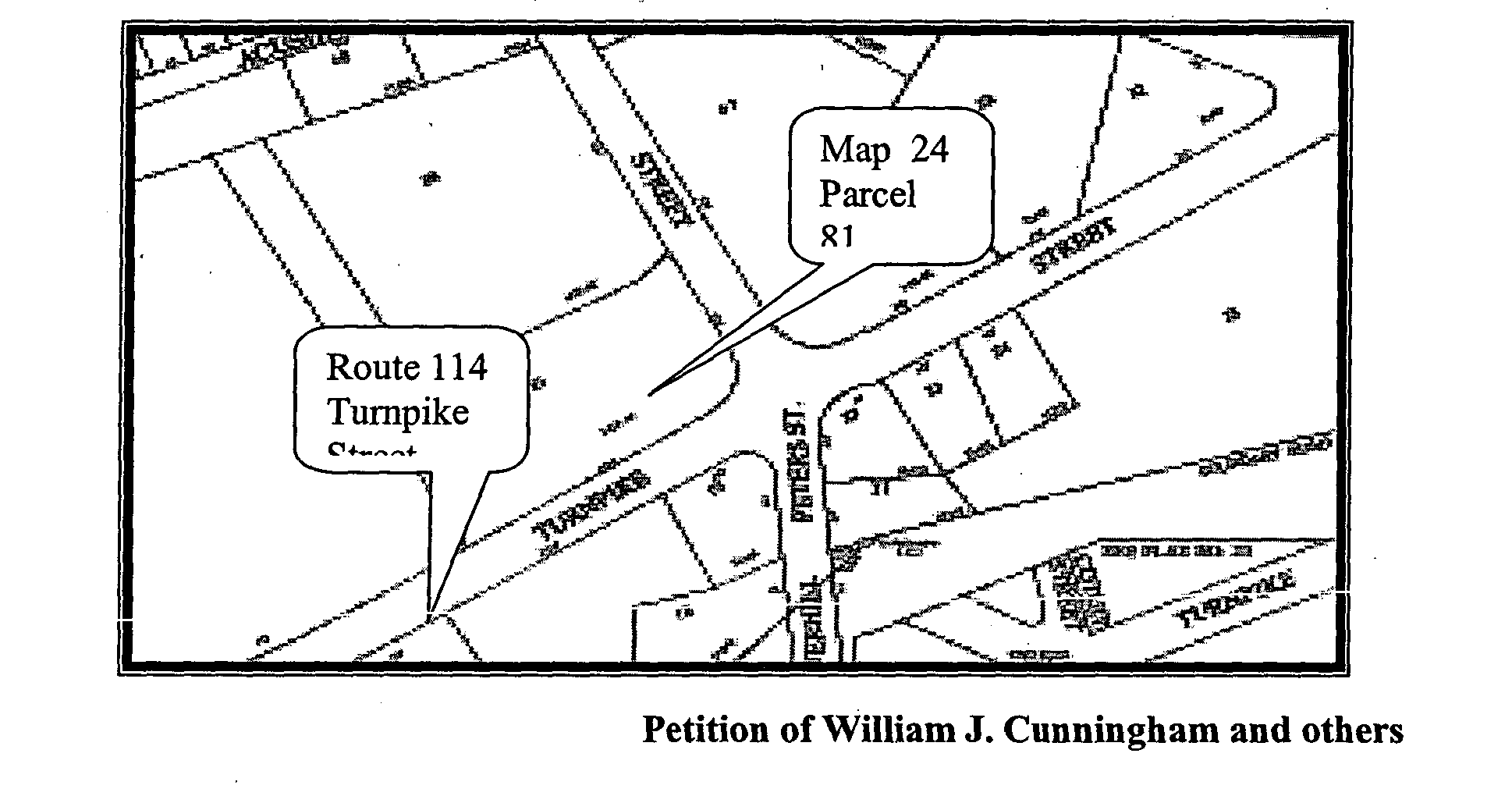
VOTED to amend the Zoning Map of the Town of North Andover- Portion of Route 114 (Turnpike Street) Assessor's Map 24 Parcel 81 from Business Four (B4) to General Business (GB), more specifically, Route 114, Map 24, Parcel 81, containing 2.858 acres more or less that being:�
Legal Description - Assessor's Map 24 - Parcel 81: A certain parcel of land located on the northeast corner of the intersection of Peters Street and Salem Turnpike in the Town of North Andover, in the County of Essex and Commonwealth of Massachusetts bounded and described as follows:�
Beginning at a point on the northeasterly side of Salem Turnpike at a distance of four hundred sixty feet, more or less, (460+/-) northwest of the centerline of Peters Street, on the easterly sideline of Salem Turnpike and being the northwest corner of the parcel hereinafter described; thence�
N 61 05' 39" E a distance of six hundred sixty two and no hundredths feet (662.00') by land of the Lawrence Eagle Tribune to a point; thence�
S 21 46'28" E a distance of sixty two and thirty one hundredths feet (62.31') by land of the Lawrence Eagle Tribune to a point; thence�
S 61 05'39" W a distance of four hundred seven and eighty three hundredths feet (407.83') by lot A to a point; thence�
S 29 02'30" E a distance of three hundred sixteen and ninety six hundredths (316.96') by Lot A to a point; thence�
S 42 40'40" E a distance of fifty and fifty eight hundredths feet (50.58') by Lot A to a point; thence �
S 60 57'30" W a distance of one hundred fifty seven feet and no hundredths feet (157.00) by the sideline of Peters Street to a point of curvature; thence�
Northwesterly and curving to the right along the arc of a curve having a radius of eighty and no hundredths feet (80.00'), a length of one hundred twenty and eighty three hundredths feet (120.83') to a point of tangency; thence�
N 32 30'00" W a distance of three hundred fifty four and no hundredths feet (354.00') to the point of beginning.�
The above parcel is shown as lot B and described in the deed in North Essex County Registry of Deeds at book 3068 Page 299. The above metes and bounds description is taken from a plan prepared for First Methodist Church dated December 20, 1989 by Richard F. Kaminski and Associates, Inc. and recorded as Plan number 11717 in the North District Essex Registry of Deeds.�
The above described parcel contains 124,482 Sq. Ft. or 2.858 acres more or less in the Town of North Andover, Massachusetts. �
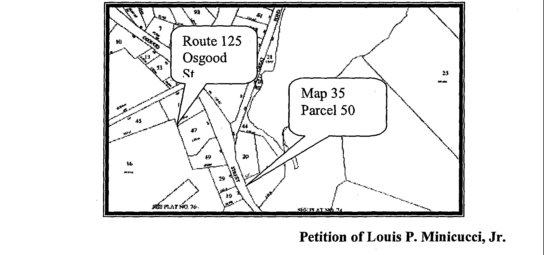
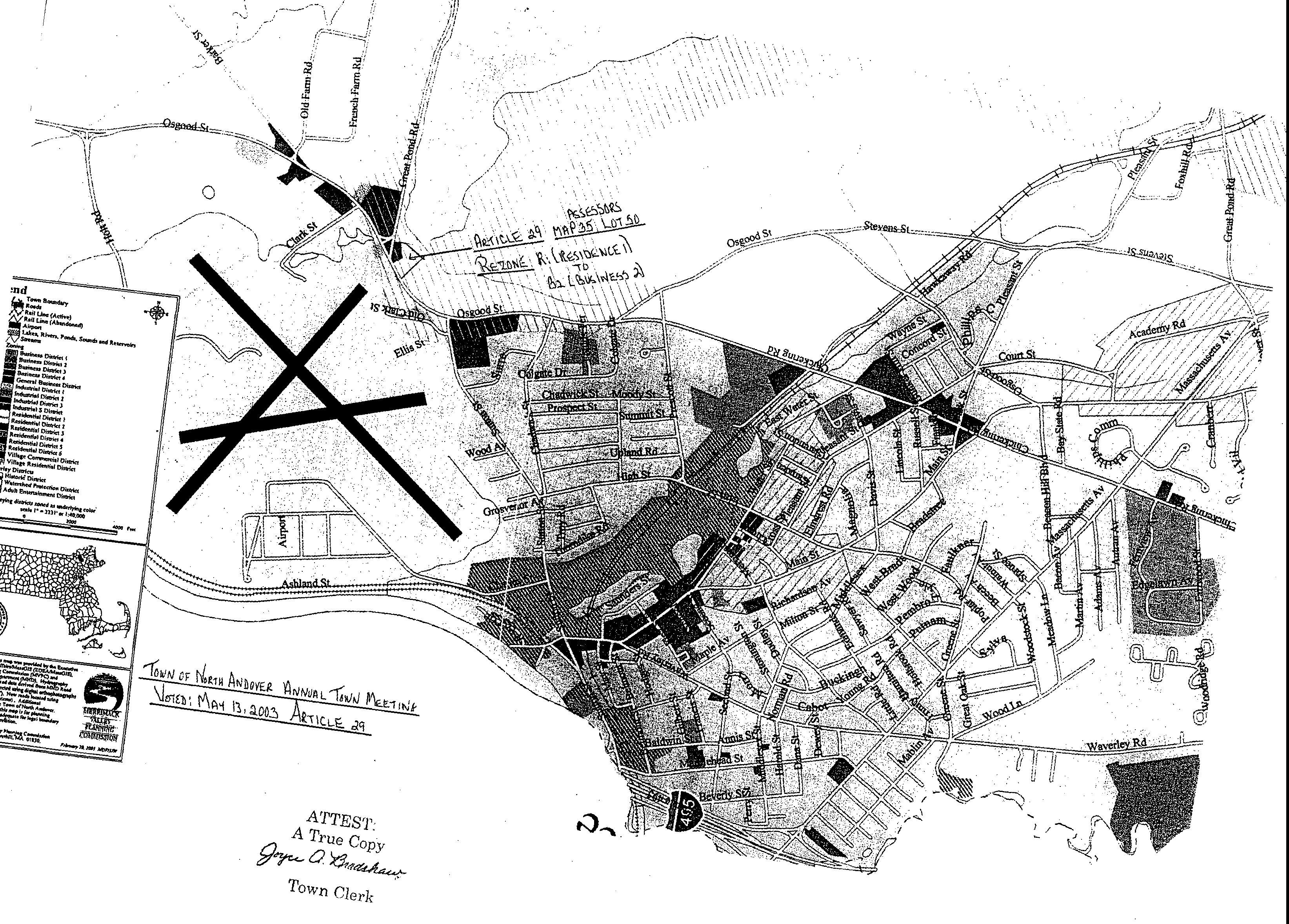
Article 29. Amend Zoning Map - Assessor Map 35 Lot 50 -1003 Osgood Street from Residential One (R-1) to Business Two (B2). VOTED BY TWO-THIRD VOTE DECLARED BY THE MODERATOR to rezone the herein described parcel of land from Residential One (R-1) to Business Two (B-2). The subject parcel is identified on the North Andover Assessor's Map 35, Lot 50, and further known as 1003 Osgood Street, North Andover Massachusetts. The subject property being generally as shown on the plan entitled "1003 Osgood Street - Existing Conditions Plan" dated August 8, 2002, scale 1 "= 20' prepared by MHF Design Consultants' Inc. a copy of which is on file in the office of the Town Clerk.�
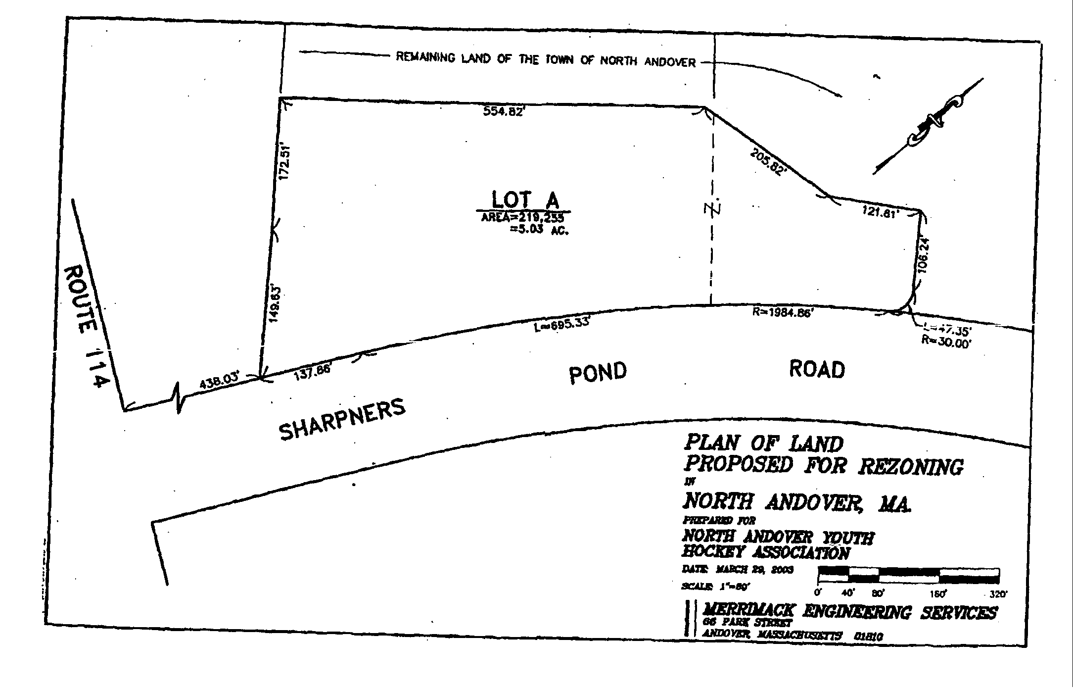
A parcel of land located on the north side of Sharpners Pond Road, beginning at a point located 438.03' east of the intersection of Sharpners Pond Road and Route 114, at a point on the north side of Sharpners Pond Road running:�
Northwesterly 322.14' along two courses to a point at other land of the Town of North Andover, thence�
Easterly 5.54.82' along land of the Town of North Andover to a point thence�
Southeasterly 205.82' along land of the Town of North Andover to a point thence�
Easterly 121.61' along land of the Town of North Andover to a point thence�
Southeasterly 106.24' along land of the Town of North Andover to a point thence�
R=30.00' L=47.35' along land of the Town of North Andover along a curve to the right to a point on the north side of Sharpners Pond Road, thence�
R=1984.86' L=695.33' along a curve to the left along Sharpners Pond Road to a point, thence�
Southwesterly 137.86' along the sideline of Sharpners Pond Road to a Point, said point being the point of beginning,�
Said parcel contains 5.03 acres of land and is shown as Lot A on a "Plan of Land proposed for rezoning in North Andover, MA prepared for North Andover Youth Hockey Association, March 29, 2003, Merrimack Engineering Services, 66 Park Street, Andover, MA 01810" and on file in the office of the Town Clerk; or take any action relative thereto.�
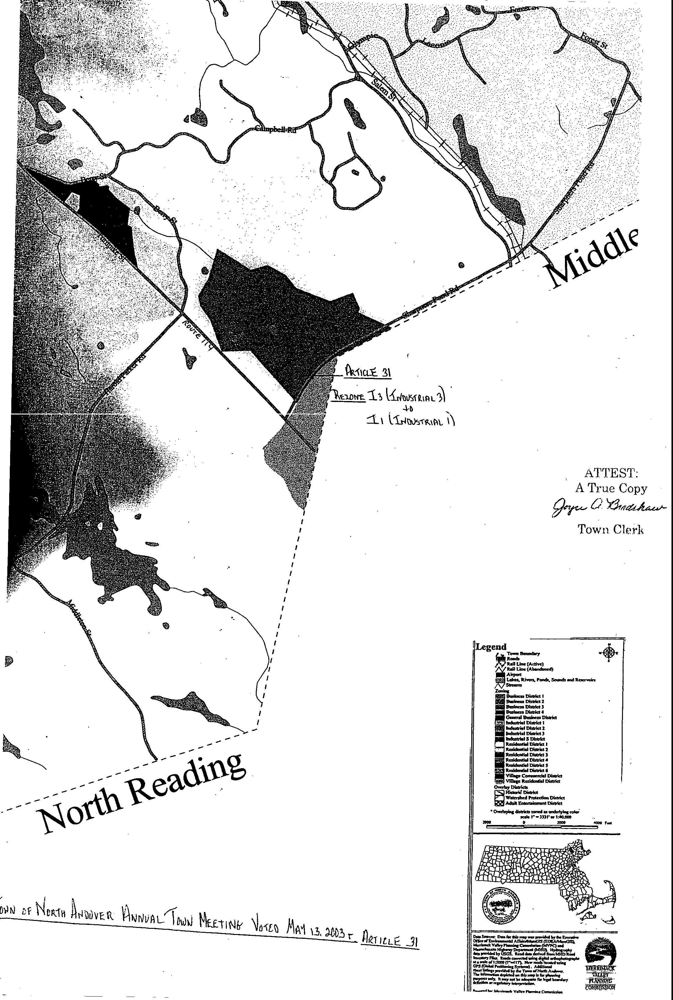
**Webmasters Note: The previous Articles of Case No. 2525 amend the zoning map which can be viewed at the zoning map link of the town page.�