 |
|
CASE NO.2163-TOWN MEETING HELD ON 5/13/02 ZONING MAP AMENDMENT�
|

|
|
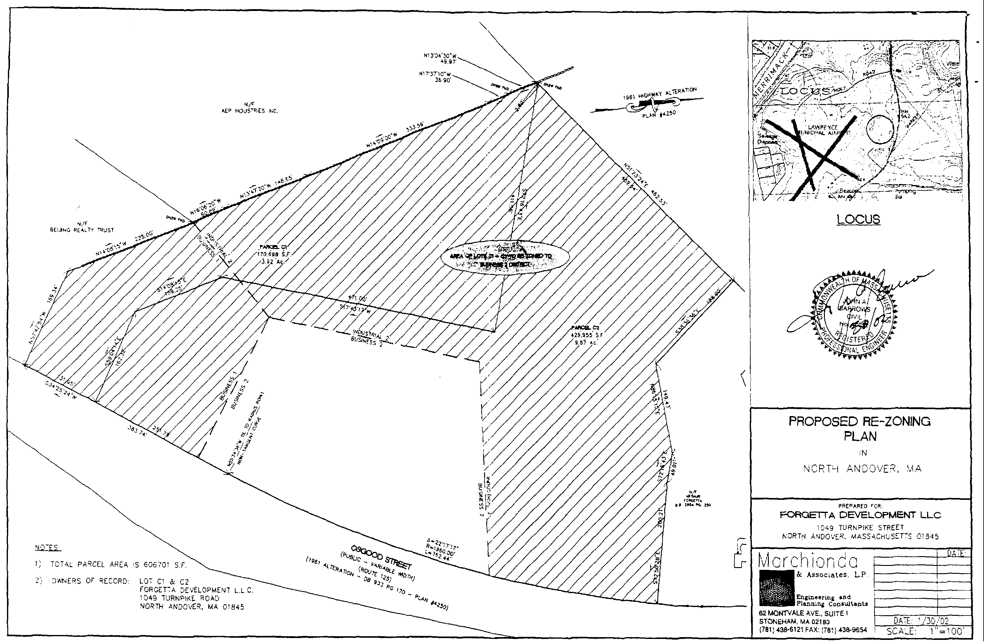
Article 33. Amend Zoning Map - Portion of Osgood Street located Between 1250 Osgood Street Beijing Realty Trust) and 1284 Osgood Street from B1 and 12 to B2. VOTED BY TWO-THIRD VOTE DECLARED BY THE MODERATOR for the Town to amend the zoning designation of Parcels C-1 and C-2 from Business 1 and Industrial 2 to Business 2 a certain parcel of land shown on Plan of Land entitled "Proposed ReZoning Plan, in North Andover, Massachusetts, prepared for Forgetta Development LLC, 1049 Turnpike Street, North Andover, Massachusetts 01845, Marchonda & Associates, L.P., 62 Montvale Avenue, Suite 1, Stoneham, MA 02180, date 1/30/02 and also shown on Map for Article 29 of the May 13,2000 as Approved by the Office of the Attorney General Dated 10-12-2000, both plans on file in the Office of the Town Clerk.�
|
|
Said parcel is more particularly bounded and described as:�
|
|
Beginning at a point on the westerly side of Osgood Street then proceeding N 5742'54" W, 169.34 feet;�
|
|
Thence 408' 15" W, 225 feet;�
|
|
Thence 606'20" W, 60.89 feet;�
|
|
Thence 1347'20 W, 148.65 feet;�
|
|
Thence 14W, 333.59 feet;�
|
|
Thence N1737' 10 W, 36.90 feet;�
|
|
Thence N 13 04' 30' W, 49.97 feet;�
|
|
Thence N51 23' 24 E, 462.53 feet;�
|
|
Thence S3836'36" E, 188.80 feet;�
|
|
Thence N86 15' 15" E, 149.43 feet;�
|
|
Thence S72 16'43" E, 49.01 feet;�
|
|
Thence S7750'28 E, 200.21 feet,�
|
|
Thence In a Southwesterly direction along the Westerly side of Osgood Street to a point, 762.44 feet; Thence S3425'24" W, 383.74 feet still along Osgood Street to the point of beginning. Containing 606,701 square feet.�
|

|
|
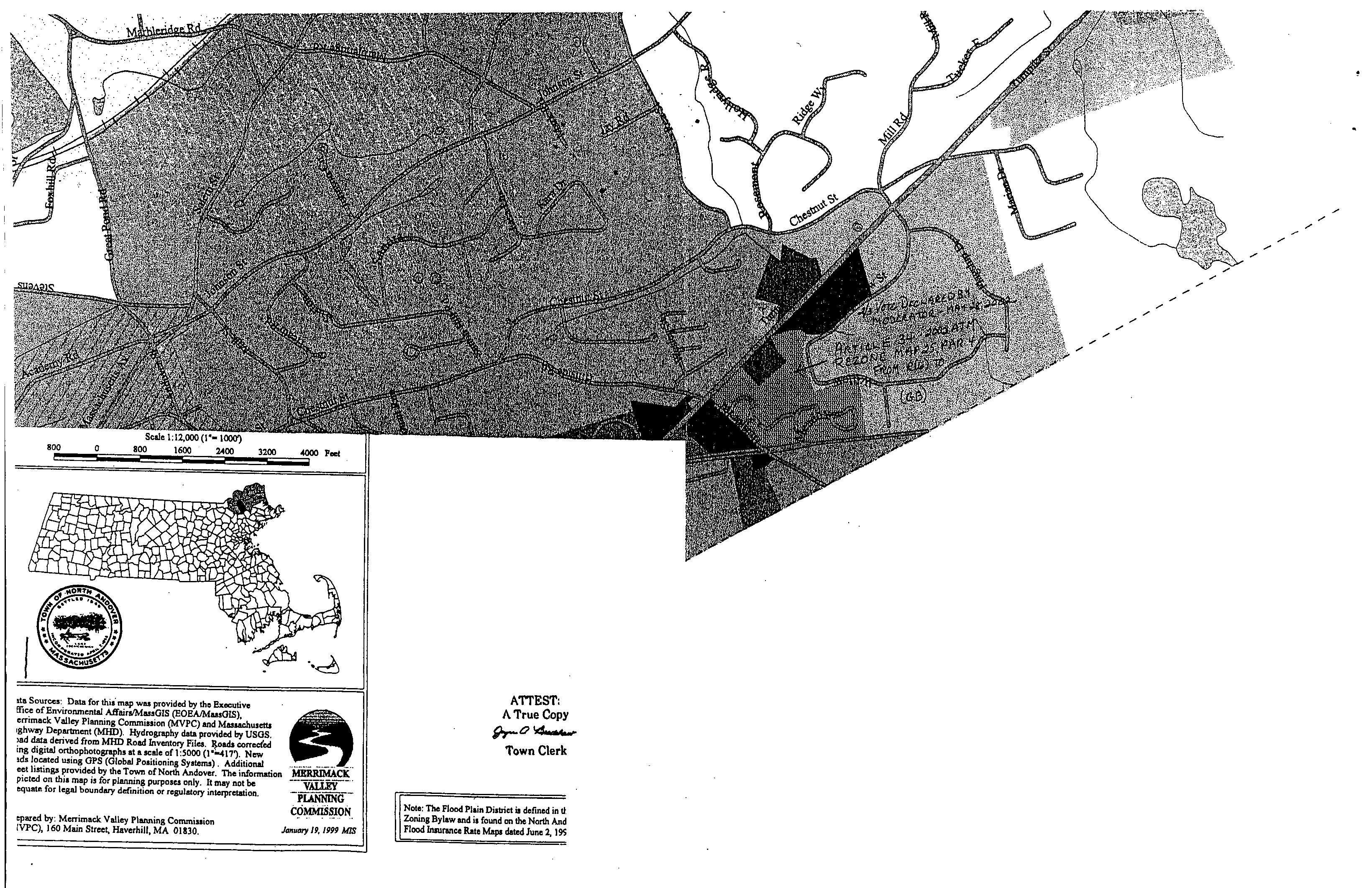
Article 34. Amending Zoning Map - Assessor Map 25 Parcel 4 (Willow Street off Route 114) from Residential 6 (R6) to General Business (GB). VOTED TWO-THIRD VOTE DECLARED BY THE MODERATOR for the Town to amend the Zoning Map of the Town of North Andover by, rezoning the following parcel of land from Residential 6 (R6) to General Business (GB). Said land is located on Willow Street. Said land is part of parcel of land shown on Assessor' Map 25, Parcel 4. Said land to be rezoned consists of approximately 145,508 square feet. Said Map on file in the Office of the Town Clerk.�
|

|
|
**Webmasters Note: The previous Articles of Case No. 2163 amend the zoning map which can be viewed at the zoning map link of the town page.�
|
  |


