
a. Submission Optional. Applicants are encouraged to submit a sketch plat of a major subdivision during the early design stages containing that information necessary to form a basis for discussion of alternatives for development. A detailed review of a sketch plat will minimize the necessity of major revisions in the more detailed preliminary plat submission. Application fees paid at the sketch plat submission stage will be deducted from the required application fees at the preliminary plat stage if submittal of the preliminary plat is made within one (1) year from the date of sketch plat approval.�
b. Required Documents. Prior to issuance of a Certificate of Completeness or scheduling of a sketch plat of a major subdivision for public hearing before the Municipal Agency, the Administrative Officer shall determine that the following have been submitted in proper form:�
1. Borough Engineer's report.�
2. Application fees.�
3. Eight (8) copies of the plat and attachments meeting the requirements set forth below (to the extent that the Municipal Agency determines such information is necessary to evaluate the proposal and discuss alternatives).�
c. Plat Requirements.�
1. General Requirements. The sketch plat shall be based on a land survey, a deed plotting, the current tax map or other suitable base map, and shall be drawn at a scale not less than one hundred (100') feet to the inch for subdivisions up to one hundred (100) acres in size, and not less than two hundred (200) feet to the inch for subdivisions over one hundred (100) acres in size, and shall show or be accompanied by the information specified below.�
2. Title Block. The title block shall appear on all sheets and include:�
(a) Title of "Sketch Plat - Major Subdivision."�
(b) Name of the subdivision, if any.�
(c) Tax map sheet, block and lot number(s) of the tract to be subdivided as shown on the latest Borough Tax Map, the date of which should also be shown.�
(d) Date (of original and all revisions).�
(e) Names and addresses of owner and subdivider so designated.�
(f) Name(s), signature(s), address(es) and license number(s) of the engineer and/or land surveyor who prepared the map. (The plat should bear the embossed seal of said engineer and/or land surveyor.)�
3. Detailed Information.�
(a) A key map (at a scale of not less than one inch equals one thousand (1" = 1,000') feet) showing the location of the tract to be subdivided with reference to surrounding areas, existing streets which intersect or border the tract, the names of all such streets and the location of any zone boundaries and Borough boundary which is within five hundred (500') feet of the subdivision.�
(b) A schedule should be placed on the map indicating the acreage of the tract, the number of lots, the zone, the minimum required lot areas, setbacks and dimensions.�
(c) Zone boundaries, tax map sheet, lot and block numbers and property lines of parcels within two hundred (200') feet of the land to be subdivided, including properties across the street, as shown by the most recent records of the Borough or of adjoining municipalities.�
(d) All existing streets, watercourses, floodplains, floodway and flood hazard areas within the proposed subdivision and within two hundred (200') feet of the boundaries thereof, both the width of the paving and the width of the rights-of-way of each street, existing public easements and Borough borders within two hundred (200') feet of the subdivision.�
(e) All existing structures, an indication of those which are to be destroyed or removed, and the front, rear and side yard dimensions of those to remain.�
(f) The boundaries, nature and extent of wooded areas and the location of any other significant physical features, including swamps, bogs and ponds, within the proposed subdivision and within two hundred (200') feet thereof.�
(g) The layout of the proposed subdivision drawn in compliance with the provisions of this Chapter.�
(h) All existing and proposed public easements or rights-of-way and the purposes thereof, and proposed streets within the proposed subdivision. The proposed streets shall show the right-of-way width(s).�
(i) If known, the maximum anticipated extent of the areas of excavation or embankment where any grade changes are proposed, including those for streets.�
(j) The existing directions of surface flow and the system of drainage of the subdivision and of any larger tract of which it is a part, together with information on how it is proposed to dispose of surface drainage.�
(k) The acreage of the drainage area (or areas) of each natural or manmade watercourse traversing the subdivision, including the area within the subdivision and the area upstream from the subdivision.�
(l) The locations of all stakes; if any, places on the property to aid in on-site inspections.�
(m) North arrow.�
(n) Written and graphic scales.�
�
(o) The preliminary utility layouts showing the methods of connection and the courses of service.�
(p) Existing five (5') foot (or less) interval contours based on United States Coast and Geodetic Survey datum (MSL-0) shall be shown extending a minimum of one hundred (100') feet beyond the boundary of the tract in question and shall be certified by a New Jersey licensed surveyor or professional engineer as to accuracy, except that where the slopes exceed five (5'%) percent, a ten (10') foot interval may be used, and if the slopes exceed ten (10%) percent, a twenty (20') foot interval is permissible. The source of elevation datum base shall be noted.�
(q) Such other information as the Engineer or Municipal Agency may require or request.�
d. Conditions of Approval. Any approval of an application for a sketch plat of a major subdivision granted by the Municipal Agency shall be subject to the following conditions being satisfied prior to signing of the plat:�
1. Payment of required reproduction fee.�
2. Submission of additional prints of the plat map and attachments for distribution (if required).�
3. Any other conditions which may be imposed by the Municipal Agency.�
�
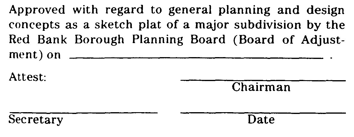
e. Certification. In the event that the application for development for a sketch plat of a major subdivision is approved, a certification to that effect in this form �
�
�
shall be endorsed on the sketch plat and the original reproducible thereof shall be provided to the Municipal Agency by the applicant. Said original shall be signed by the Chairman and Secretary or Assistant Secretary of the Municipal Agency after they receive certification from the Administrative Officer that all conditions of approval have been satisfied. After signature, the sketch plat shall be reproduced as provided for in Subsection 25-6.4 of this Chapter and the signed original shall be returned to the applicant.�
f. Applicant's Rights Upon Approval. Approval of a sketch plat shall confer upon the applicant, for a period of one (1) year following the date of sketch plat approval by the Municipal Agency, the right to submit an application for development for a preliminary plat conforming to the approved sketch plat.�
(Ord. #686, S 13-6.7)�
a. Required Documents. Prior to issuance of a Certificate of Completeness of scheduling of a preliminary plat of a major subdivision for public hearing, the Administrative Officer shall determine that the following has been submitted in proper form:�
1. Borough Engineer's report.�
2. Copy of application granting of CAFRA Permit, where required and if submitted.�
3. Application for municipal and/or State Wetlands Permit, where required.�
4. Other submittals which may be required by the Borough Engineer, Planning Board, Board of Adjustment, or Federal, State or local law.�
5. The application for development for a preliminary plat of a major subdivision shall include a request for the granting of any variances required.�
6. Required application fees.�
7. Fifteen (15) copies of a plat and attachments meeting the requirements set forth below.�
b. Plat Requirements.�
1. General Requirements. All plats containing proposals or designs for drainage, streets and subdivision layouts shall be prepared by a professional engineer licensed to practice in the State of New Jersey and shall bear the address, signature, embossed seal and license number of said professional engineer. The preliminary plat shall be based on a land survey conducted not more than five (5) years prior to the date of application and certified to the subdivider and shall be drawn at a scale of not less than one hundred (100') feet to the inch for subdivisions up to one hundred (100) acres in size, and not less than two hundred (200') feet to the inch for subdivisions over one hundred (100) acres in size, and shall show or be accompanied by the information specified below.�
2. Title Block. The title block shall appear on all sheets and include:�
(a) "Preliminary Plat - Major Subdivision."�
(b) Name of subdivision, if any.�
(c) Tax map sheet, block and lot number(s) of the tract to be subdivided as shown on the latest Borough Tax Map, the date of which shall also be shown.�
(d) Date (of original and all revisions).�
(e) Names and addresses of owner and subdivider, so designated.�
(f) Name(s), signature(s), address(es) and license number(s) of the engineer and/or land surveyor who prepared the map. (The plat shall bear the embossed seal of said engineer and/or land surveyor.)�
�
3. A key map (at a scale of not less than one inch equals one thousand (1" = 1,000') feet) showing; the location of the tract to be subdivided, with reference to surrounding areas, existing streets which intersect or border the tract, the names of all such streets and any zone boundary or Borough boundary which is within five hundred (500') feet of the subdivision.�
4. A schedule shall be placed on the map indicating the acreage of the tract, the number of lots, the zone, the minimum required lot areas, setbacks, yards and dimensions.�
5. Zone boundaries, Borough borders and the names of all owners, lot and block numbers and property lines of parcels within two hundred (200') feet of the land to be subdivided, including properties across the street, as shown by the most recent records of the Borough, or of the municipality of which the property is a part.�
6. The preliminary plat shall be based on a current certified boundary survey as required above with sufficient lines of the adjoining tracts surveyed t establish any overlap or gap between the adjoining boundary lines and the boundary lines of the tract in question. The date of the survey and the name of the person making the same shall be shown on the map.�
7. Contours.�
(a) Existing one (1') foot interval contours bused on United States Coast and Geodetic Survey datum (MSL = 0) shall be shown extending; a minimum of one hundred (100') feet beyond the boundary of the tract in question and shall be certified by a New .Jersey licensed surveyor or professional engineer as to accuracy, except that where the slopes exceed five (5%) percent, a two (2') foot interval may be used, and if the slopes exceed ten (10%) percent, a five (5') foot interval is permissible. The source of elevation datum base shall be noted. If contours have been established by aerial photography, a check profile shall be made on the boundary line of the tract and certified by a New Jersey licensed land surveyor.�
(b) Ninety (90%) percent of elevations interpolated from contour lines will be within one-half (1/2) the contour interval when referred to the nearest bench mark. All spot elevations shall be to the nearest one-tenth (0.1') foot and accurate to within three-tenths (0.3) of afoot.�
(c) Ninety (90%) percent of all planimetric features shown on the map will be within one-fortieth (1/40") inch of their true position and no planimetric features will be out of true position more than one-twentieth (1/20") inch at map scale when referenced to the nearest field-established station. A statement of compliance and/or a complete statement concerning any areas of noncompliance with this requirement shall be placed on the tentative plat.�
8. All existing streets, public easements, watercourses, floodways and flood hazard areas within the proposed subdivision and within two hundred (200') feet of the boundaries thereof, including both the width of the paving and the width of the right-of-way of each street, within two hundred (200') feet of the subdivision.�
9. All existing structures, an indication of those which are to be destroyed or removed, and the front, rear, and side yard dimensions of those to remain.�
10. The boundaries, nature, extent and acreage of wooded areas and other important physical features, including swamps, bogs and ponds within the proposed subdivision and within two hundred (200') feet thereof.�
11. The layout of the proposed subdivision drawn in compliance with the provisions of the Chapter.�
12. All proposed public easements or rights-of-way and the purposes thereof, and proposed streets within the proposed subdivision. The proposed streets shall show the right-of-way and proposed pavement width.�
13. The existing system of drainage of the subdivision and of any larger tract of which it is a part, together with information on how it is proposed to dispose of surface drainage.�
14. The acreage of the drainage area (or areas) of each natural or man-made watercourse traversing the subdivision, including the area within the subdivision and the area upstream from the subdivision.�
15. All proposed lot lines and the areas of all lots in square feet. The areas and dimensions specified should be accurate to within minus zero (-0%) percent and plus four (+4%) (for example, a lot line specified as two hundred fifty (250') feet long should not be less than two hundred fifty (250') feet but may be as long as two hundred sixty (260') feet.)�
16. North arrow and basis therefor and written and graphic scales.�
17. Preliminary utility layouts showing methods of connection and sources of service.�
18. The proposed location and area, in acres or square feet, of all proposed common open space areas.�
19. The types and locations of all stakes, marks or flagged points, if any, placed on the property to aid in on-site inspections. The Planning Board may require the marks or stakes, as a minimum, be placed at the intersection of all lines of the tract boundary with existing streets, at the center of all cul-de-sacs, at all internal street intersections, along street tangents at intervals not exceeding five hundred (500') feet, and at such additional locations as the Planning Board may deem necessary. The locations indicated on the plat shall be accurate within plus or minus ten (10') feet. Any traverse lines cut out and/or marked on the site shall be shown on the plat. If such on-site points, as above discussed, have not been established at the time of submission of a tentative plat, the Planning Board may give the subdivider fifteen (15) days notice of the date of any proposed site inspection by the Board, so the points can be set.�
20. The tentative plat shall show, on the property to be subdivided and within two hundred (200') feet of that property all existing paper streets, dirt roads, paved streets, curbs, manholes, sewer lines, water and gas pipes, utility poles, ponds, swamps and all other topographical features of a physical or engineering nature.�
(a) The preliminary plat shall show or be accompanied by a preliminary grading and drainage plan which shall show locations of all existing and proposed drainage swales and channels, retention-recharge basins, the scheme of surface drainage and other items pertinent to drainage including the approximate proposed grading contours at one (1') foot intervals, except if slopes exceed five (5%) percent, a two (2') foot interval may be used, and if they exceed ten (10%) percent, a five (5') foot interval is permissible. Datum shall be United States Coast and Geodetic Survey datum (MSL=0) and the source of datum shall be noted.�
(b) The plan shall outline the approximate area contributing to each inlet.�
(c) All proposed drainage shall be shown with preliminary pipe type and sizes, invert elevations, grades and direction of flow. The direction of flow of all surface waters and all watercourses shall be shown.�
(d) The preliminary grading and drainage plan shall be accompanied by drainage calculations made in accordance with standards set forth in this Chapter.�
22. Preliminary off-site drainage plan. The preliminary plat shall also be accompanied by a preliminary offsite drainage plan prepared in accordance with the following standards:�
(a) The plan shall consist of an outline of the entire drainage basin in which the property to be subdivided is located. The terminus of the basin and existing ground contours or other basis for determining basin limits shall be shown.�
(b) Pertinent off-site existing drainage, which receives or discharges runoff from or onto the site, shall be shown with elevations of inverts, pipe types and sizes or other appropriate physical data for open or nonpipe conduits.�
(c) To the extent that information is available and may be obtained from the County or Borough Engineer(s), any existing plans for drainage improvements shall be shown.�
(d) In the event a temporary drainage system is proposed, tentative plans of that system shall be shown.�
23. Boring Logs. Unless the Borough Engineer shall determine that less boring logs are required or that some or all of the boring logs may be deferred to the final plat stage, the preliminary plat shall be accompanied by a set of boring logs and soil analyses for borings made in accordance with the following requirements:�
�
(a) Borings shall be spaced evenly throughout the tract.�
(b) One (1) boring not less than fifteen (15') feet below the proposed grade or twenty (20') feet minimum depth shall be made for every five (5) acres, or portion thereof, of land within a tract where the water table is found to be ten (10') feet, or more below the proposed or existing grade at all boring locations.�
(c) One (1) additional boring shall be made per acre, or portion thereof, in those areas where the water table is found to be less than ten (10') feet below the proposed or existing grade.�
(d) In addition to the above, in those areas where the water table is found to be five (5') feet or less below the existing or proposed grade, two (2) additional borings per acre, or portion thereof, will be required. If construction of homes with basements is contemplated, at least one (1) boring will be located on each lot within the building setback lines.�
(e) Boring logs shall show soil types and characteristics encountered, groundwater depths, the methods and equipment used, the name of the firm, if any, making the borings and the name of the person in charge of the boring operation. The boring logs shall also show surface elevations to the nearest one-tenth (0.1) of afoot.�
(f) Based on the borings, the preliminary plat shall clearly indicate all areas having a water table within two (2') feet of the existing surface of the land, or within two (2') feet of proposed grade, or all areas within which two (2') feet or more of fill is contemplated or has previously been placed.�
24. The location, dimensions, area and disposition of any park and recreation areas shall be shown and noted on the preliminary plat and shall be subject to the approval of the Planning Board.�
25. Sectionalization and staging plans. The preliminary sectionalization and staging plan showing the following:�
(a) If the subdivision is proposed to be filed for final approval in sections, the plan shall ,grow each such section and the anticipated date of filing for each section. The staging of the various sections in the subdivision shall be such that if development of the subdivision were to be discontinued after the completion of any section, the developed portion of the subdivision would be provided with adequate street drainage and utility systems. The size and staging of the section in a subdivision shall be established to promote orderly development. and shall he subject to the approval of the Board.�
(b) The sectionalization and staging plan shall identify for each lot or groups of lots in the subdivision those improvements that will be completed prior to application for Certificates of Occupancy. The plan should demonstrate that the staging of construction will minimize adverse affects upon occupied buildings in the subdivision and adjoining properties.�
26. If the Borough Engineer, Planning Board or Board of Adjustment, or Environmental Commission determines that existing trees located on the site may have an effect on the proper layout of the subdivision, it may be required that the location, caliper and type be shown on the plat for the following:�
(a) Living deciduous trees having a trunk of six (6") inches diameter or more at breast height.�
(b) All living coniferous trees having a trunk of six (6") inches or more diameter at breast height.�
(c) All living dogwood (Corpus florida) or American Holly (Ilex opaca) trees having a trunk of one (1") inch or greater diameter at breast height.�
(d) All native laurel (Kalmia latifolia) shrubs having a root crown of three (3") inches or greater measured at the soil or surface level.�
27. The location of proposed depressed pedestrian ramps and other facilities for the handicapped.�
28. Such other information as the Board and/or Borough Engineer may require or request during the review of the preliminary plat.�
c. Conditions of Approval. Any approval of an application for development for a preliminary plat of a major subdivision by the Planning Board or Board of Adjustment shall be subject to the following conditions being satisfied prior to the signing of the plat:�
1. Payment of required reproduction fee.�
2. Submission of additional prints of the plat and attachments for distribution (if required).�
3. Preliminary Monmouth County Planning Board approval (if not previously granted).�
4. Preliminary Red Bank Public Utilities Department approval (if not previously granted).�
5. Publication of a notice of the decision of the Board by the applicant within the time set forth in Subsection 25-3.3f. of this Chapter.�
6. Any other conditions which may be imposed by the Board or may be required by Federal, State or local law.�
7. A condition setting forth the time within which all conditions must be satisfied as described in Subsection 25-3.3 g. of this Chapter.�
The Board may also condition its preliminary approval upon the applicant providing for certain revisions or additions on the final plat submission.�
d. Certification. In the event that the application for development for a preliminary plat of a major subdivision is approved, a certificate to that effect in this form:�
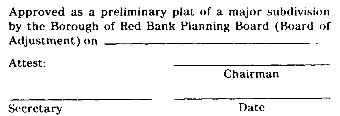
shall be endorsed as the preliminary plat and the original reproducible thereof shall be provided to the Board by the applicant. Said original shall he signed by the Chairman and Secretary of the Board after they receive certification from the Administrative Officer that all conditions of approval have been satisfied. After signature, the prelminary plat shall be reproduced as provided for in Subsection 25-6.4 of this chapter and the signed original shall be returned to this applicant.�
e. Applicants Rights Upon Approval. Approval of a preliminary plat shall confer upon the applicant the rights set forth in N.J.S.A. 40:55D-49 and Subsection 25-3.1j,5 of this Chapter.�
�
f. Improvements Not to Be Installed. Approval of a preliminary plat shall not confer upon the developer the right to undertake any clearing, grading and/or to install any improvements prior to final plat approval unless it shall be determined by the Planning Board or Board of Adjustment and the Borough Engineer that (1) such clearing, grading and/or installation of improvements would not hinder future development -or create physical or aesthetic problems in the event that further development of the subdivision is not undertaken and (2) that required inspection fees have been paid and adequate performance guarantees have been posted to provide for the cost to the Borough of performing work that may be necessary to protect adjacent property owners and the public interest in the event that such clearing, grading and/or installation of improvement is not completed and/or further development of the subdivision is not undertaken. Such performance guarantees shall include, but are not limited to, the cost to the Borough of providing erosion control facilities, seeding or otherwise stabilizing the site, drainage facilities necessary to protect off-tract acres from flooding, screening or fencing that may be required and all improvements to be undertaken which are within existing public rights-of-way of easements.�
(Ord. #686, S 13-6.8)�

