
a. Required Documents. Prior to issuance of a Certificate of Completeness of scheduling of a preliminary plat of a major site plan for public hearing, the Administrative Officer shall determine that the following has been submitted in proper form:�
1. Borough Engineer's Report.�
2. Copy of application for granting; of a CAFRA Permit, where required and if submitted.�
3. Application for State Wetlands Permit, where required.�
4. Other submittals that may be required by the Borough Engineer, Planning Board, Board of Adjustment, or Federal, State or local law.�
5. The application for development for a preliminary plat of a major site plan shall include a request for the granting of any variances required.�
6. Required application fees.�
7. Fifteen (15) copies of a plat and attachments meeting the requirements set forth below.�
b. Plat Requirements.�
1. General Requirements.�
(a) Any preliminary plat of a major site plan presented to the Planning Board or Board of Adjustment for its approval shall be signed and appropriately sealed by an architect, professional engineer, land surveyor and/or professional planner licensed to practice in the State of New Jersey: provided, however, that sanitary sewer, water distribution and storm drainage plans and water anti sewage treatment plans may only be signed and sealed by a professional engineer.�
(b) Site plans shall not be drawn at a scale smaller than one inch equals fifty (1" = 50') feet nor larger than one inch equals ten (1" = 10') 1 feet. If the size of the site would require the use of sheets larger then thirty inches by forty-two (30" x 42") inches in order to show the entire site on one (1) sheet, the detailed information for the site plan shall be shown in sections on sheets not larger than thirty inches by fortytwo (30" x 42".) inches, which sheets shall be keyed to an overall plan of the site drawn at a scale of not less than one inch equals two hundred (1" = 200') feet.�
The site plan shall be based on a monumented, current certified boundary survey. The date of the survey and the name of the person making same shall be shown on the map. If twelve (12) months or more has passed since the date of (or date of last recertification of) the survey, it shall be recertified- and if necessary, brought up to date.�
2. Title Block. The title block shall appear on all sheets and include:�
(b) Name of the development, if any.�
(c) Tax map sheet, block and lot number of the site, as shown on the latest Borough Tax Map, the date of which should also be shown.�
(d) Date (of original and all revisions).�
(e) Names and addresses of owner and developer, so designated.�
(f) Name(s), signature(s), address(es), and license number(s) of engineer, architect, land surveyor or planner who prepared the plan and their embossed seal.�
(g) If the site plan contains more than one (1) sheet, each sheet shall be numbered and titled.�
3. A schedule shall be placed on the site plan indicating:�
(a) The acreage of the tract and site (the portion of the tract involved in the site plan).�
(b) The floor area of the existing and proposed buildings (listed separately).�
(c) The proposed use or uses and the floor area devoted to each use.�
(d) The zone in which the site is located.�
(e) Proposed and required lot dimensions and front, rear and side setbacks.�
(f) Proposed and required off-street parking spaces.�
(g) Square footage and percentage of the site retained in unoccupied open space and occupied by buildings.�
4. North arrow and written and graphic scales.�
5. The tops of the banks and boundaries of the floodways and flood hazard areas of all existing watercourse, where such have been delineated or the limits of alluvial soils where the boundaries of floodways and flood hazard areas have not been determined, and/or such other information as may assist the Board in the determination of floodway and flood hazard area limits.�
6. Paving and right-of-way widths of existing streets within two hundred (200') feet of the site.�
7. The boundary, nature and extent of wooded area, swamps, bogs and ponds within the site and within two hundred (200') feet thereof.�
8. Existing and proposed manholes, sewer lines, fire hydrants, water lines, utility poles and all other topographical features of a physical or engineering nature within the site and within two hundred (200') feet thereof.�
9. All existing structures on the site and within two hundred (200') feet thereof, including their use, indicating those to be destroyed or removed and those to remain.�
10. Location, use, finished grade level, ground coverage, first floor and basement elevations, front, rear and side setbacks of all existing buildings and other pertinent improvements.�
�
11. Existing and proposed public easements or rightsof-way and the purposes thereof.�
12. A grading plan showing existing and proposed grading contours at one (1') foot intervals throughout the tract, except if slopes exceed five (5%) percent, a two (2'') foot interval may be used, and if they exceed ten (10%) percent, a five (5') foot interval is permissible. Datum shall be United States Coast and Geodetic Survey datum (MSL=0) and source of datum shall be noted. In addition to proposed grading contours, sufficient additional spot elevations shall be shown to clearly delineate proposed grading.�
(a) The drainage plan shall be presented in graphic form which shall clearly show the street and lot layout and those items which are pertinent to drainage including existing and proposed contours as previously required.�
(b) The plan shall outline each area contributing to each inlet.�
(c) All proposed drainage shall be shown with pipe type and sizes, invert and grate or rim elevations, grades and direction of flow. The direction of flow of all surface waters and of all streams shall be shown.�
(d) The drainage plan shall be accompanied by complete drainage calculations made in accordance with the standards set forth in this Chapter.�
14. Off-site drainage plan. The plat shall also be accompanied by an off-site drainage plan prepared in accordance with the following standards:�
(a) The plan shall consist of an outline of the entire drainage basin in which the site is located. The terminus of the basin and existing ground contours or other basis for determining basin limits shall be shown.�
(b) The pertinent off-site existing drainage shall be shown with elevations of inverts and grates to the nearest one-tenth (0.1) of a foot.�
(c) To the extent that information is available and may be obtained from the County or municipal Engineer(s), any existing plans for drainage improvements shall be shown.�
(d) In the event a temporary drainage system is proposed, full plans of that system shall be shown.�
(e) The off-site drainage plans shall be accomplished by profiles of all proposed drainage, showing existing details, pipe sizes, type, inverts, crowns and slopes; all proposed structures and connections and design hydraulic grade lines for all conduits designed to carry forty (40) or more cubic feet per second. Cross-sections at intervals not exceed one hundred (100') feet. shall be shown for all open channels.�
15. If required by the Borough Engineer, centerline profiles of streets bordering the site, internal roadways and major circulation aisles showing:�
(a) Existing and proposed final grades and slopes.�
(b) Pipe sizes, slope, type, inverts and grate or rim elevation of drainage and sanitary sewage facilities.�
16. Boring Logs. Unless the Borough Engineer shall determine that less boring logs are required or that some or all of the boring lots may be deferred to the final plat stage, the site plan shall be accompanied by a set of boring logs and soil analyses for borings made in accordance with the following requirements:�
(a) Borings shall be spaced evenly throughout the site.�
(b) One (1) boring not less than fifteen (15') feet below grade or twenty (20') feet minimum depth shall be made for every five (5) acres (or portion thereof) of land where the water table is found to be ten (10') feet -or more below proposed or existing grade at all boring locations.�
(c) One (1) additional boring shall be made per acre (or portion thereof) in those areas where the water table is found to be less than ten (10') feet below proposed or existing grade.�
(d) In addition to the above, in those areas where the water table is found to be five (5') feet or less below existing or proposed grade, two (2) additional borings per acre (or portion thereof) will be required if construction of basements is contemplated. Borings shall be located where such basements are proposed.�
(e) Boring logs shall show soil types and characteristics encountered, ground water depths, the methods and equipment used, the name of the firm, if any, making the borings and the name of the person in charge of the boring operation. The boring logs shall also show surface elevations to the nearest one-tenth (1/10) of a foot.�
(f) Based on the borings, the site plan shall clearly indicate all areas having a water table within two (2') feet of the existing surface of the land, or within two (2') feet of proposed grade; or all areas within which two (2') feet or more of fill is contemplated or has previously been placed.�
17. Zone boundaries and the tax map sheet, lot and block numbers and names of owners of all properties within two hundred (200') feet of the site.�
18. A key map, (at a scale of not less than one inch equals one thousand (1" = 1,000') feet), showing the location of the site with reference to surrounding areas, existing streets, the names of all such streets and any zone boundary or Borough boundary which is within five hundred (500') feet of the site plan.�
19. The location, area, dimensions and proposed disposition of any area or areas of the site proposed to be retained as common open space, indicating the facilities to be provided in such areas.�
20. The capacity of off-street parking areas and the location and dimensions of all access drives, aisles and parking stalls. The location and treatment of existing and proposed entrances and exits to public rights-of-way, including the possible utilization of traffic signals, channelization, acceleration and deceleration lanes, additional width and any other device necessary for traffic safety and/or convenience, and the estimated average number of passenger vehicles, single unit trucks or buses, and semi-trailers that will enter the site each day.�
21. Graphic depiction of the anticipated routes and details of the system of on-site vehicular and pedestrian circulation. If the developer desires to have the appropriate provisions of Title 39 of the Revised Statutes governing motor vehicle operation, made applicable to the site, thereby allowing municipal police regulation of traffic control devices, he shall submit a formal request and a detailed plan meeting the requirements of the New Jersey Department of Transportation. The Borough Engineer will advise the developer regarding the details of such a plan.�
22. The location and size of proposed loading docks.�
23. Location of curbs and sidewalks.�
24. Cross-section(s) showing the composition of pavement areas, curbs and sidewalks.�
25. Exterior lighting plan, including the location, direction of illumination, amount of illumination expressed in horizontal foot candles, wattage and drawn details of all outdoor lighting standards and fixtures.�
26. Landscaping and screening plan showing the location, type, spacing and number of each type of tree or shrub and the location, type and amount of each type of ground cover to be utilized.�
27. Location of signs and drawn details showing the size, nature of construction, height and content of all signs.�
28. Drawn details of the type of screening to be utilized for refuse storage areas, outdoor equipment and bulk storage areas.�
29. Floor plans and building elevation drawings of any proposed structure or structures, or existing structures to be renovated.�
30. Location of handicapped facilities including parking spaces and ramps (where applicable).�
31. If the Borough Engineer, Planning Board or Environmental Commission determine that existing trees located on the site may have an effect on the proper layout of the site, it may be required that the location, caliper and type be shown on the plat for the following:�
(a) Living deciduous trees having a trunk of six (6") inches diameter or more at breast height.�
(b) All living coniferous trees having a trunk of six (6") inches or more diameter at breast height.�
(c) All living dogwood (Cornus florida) or American holly (Ilex opaca) trees having a trunk of one (1") inch or greater diameter at breast height.�
(d) All native laurel (Kalmia latifolia) shrubs having a root crown of three (3") inches or greater measured at the soil or surface level.�
32. Sectionalization and staging plan. Developers of large uses such as shopping centers, multi-family dwellings, industrial parks or other such uses proposed to be developed in stages shall submit a sectionalization and staging plan showing the following:�
(a) The anticipated date for commencing construction of each section or stage. The staging of development on the site shall be such that if development of the site were discontinued after the completion of any stage, the developed portion of the site would comply in all respects to the requirements of this Chapter and be provided with adequate drainage and utility systems.�
(b) Those improvements that will be completed in each stage pror to application for Certificate of Occupancy. The plan should demonstrate that the staging of construction will minimize adverse affects upon occupied buildings in the site and adjoining properties.�
33. Written description of the proposed operations in sufficient detail to indicate the effects of the use in producing traffic congestion, noise, glare, air pollution, fire hazards or safety hazards. The written description shall also include the hours of operation of the use, the number of shifts to be worked, the number of employees in each shift, the number of vehicles to be stored or parked on the site, and provisions to be made for site maintenance.�
34. Such other information as the Municipal Agency and/or Borough Engineer may request during site plan review.�
c. Conditions of Approval. Any approval of an application for development for a preliminary plat of a major site plan by the Planning Board or Board of Adjustment shall be subject to the following conditions being satisfied prior to the signing of the plat:�
1. Payment of required reproduction fee.�
2. Submission of additional prints of the plat and attachments for distribution (if required).�
3. Preliminary Monmouth County Planning Board approval (if not previously granted).�
4. Preliminary Red Bank Borough Public Utilities Department approval (if not previously granted).�
5. Publication of a notice of the decision of the Board by the applicant.�
6. Any other conditions which may be imposed by the Board or may be required by Federal, State or local law.�
The Board may also condition its preliminary approval upon the applicant providing for certain revisions or additions on the final plat submission.�
d. Certification. In the event that the application for development for a preliminary plat of a major subdivision is approved, a certification to that effect in this form:�
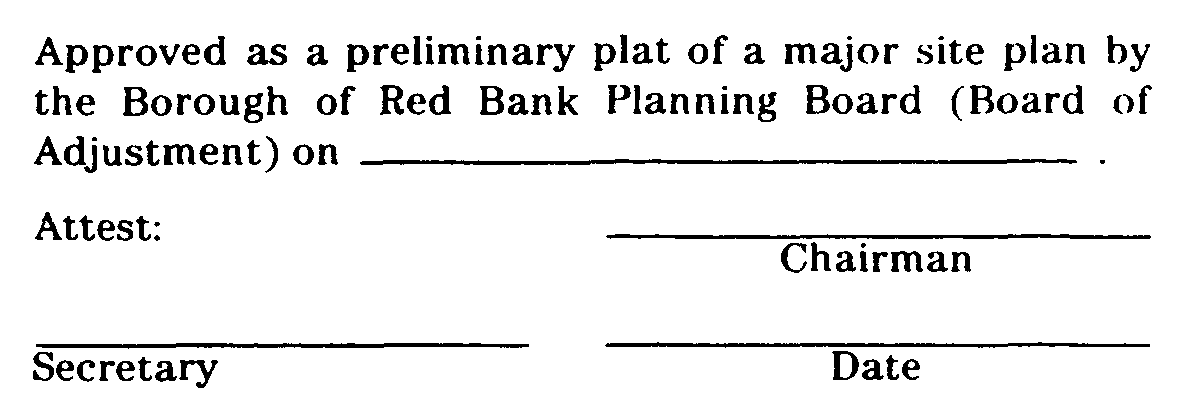
shall be endorsed on the preliminary plat and the original reproducible thereof shall be provided to the Board by the applicant. Said original shall be signed by the Chairman and Secretary of the Municipal Agency after they receive certification from the Administrative Officer that all conditions of approval have been satisfied. After signature the preliminary plat shall be reproduced as provided for in Subsection 25-6.4 of this Chapter and the signed original shall be returned to the applicant.�
e. Applicant's Rights Upon Approval. Approval of a preliminary plat shall confer upon the applicant all the rights set forth in N.J.S.A 40:55D-49 and Subsection 25-3.1k,5. of this Chapter.�
f. Improvements Not to Be Installed. Approval of a preliminary plat shall not confer upon the developer the right to undertake any clearing, grading and, err install any improvements prior to final plat. approval unless it shall be determined by the Planning Board or Board of Adjustment and the Borough Engineer that (1) the clearing, grading and/or installation of improvements would not hinder future development or create physical or aesthetic problems in the event that further development of the site plan is not undertaken and (2) that required inspection fees have been paid, and adequate performance guarantees have been posted to provide for the cost to the Borough of performing work that. may be necessary to protect adjacent property owners and the public interest in the event that such clearing, grading and/or installation of improvements is not completed and/or further development of the site is not undertaken. Such performance guarantees shall include, but are not limited to, the cost to the Borough of providing erosion control facilities, seeding or otherwise stabilizing the site, drainage facilities necessary to protect off-tract areas from flooding, screening or fencing that may be required and all improvements to be undertaken which are within existing public rightsof-way or easements. (Ord. #686, S 13-6.9)�
a. Required Documents. Prior to issuance of a Certificate of Completeness or scheduling of a final plat of a major subdivision for public hearing, the Administrative Officer shall determine that the following has been submitted in proper form:�
1. Borough Engineer's Report.�
2. Application for Land Disturbance Permit.�
3. Application for State wetlands approval, where required.�
4. Application for Stream Encroachment Permit, where required.�
5. Where applicable, a copy of the permit issued, or if the permit has not been issued, the application filed with the New Jersey Department of Environmental Protection, under the Coastal Area Facility Review Act, and copies of the Environmental Impact Statement and any attachments thereto filed in accordance with the provisions of the Act, or, in the alternate, a statement issued by the Department of Environmental Protection that the proposed development is exempt from the Act.�
6. A certificate of title, which may be on the plat (signed by the owner and notarized) or in letter form, signed by a member of the New Jersey Bar or by a title officer or authorized agent of a title insurance company licensed to do business in the State of New Jersey, which certificate shall confirm that the owner of the premises in question is the owner as shown on the plat.�
7. Other submittals that may be required by the Borough Engineer, Planning Board, Board of Adjustment, or Federal, State or local law.�
8. Unless waived by the Board, a formal request, in appropriate statutory form, requesting that the applicable provisions of Title 39 of the Revised Statutes be made applicable to the site in order to permit police regulation of traffic control devices prior to acceptance of streets.�
9. Required application fees.�
10. Fifteen (15) copies of the plat and attachments meeting the requirements set forth below.�
11. A condition setting forth the time within which all other conditions must be satisfied as described in Subsection 25-3.3 g. of this Chapter.�
b. Plat Requirements.�
1. General Requirements. A final plat may, for all or any portion of an approved preliminary plat., be submitted to the Municipal Agency within three (3 ) years of the date of approval of the preliminary plat. In general, all requirements set forth in this Chapter for tentative plats shall apply to final plats with the addition of the specific additional requirements set. forth herein.�
(a) A final plat shall be drawn at a scale of not less than one hundred (100') feet to the inch, shall conform to the provisions of Chapter 141 of the Laws of 1960 of the State of New Jersey as amended and supplemented, specified herein.�
(b) All dimensions, both linear and angular, of the exterior boundaries of the subdivision and all lots and all lands reserved or dedicated for public use shall balance and their description shall close within a limit of error of not more than one (1) part in ten thousand (10,000).�
(c) Unless specifically waived by the Borough Engineer, the bearing system used on the exterior boundaries of the final plat shall conform to the New Jersey State Plane Coordinate System or the plat shall show bearings based on said system in addition to any other bearings shown. When multiple bearing systems are shown, the bearings conforming to the New Jersey State Plan Coordinate System shall be enclosed in brackets.�
(d) Unless specifically waived by the Borough Engineer, coordinates, based on the New Jersey State Plan Coordinate System (x and y) shall be shown, individually or in tabular form, for the monumented (existing or proposed) corners of the exterior boundary of the tract.�
(e) The source of New Jersey State Plane Coordinate System information shown as required above shall be noted on the final plat.�
2. Purpose of Final Plat. A final plat and supporting drawing and documents for a proposed subdivision constitute the complete and fully detailed and documented development of the subdivision proposal and becomes the basis for the construction of the subdivision and inspection by the Borough Engineer, other officials and Planning Board or Board of Adjustment. The portion of the plat intended for filing must be recorded at the County Clerk's office to have legal status.�
3. Title Block. The title block shall appear on all sheets and include:�
(a) Title of "Final Plat - Major Subdivision."�
(b) Development name, if any.�
(c) Tax map sheet, block and lot number(s) of the tract to be subdivided as shown on the latest Borough Tax Map, the date of which shall also be shown.�
(d) Date (of original and all revisions).�
(e) Names and addresses of owner and subdivider, so designated.�
(f) The name(s), signature(s), addresses) and license number(s) of the engineer and land surveyor who prepared the map. (The plat shall bear the embossed seal of said engineer and land surveyor.)�
4. The final plat shall be based on a monumented, current, certified boundary survey. The date of the survey and the name of the person making the same shall be shown on the map. If twelve (12) months or more have passed since the date of last recertification of the survey, it shall be recertified arid, if necessary, brought up to date. Any necessary revisions from the survey used as a base for the tentative plat shall be specifically noted.�
5. A schedule shall be placed on the map indicating the acreage of the tract, the number of lots, the zone, the minimum required lot areas, setbacks, yards and dimensions.�
6. All design information submissions required by the provisions of the improvements and design standards portions of this Chapter shall accompany the final plat.�
7. A grading plan showing existing and proposed grading contours at one (1') foot intervals throughout the tract, except if slopes exceed five (5%) percent, a two (2') foot interval may be used, and if they exceed ten (10%) percent, a five (5') foot interval is permissible. Datum shall be United States Coast and Geodetic Survey datum (MSL=0) and source of datum shall be noted. In addition to the proposed grading contours, sufficient additional spot elevations shall be shown to clearly delineate proposed grading, including corner elevations of buildings and first floor and basement elevations.�
8. The limits of all areas of proposed cuts and fills (exclusive of excavations for basements) shall be clearly designated.�
(a) The drainage plan shall be presented in graphic form which shall clearly show the street and lot layout and those items which are pertinent to drainage including existing and proposed contours as previously required.�
(b) The plan shall outline each area contributing to each inlet.�
(c) All proposed drainage shall be shown with pipe type and sizes, invert and grate or rim elevations, grades and direction of flow. The direction of flow of all surface waters and of all streams shall be shown.�
(d) The drainage plan shall be accompanied by complete drainage calculations made in accordance with standards set forth herein.�
10. Off-Site Drainage Plan. The final plat shall also be accompanied by an off-site drainage plan prepared in accordance with the following standards:�
(a) The plan shall consist of an outline of the entire drainage basin in which the property to be subdivided is located. The terminus of the basin and existing ground contours or other basis for determining basin limits shall be shown.�
(b) The pertinent off-site existing drainage shall be shown with elevations of inverts and grade to the nearest one-tenth (0.1) of a foot.�
�
(c) To the extent that information is available and may be obtained from the County or Municipal Engineer(s), any existing plans for drainage improvements shall be shown.�
(d) In the event a temporary drainage system is proposed, full plans of that system shall be shown.�
(e) The off-site drainage plans shall be accompanied by profiles of all proposed drainage, showing existing and proposed finished grades, channel section details, pipe sizes, type, inverts, crowns and slopes; all proposed structures and connections and design hydraulic grade lines for all conduits designed to carry forty (40) or more cubic feet per second. Cross-sections at intervals not exceeding one hundred (100') feet shall be shown for all open channels.�
11. Centerline profiles of all proposed streets showing:�
(a) Existing and proposed finished grades and slopes.�
(b) Pipe sizes, slope, type, inverts and grate or rim elevations of drainage and sanitary sewage facilities.�
12. Where required by the Borough Engineer, cross section of proposed streets to at least ten ( l0') feet outside of any grading limit at intervals of at least every one hundred (100') feet, of all proposed streets.�
13. Where required by the Planning Board or Board of Adjustment, or Environmental Commission, the location, caliper and type of all:�
(a) Living deciduous trees having a trunk of six (6") inches diameter at breast height or more.�
(b) All living coniferous trees having a trunk of six (6") inches or more diameter at breast height.�
(c) All living dogwood (Cornus florida) or American holly (Ilex opaca) trees having a trunk of one (1") inch or greater diameter at breast height.�
(d) All native laurel (Kalmia latifolia) shrubs having a root crown of three (3") inches or greater measured at the soil or surface level.�
14. The number, location and species of all proposed shade trees or other plantings.�
15. Utility layouts, specifications and cross-sections (sewers, water, gas, electric, telephone, etc.), showing feasible connections to any existing or proposed utility systems; provided, however, that detailed layouts of gas, electric and telephone lines are not required. An indication of these on a typical road cross-section shall be sufficient. Layouts shall include proposed locations of street lights and fire hydrants. If private utilities are proposed, they shall comply with all local, County and State regulations.�
16. The tops of the banks and boundaries of the floodways and flood hazard areas of all existing watercourses, where such have been delineated or the limits of alluvial soils where boundaries of floodways and flood hazard areas have not been determined, and/or such other information as may assist the Board in the determination of floodway and flood hazard area limits.�
17. Tract boundary lines, right-of-way lines of streets, easements and other rights-of-way; land to be reserved or dedicated to public use, all lot lines and site easement lines, with accurate dimensions and bearings and radii, tangents, chords, arcs and central angles to all curves and all front, rear and side (or yard) setback lines.�
18. All monuments in accordance with Chapter 141 of the Laws of 1960 of the State of New Jersey, including all monuments found, monuments set, and monuments to be set, and an indication of monumentation found and reset.�
19. Certificate of engineer or land surveyor as to accuracy of the details of the plat.�
20. Lot and block numbers shown on the final plat shall conform to the Borough Tax Map (or proposed revisions thereof) and shall be obtained by the applicant's engineer from the Borough Engineer. Proposed house numbers shall also be obtained from the Borough Engineer and shall be shown encircled on the final plat, or on one (1) of the attachments thereto. The Borough Engineer shall not affix his signature to the final plat unless the applicant has fully complied with this regard.�
21. Subdivision names and street names shown on the final plat shall not be the same or similar to any name of any existing subdivision or street in the Borough, and shall be approved by the Borough Engineer.�
22. The location of areas dedicated for park and recreation facilities or common open space its approved by the Board.�
23. Unless waived by the Board, a detailed plan setting forth the type and location of all traffic control and regulatory devices. This plan shall have been approved by, or in the opinion of the Borough Engineer be likely to be approved by the New Jersey Department of Transportation. This plan shall be prepared in consultation with the Borough Engineer and the Borough Police Department and shall provide for all appropriate traffic control measures necessary for the health, safety, convenience and well being of those occupying, or likely to occupy, the subdivision between final approval and final acceptance. This plan shall be accompanied by the formal request referred to in Subsection 25-6.10a.�
24. Such other information as the Board and/or Borough Engineer may request during review.�
25. Sectionalization of final plats shall be in conformance with the sectionalization and staging plan, if any, approved with the preliminary plat.�
c. Conditions of Approval. Any approval of an application for development of a final plat of a major subdivision shall be subject to the following conditions being satisfied within a period of time specified by the Planning Board or Board of Adjustment, prior to the signing of the plat or issuance of a development permit.�
1. Payment of any outstanding real estate, water and sewer charges.�
2. Submission of additional prints of the plat map and attachments for distribution, if required.�
3. Publication of a notice of the decision of the Board by the applicant within the time set forth in Subsection 25-3.3 f. of this Chapter.�
4. Final Monmouth County Planning Board approval (if not previously obtained).�
5. Final Red Bank Public Utilities Department approval (if not previously obtained).�
6. Payment of the required reproduction and tax map revision fees.�
7. Certification of Soil Erosion and Sediment Control Plans (if not previously obtained).�
8. Bureau of Fire Prevention approval (if not previously obtained).�
9. Granting of State Wetlands Permit (if required).�
10. Certification of approval of plans for drainage or watercourse diversions by the State of New Jersey, Department of Environmental Protection, where required.�
11. Granting of a Coastal Area Facilities Review Act (CAFRA) Permit (where required).�
12. Approval of any required riparian grants or licenses.�
13. Granting of any required construction permits.�
14. Posting of required performance guarantees.�
15. Payment of required inspection fees.�
16. Evidence of a comprehensive general liability insurance policy in an amount not less than three hundred thousand ($300,000.00) dollars per occurrence indemnifying and saving harmless the Borough and its agency, employees and agents from any liability for any acts of the subdivider or his agent, contractors or employees in the implementation of the approved subdivision. The insurance policy shall provide for ten (10) days notice to the Borough prior to cancellation. It shall be a violation of this Chapter for any property owner, subdivider or builder to carry on the construction of a subdivision without having current valid evidence of insurance on file.�
17. Any other conditions which may be imposed by the Board or may be required by Federal, State or local law.�
18. A condition setting forth the time within which all other conditions must be met as described in Subsection 25-3.3g. of this Chapter.�
d. Certification. In the event that the application for development for a final plat of a major subdivision is approved, a certification to that effect in this form:�
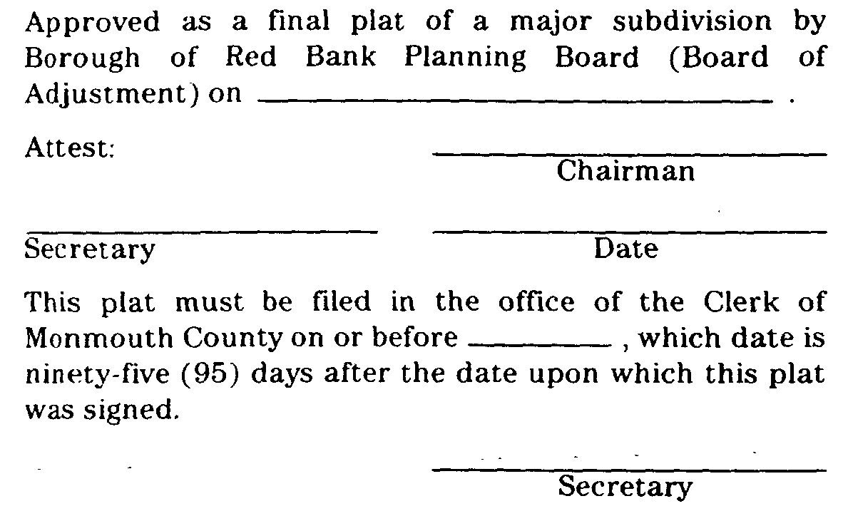
shall be endorsed on the plat and the original reproducible thereof shall be provided to the Board by the applicant. Said original shall be signed by the Chairman and the Secretary of the Board and the Borough Engineer (as to the map filing law certification) after they receive a certification from the Administrative Officer that all conditions of approval have been satisfied. After signature, plat shall be reproduced as provided for in Subsection 25-6.4 of this Chapter and the signed original shall be returned to the applicant for filing.�
e. Filing of Approved Plat. If the applicant desires to proceed with a subdivision for which final approval has been granted, he shall file with the County Recording Officer a plat map drawn in compliance with Chapter 141 of the Laws of 1960, as amended and supplemented, within ninety-five (95) days from the date upon which the plat was signed by the Planning Board Chairman and Secretary. The applicant shall, within one (1) week after filing the subdivision with the County Recording Officer, notify, in writing, the Borough Engineer and Borough Tax Assessor of the date of filing of the subdivision with the County Recording Officer and the case and sheet or page number for the filed map. A duplicate tracing of the tiled map indicating thereon the filing date shall be obtained from the County Recording Officer by the Borough who shall distribute copies of the filed map to appropriate municipal officials. In the event the subdivider fails to so file within the period allowed, the approval of the plat shall expire unless, prior to expiration, such time is extended by the Board for a period not to exceed ninety-five (95) days for good cause shown.�
f. Applicant's Rights Upon Approval. Approval of final plat shall confer upon the applicant all the rights set forth in N.J.S.A. 40:55D-52 and Subsection 25-3.1k,7. of this Chapter.�
g. Display of Final Plat. The subdivider or his agent shall keep a clear and legible copy of the approved final plat in plain view in a prominent location in his offices and/or salesrooms from which sales in the approved subdivision are made so that prospective purchasers may have the opportunity to learn the special conditions, if any, under which approval was given.�
(Ord. #686, S 13-6.10)�

