�
**Webmasters Note: The previous checklist has been amended as per Ord. No. 03-02.�
LIBERTY TOWNSHIP�
[Added 12-15-1998 by Ord. No. 98-21]�
1.___ Tax map, block and lot, tax map sheet and zone district.�
2.___ North arrow and reference meridian.�
3.___ Scale of not less than 1 inch = 50 feet, written and graphic scale.�
�
4.___ Existing and proposed street names.�
5.___ Title of plan.�
6.___ A key map indicating the property and the two most closely intersecting streets with the street serving the property.�
7.___ Name and address of owner and applicant together with the names of owners of all contiguous land within 200 feet of the boundary of the site.�
8.___ Lot dimensions to the nearest hundredth of a foot, bearings to the nearest second.�
9.___ Location of all existing and proposed structures, outside dimensions and elevations.�
10.___ Zoning schedule.�
11.___ Topography showing existing and proposed contours at two foot intervals based upon United States Coast and Geodetic Survey datum. A reference bench mark shall be clearly designated. All lands with slopes in excess of 15% contours shall be shown at five foot intervals.�
12.___ All existing physical features, including streams, water courses, wooded areas where there exist trees greater than five inches in caliper, measured at a height of four and one-half feet above ground level, indicated in general location on the plan and marked in the field, and significant soil conditions, such as swamp or rock.�
13.___ Building setback, side line and rear yard distances.�
14.___ Parking, loading and unloading area, including the number of places, dimensions, traffic patterns, access aisles and curb radius.�
15.___ Improvements, such as roads, curbs, bumpers and sidewalks, with. cross-sections, design detail and dimensions.�
16.___ The location and design of existing and proposed water systems, sanitary waste disposal systems, water mains and appurtenances and the method of refuse disposal and storage. Two soil logs and two permeability tests.�
17.___ A landscaping and buffering plan, showing what will remain or be removed and what will be planted, indicating types of plants, trees and dimensions. Where a commercial use abuts a residential zone or use, buffering shall screen the commercial use from such residential properties.�
18.___ Lighting details, indicating type of standard, location, radius of light and intensity of foot candles.�
�
19.___ Locations, dimensions and details of signs.�
20.___ Renderings or drawings of front facade, as well as the building materials to be used.�
22.___ A surface water runoff control plan, which shall contain all the data set forth under requirements for preliminary approval of a major subdivision.�
23.___ A delineation of wetlands in metes and bounds.�
24.___ At least two soil logs and associated permeability testing, a plan showing the proposed location of existing systems and typical design and layout for said systems.�
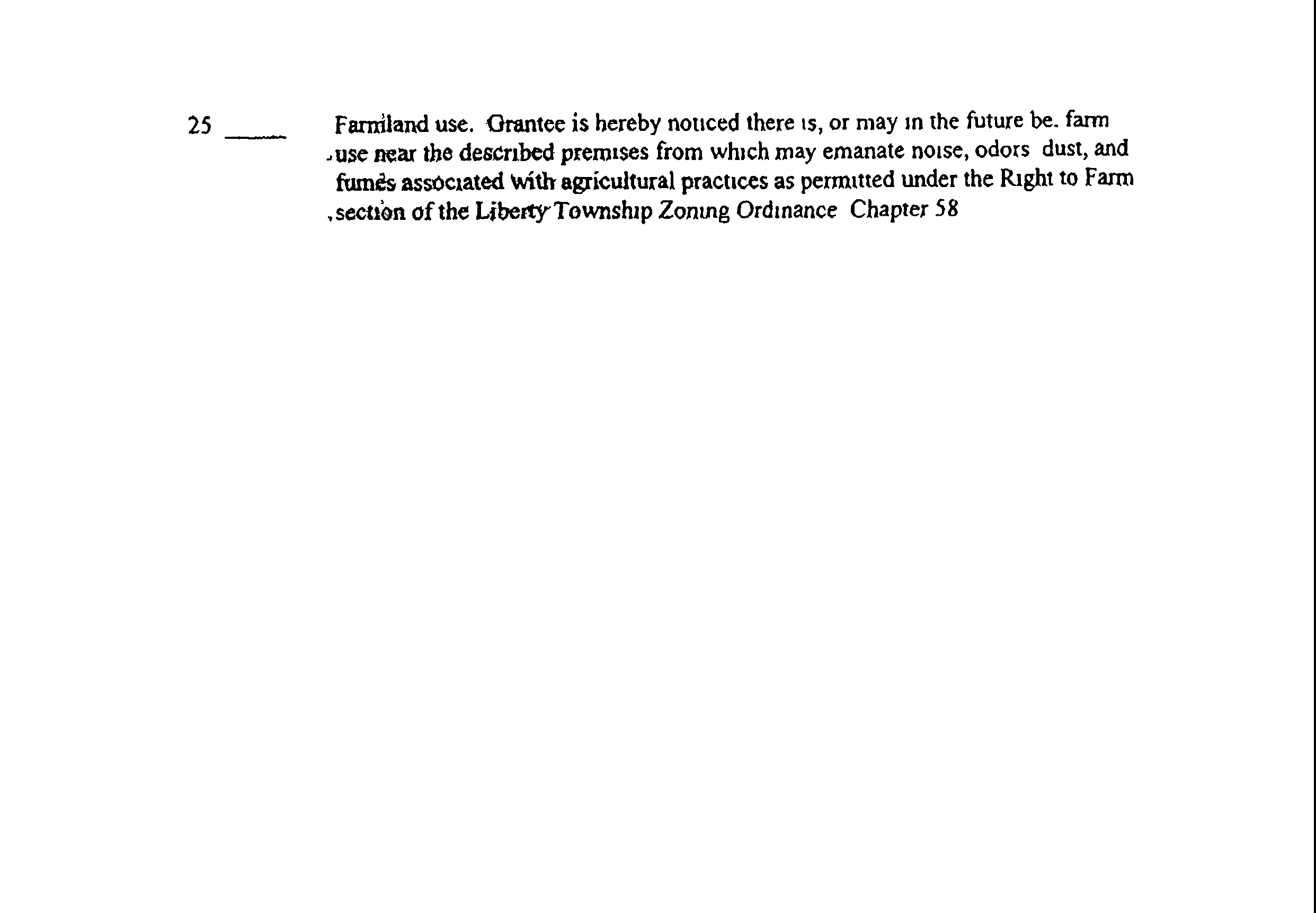
25.___ For site plans on lots in excess of ten acres an environmental impact statement.�
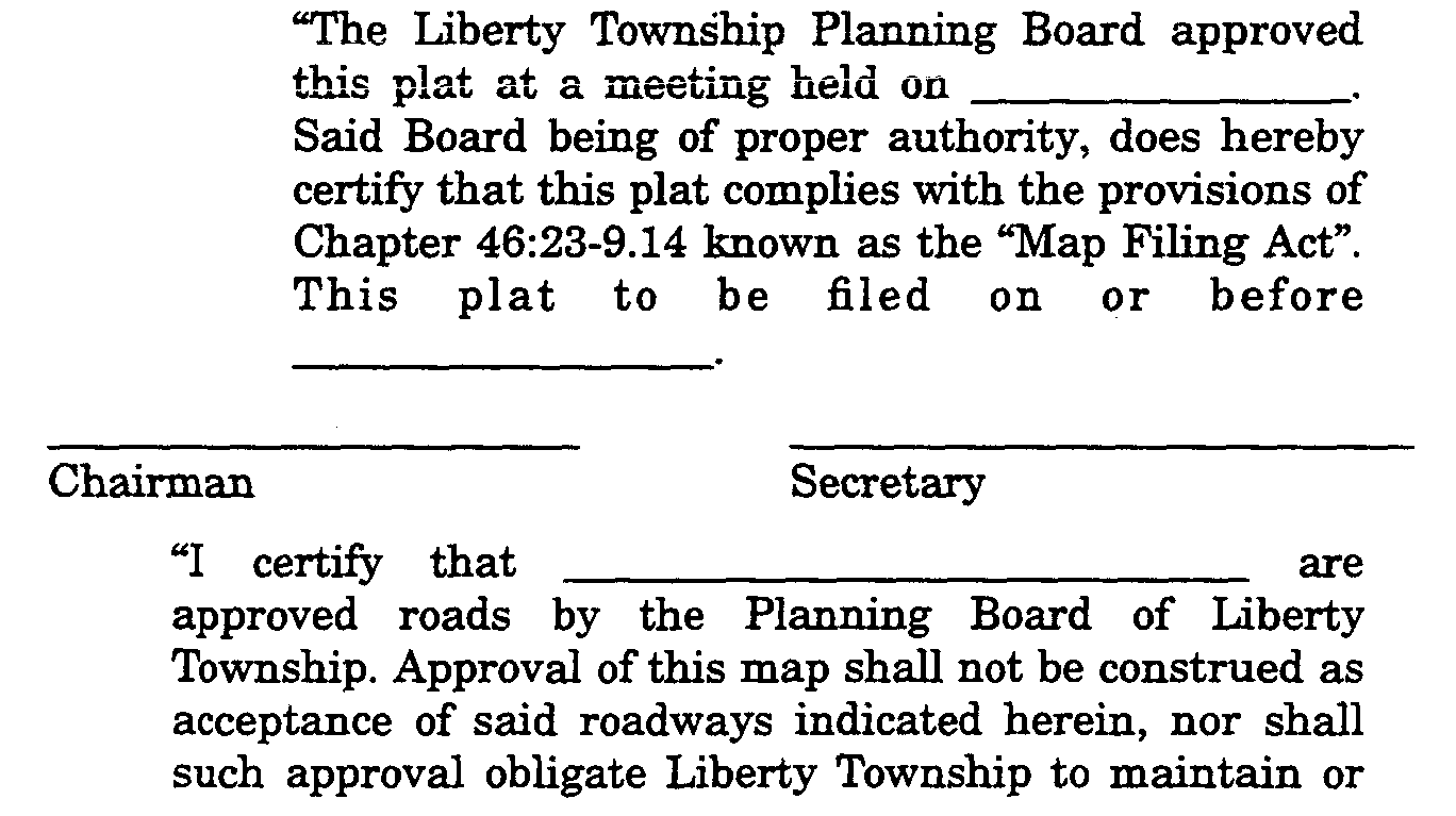
26.___ Provision for Board Chairman and Secretary signatures.�
27.___ Affidavit of proof of service, mail receipts, certified list, copy of notice sent, copy of newspaper notice as published.�
28.___ Aerial photo if tract is five acres or more.�
LIBERTY TOWNSHIP�
[Added 12-15-1998 by Ord. No. 98-21]�
Applicant's Name______________________________�
Application #__________________________________�
THE FOLLOWING ITEMS ARE REQUIRED TO PROVIDE A COMPLETE APPLICATION FOR A FINAL MAJOR SUBDIVISION�
1.___ Two original tracings on Mylar.�
2.___ North Arrow and scale not less than 1":50'.�
3.___ Title block including:�
4.___ Name of subdivision.�
Name address and certification or�
5.___ Licensed preparer (L.S.).�
6.___ Owner.�
7.___ Subdivider.�
8.___ Date of preparation and each subsequent revision.�
Key map including:�
9.___ North arrow and scale not less than 1':2,000'.�
10.___ Entire tract and its relationship to surrounding areas.�
11.___ Portion of tract to be subdivided.�
12.___ Fronting streets and at least two closest intersections.�
13.___ Adjoining properties, lot & block number & owner.�
14.___ Metes and bounds of proposed lot(s).�
15.___ Area of entire tract.�
16.___ Area and frontage of proposed lot(s).�
17.___ Frontage of remaining tract.�
18.___ Property lines to the nearest hundredth.�
19.___ Bearings to the nearest second.�
20.___ Lot acreage to the nearest tenth.�
21.___ Road locations, names, widths of R.O.W.�
22.___ Minimum. building setback lines.�
23.___ Location and description of all monuments.�
24.___ Sight triangle, drainage, utility, driveway or other easements.�
25.___ Open space areas, municipal and public areas and lands to be conveyed to the Township.�
26.___ Provisions for certification and approvals.�
27.___ Letter itemizing all elements covered under performance bond.�
28.___ Letter certifying conformance to preliminary plat by applicant's engineer.�
29.___ Final map statements included on plat:�