
C. DESIGNATION AND INTERPRETATION OF DISTRICT BOUNDARIES
(1) Zone boundary lines are intended to follow the center line of streets, railroad rights-of-way, streams, lot or property lines as they exist on plats of record at the time of the passage of this ordinance, unless such zone boundary lines are fixed by dimensions as shown on the Zoning Map.
(2) Where such boundaries are not fixed by dimensions and where they approximately follow lot lines and where they do not scale more than ten feet distant therefrom, such lot lines shall be construed to be such boundaries unless specifically shown otherwise.
(3) in unsubdivided land and where a zone boundary divides a lot, the location of such boundary, unless the same is indicated by dimensions shown on the map, shall be determined by the use of the scale appearing thereon.
D. PURPOSES OF DISTRICTS
(1) A-AGRICULTURAL DISTRICT
The purpose of the All District is to preserve those agricultural areas in Franklin Township where it is necessary and desirable because of their highly productive agricultural capability to promote, maintain and enhance the use of the land for agricultural purposes, and to protect from encroachment by non-agricultural uses, structures or activities.
(2) RR - RURAL RESIDENTIAL (Deleted 7/11/89 by ordinance #1500).
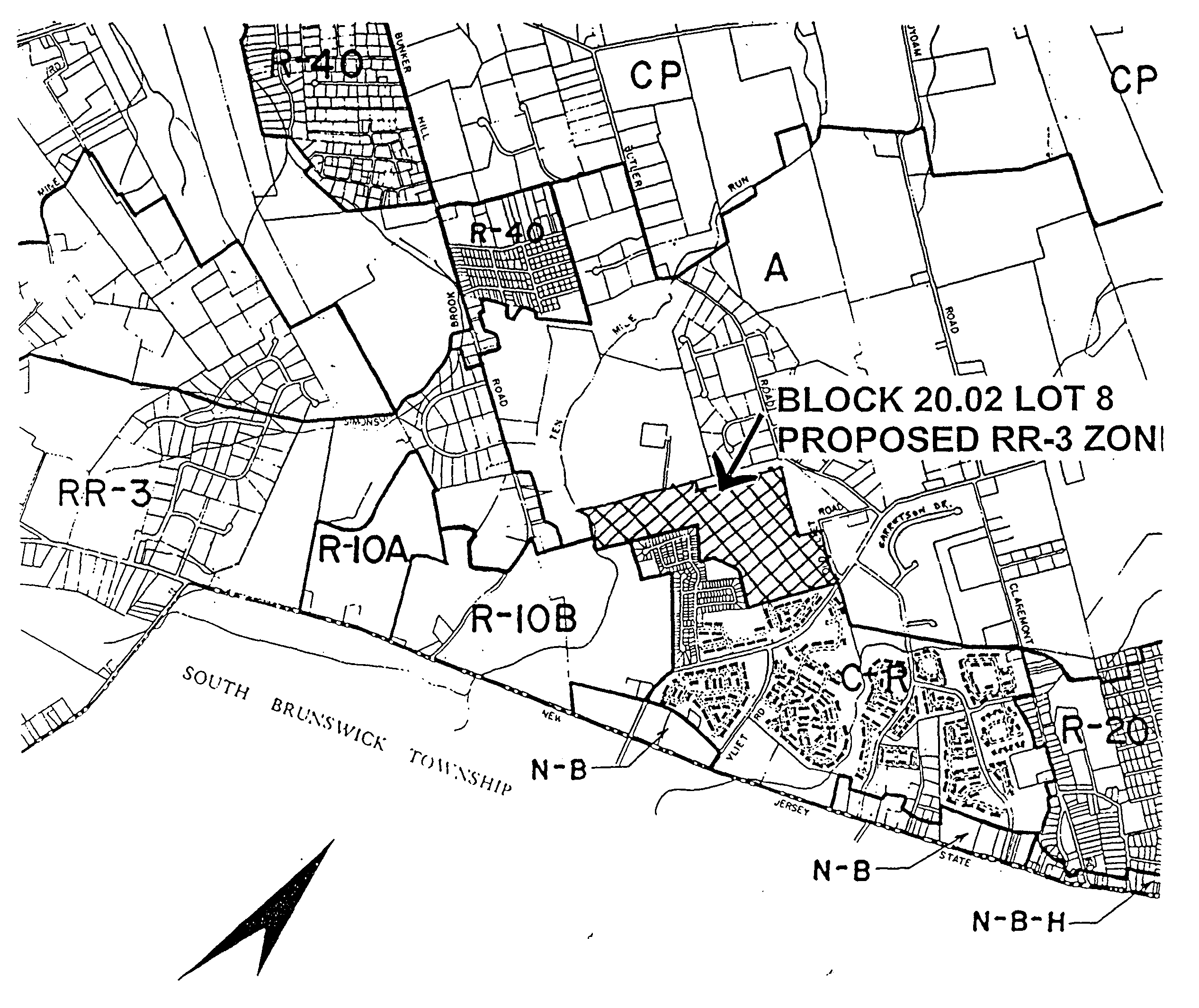
(a) RR3
The purpose of this district is to recognize the development opportunities and limitations of the Brunswick shale formation and underlying soils; to protect groundwater quantity and quality and to limit degradation of this resource; to maintain and enhance forested areas; to preserve stream quality which feeds the Canal; and to permit relatively low density single-family residential development. (Amended 7/11/89 by ordinance #1500).
(b) RR5
The purpose of this district is to recognize the development opportunities and limitations of the diabase formation and underlying soils; to protect steep slopes from development activities; to maintain agricultural resources; to protect groundwater quantity and quality and to limit degradation of this resource; to maintain and enhance forested areas; to preserve stream quality which feeds the Canal; and to permit low density single-family residential development. (Amended 7/11/89 by Ordinance #1500).
(3) R-40 - SINGLE FAMILY RESIDENTIAL
The purpose of the R-40 District is to provide for the continuance of single-family residential development on one-acre lots.
(4) R-20 - SINGLE FAMILY RESIDENTIAL
The purpose of the R-20 District is to provide for the continuance of single-family residential development on one-half acre lots.
(5) R-15 - SINGLE FAMILY RESIDENTIAL
The purpose of the R-15 District is to provide for the continuance of single-family residential development on 15,000 square-foot lots.
(6) R-10 - SINGLE FAMILY RESIDENTIAL
The purpose of the R-10 District is to provide for the continuance of single-family residential development on 10,000 square-foot lots.
(7) R-7 - SINGLE FAMILY RESIDENTIAL
The purpose of the R-7 District is to provide for the continuance of single-family residential development on 7,500 square-foot lots and also two-family residences on 10,000 square-foot lots.
(8) C-R - CLUSTER RESIDENTIAL
The purpose of the CR District is to accommodate single-family, two-family and multi-family residences while fostering the preservation of open space, recreational areas, flood plains and wooded tracts and provide low and moderate income housing.
(9) N-B - NEIGHBORHOOD BUSINESS
The purpose of the NB District is to allow for small areas throughout the Township where small retail and service businesses may be located, primarily for the convenience of the residents in the immediate neighborhood.
(10) G-B - GENERAL BUSINESS
The purpose of the GB District is to provide business and commercial uses for the local traveling public. The district is established to preserve and enhance commercial, financial, retail and similar activities and services.
(11) C-B - CORPORATE BUSINESS
The purpose of the CB District is to take advantage of major highway access to Route 287. The standards are intended to require maximum attention to proper site design including the location of structures and parking areas, proper ingress and egress, architectural design, landscaping and the need to avoid visual intrusions and performance nuisances upon adjacent residential areas. Primary uses are intended to be oriented towards corporate office and research operations with only incidental shipping and receiving related to non-production oriented uses.
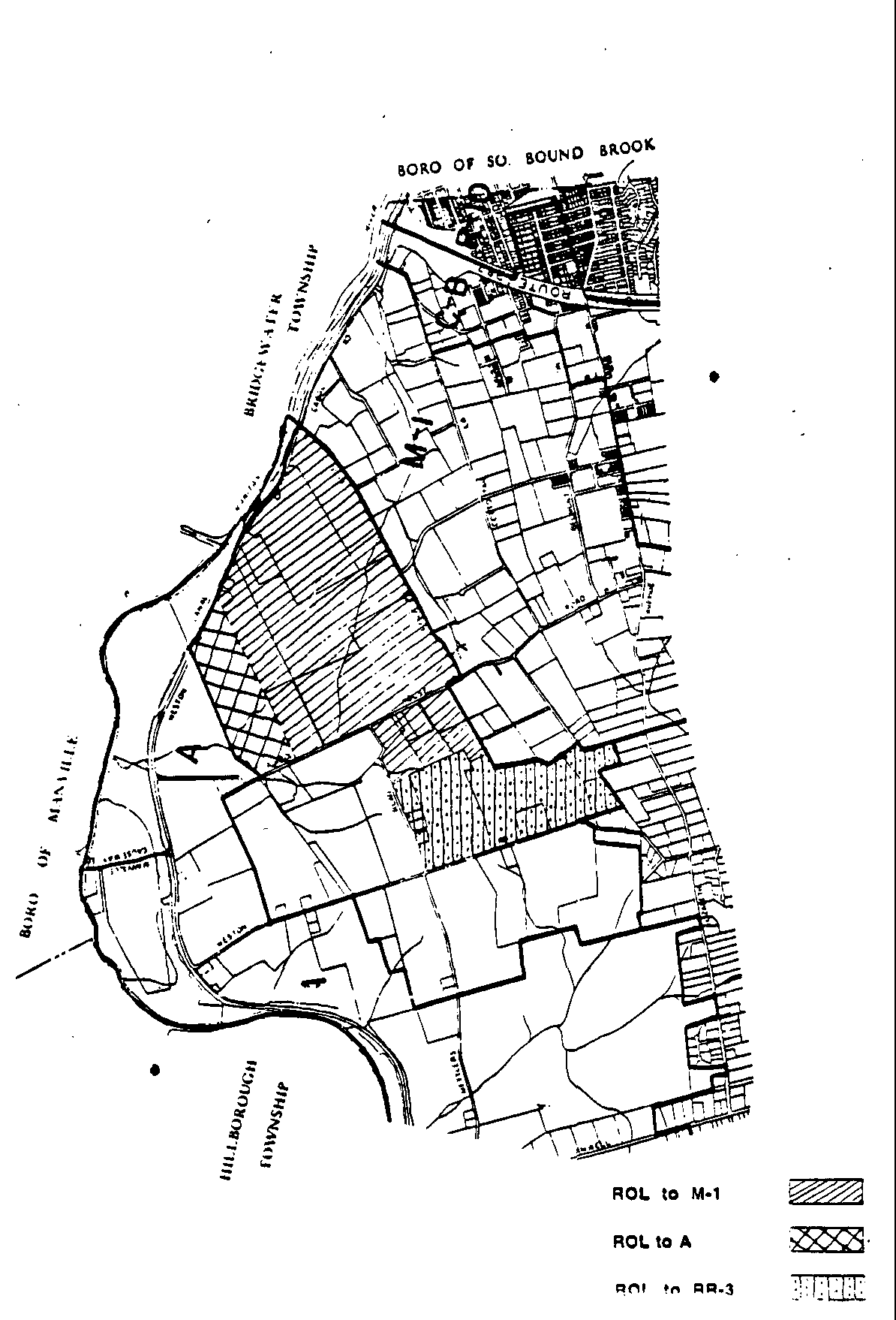
(12) ROL - RESEARCH-OFFICE-LABORATORY
The purpose of the ROL District is to encourage large-lot research, office and laboratory uses in an open setting.
(13) OP - OFFICE-PROFESSIONAL
The purpose of-the OP District is to permit small professional office buildings, small general office buildings, and mixed use buildings which are compatible with the single family detached dwellings and two-family dwellings permitted in the district, and the adjacent, densely developed residential areas. (Amended 5/13/86 by ordinance #1278).
(14) M-1 - LIGHT MANUFACTURING
The purpose of the M-l District is to permit light manufacturing and industrial uses on 5-acre minimum lots.
(15) M-2 - LIGHT MANUFACTURING
The M-2 District is designated for manufacturing and industrial operations on 2-acre minimum lots.
(16) M-3 - MINING AND MANUFACTURING
The purpose of the M-3 District is to allow quarrying activities consistent with the character of adjacent development and the preservation of environmental and historical features.
(17) H - HISTORIC OVERLAY
The purpose of the HI' Overlay District is to recognize, preserve and protect the cultural, architectural and historic resources of Franklin Township and to promote the use of scenic and historic areas for the education, pleasure and general welfare of citizens of Franklin Township and its visitors.
(18) RC - RESIDENTIAL CLUSTER OPTION
RESIDENTIAL CLUSTER OPTION (Amended 12/8/87 by ordinance #1375; Deleted in its entirety 9/15/92 by Ordinance #1733 and section number reserved.)
(19) NRPC - NATURAL RESOURCES PRESERVATION CLUSTER
The purpose of the NRPC option is to recognize, preserve and protect certain defined natural resources and, to preserve an environment for the continuance of viable agricultural and horticultural uses; preserve open space to serve environmental, scenic, and public service purposes; promote imaginative, well-designed residential subdivisions; and respect the physical and socioeconomic qualities of the land. (Amended 2/9/88 by ordinance #1380).
(20) AC - AGRICULTURAL CLUSTER
Note - the zoning requirements for Agricultural Option shall remain in effect for the Wildflower Ridge development
**Webmasters Note: The previous subsection has been amended as per Ordinance No. 3416.
(21) CP - CANAL PRESERVATION
The purpose of the Canal Preservation Zone is to recognize, protect and preserve the unique resources of the Delaware and Raritan Canal; to protect and preserve the groundwater and surface water resources which flow into the Canal; to maintain the scenic amenity of the Canal and adjacent slopes and ridges; to reduce the impact upon streets adjacent to the Canal; to protect the wooded slopes and areas from the impact of development, including erosion and increased runoff; and to maintain the agricultural resources which currently exist in the area. (Amended 4/25/89 by Ordinance #1481).
(22) R-10B - SINGLE FAMILY DEVELOPMENT
The purpose of the R10B District is permit to preservation of forests identified in the 'Forest Survey' prepared by the Franklin Township Environmental commission by providing for development on lots containing 7,500 square feet at a density of 2.1 units per acre and requiring a minimum set aside for open space preservation of 25% of the tract. [Added 4/22/98 by ordinance #2075]

