
A. Required documents. Prior to issuance of a certificate of completeness or scheduling of a preliminary plat of a major site plan for public hearing before the Planning Board, the Administrative Officer shall determine that the following has been submitted in proper form:�
(1) (Reserved)�
(2) Application for preliminary Ocean County Planning Board approval.�
(3) Application for preliminary Dover Sewerage Authority approval.�
(4) Application for land disturbance permit.�
(5) Application for Bureau of Fire Prevention approval.�
(6) Copy of application for granting of a Coastal Area Facility Review Act (CAFRA) permit, where required and if submitted.�
(7) Application for tree removal permit, where required.�
(8) Traffic Safety Officer's report, where required.�
(9) Application for floodplain encroachment permit, where required.�
(10) Application for municipal and/or state wetlands permit, where required.�
(11) (Reserved)�
(12) Other submittals that may be required by the Planning Board Engineer, Planning Board or federal, state or local law.�
(13) The application for development for a preliminary plat of a major site plan shall include a request for the granting of any variances required or other approvals required from the Planning Board.�
(14) Required application fees.�
(15) Ten copies of a plat and attachments meeting the requirements set forth below. [Amended 2-9-1982 by Ord. No. 2068; 5-22-1984 by Ord. No. 2244-84; 9-24-1996 by Ord. No. 3196-96; 12-9-2003 by Ord. No. 3843-03]�
B. Plat requirements.�
(1) General requirements.�
(a) Any preliminary plat of a major site plan presented to the Planning Board for its approval shall be signed and appropriately sealed by an architect, professional engineer, land surveyor and/or professional planner licensed to practice in the State of New Jersey; provided, however, that sanitary sewer, water distribution and storm drainage plans and water and sewage treatment plans may only be signed and sealed by a professional engineer.�
(b) Site plans shall not be drawn at a scale smaller than one inch equals 50 feet nor larger than one inch equals 10 feet. If the size of the site would require the use of sheets larger than 30 inches by 42 inches in order to show the entire site on one sheet, the detailed information for the site plan shall be shown in sections on sheets not larger than 30 inches by 42 inches, which sheets shall be keyed to an overall plan of the site drawn at a scale of not less than one inch equals 200 feet. The site plan shall be based on a monumented, current certified boundary survey. The date of the survey and the name of the person making same shall be shown on the map. If 12 months or more has passed since the date of (or date of last recertification of) the survey, it shall be recertifed and, if necessary, brought up-to-date.�
(2) Title block. The title block shall appear on all sheets and shall include:�
(b) Name of the development, if any.�
(c) Tax Map sheet, block and lot number of the site, as shown on the latest Township Tax Map, the date of which should also be shown.�
�
(d) Date of original and all revisions.�
(e) Names and addresses of owner and developer, so designated.�
(f) Names(s), signature(s), address(es) and license number(s) of engineer, architect, land surveyor or planner who prepared the plan and their embossed seal.�
(g) If the site plan contains more than one sheet, each sheet shall be numbered and titled.�
(3) A schedule shall be placed on the site plan indicating:�
(a) The acreage of the tract and site (the portion of the tract involved in the site plan).�
(b) The floor area of the existing and proposed buildings, listed separately.�
(c) The proposed use or uses and the floor area devoted to each use.�
(d) The zone in which the site is located.�
(e) Proposed and required lot dimensions and front, rear and side setbacks.�
(f) Proposed and required off-street parking spaces.�
(g) Square footage and percentage of the site retained in unoccupied open space.�
(4) North arrow and written and graphic scales.�
(5) The tops of the banks and boundaries of the floodways and flood hazard areas of all existing watercourses, where such have been delineated, or the limits of alluvial soils where the boundaries of floodways and flood hazard areas have not been determined, and/or such other information as may assist the Planning Board in the determination of floodway and flood hazard area limits. In cases where all or a portion of a site within the R-800 Zone is located in an unnumbered "A" Zone as shown on the Flood Insurance Rate Maps of the Federal Insurance Administration, the applicant shall undertake and submit such studies as are necessary to determine the base flood elevation.�
(6) Paving and right-of-way widths of existing streets within 200 feet of the site.�
(7) The boundary, nature and extent of wooded areas, swamps, bogs and ponds within the site and within 200 feet thereof.�
(8) Existing and proposed manholes, sewer lines, fire hydrants, waterlines, utility poles and all other topographical features of a physical or engineering nature within the site and within 200 feet thereof.�
(9) All existing structures on the site and within 200 feet thereof, including their use, indicating those to be destroyed or removed and those to remain.�
(10) Location, use, finished grade level, ground coverage, first floor and basement elevations, front, rear and side setbacks of all existing buildings and other pertinent improvements.�
(11) Existing and proposed public easements or rights-of-way and the purposes thereof.�
(12) A grading plan showing existing and proposed grading contours at one-foot intervals throughout the tract, except that if slopes exceed 5%, a two-foot interval may be used, and if they exceed 10%, a five-foot interval is permissible. Data shall be United States Coast and Geodetic Survey data (MSL=0) and source of data shall be noted. In addition to proposed grading contours, sufficient additional spot elevations shall be shown to clearly delineate proposed grading.�
(13) On-site drainage plan.�
(a) The drainage plan shall be presented in graphic form which shall clearly show the street and lot layout and those items which are pertinent to drainage, including existing and proposed contours as previously required.�
(b) The plan shall outline each area contributing to each inlet.�
(c) All proposed drainage shall be shown with pipe type and sizes, invert and grate or rim elevations, grades and direction of flow. The direction of flow of all surface waters and of all streams shall be shown.�
(d) The drainage plan shall be accompanied by complete drainage calculations made in accordance with the standards set forth in this chapter.�
(14) Off-site drainage plan. The plat shall also be accompanied by an off-site drainage plan prepared in accordance with the following standards:�
(a) The plan shall consist of an outline of the entire drainage basin in which the site is located. The terminus of the basin and existing ground contours or other basis for determining basin limits shall be shown.�
(b) The pertinent off-site existing drainage shall be shown with elevations of inverts and grade to the nearest 0.1 foot.�
(c) To the extent that information is available and may be obtained from the county or municipal engineer(s), any existing plans for drainage improvements shall be shown.�
(d) In the event that a temporary drainage system is proposed, full plans of that system shall be shown.�
(e) The off-site drainage plans shall be accomplished by profiles of all proposed drainage, showing existing details; pipe sizes, types, inverts, crowns and slopes; all proposed structures and connections; and design hydraulic grade lines for all conduits designed to carry 40 or more cubic feet per second. Cross sections at intervals not exceeding 100 feet shall be shown for all open channels.�
(15) If required by the Planning Board Engineer, center-line profiles of streets bordering the site, internal roadways and major circulation aisles showing:�
(a) Existing and proposed Final grades and slopes.�
(b) Pipe sizes, slope, type, inverts and grate or rim elevation of drainage and sanitary sewage facilities.�
(16) Boring logs. Unless the Planning Board Engineer shall determine that fewer boring logs are required or that some or all of the boring logs may be deferred to the final plat stage, the site plan shall be accompanied by a set of boring logs and soil analyses for borings made in accordance with the following requirements:�
(a) Borings shall be spaced evenly throughout the site.�
(b) One boring not less than 15 feet below grade or 20 feet minimum depth shall be made for every five acres, or portion thereof, of land where the water table is found to be 10 feet or more below proposed or existing grade at all boring locations.�
(c) One additional boring shall be made per acre, or portion thereof, in those areas where the water table is found to be less than 10 feet below proposed or existing grade.�
(d) In addition to the above, in those areas where the water table is found to be five feet or less below existing or proposed grade, two additional borings per acre, or portion thereof, will be required if construction of basements is contemplated. Borings shall be located where such basements are proposed.�
(e) Boring logs shall show soil types and characteristics encountered, groundwater depths, the methods and equipment used, the name of the firm, if any, making the borings and the name of the person in charge of the boring operation. The boring logs shall also show surface elevations to the nearest 0.1 foot.�
(f) Based on the borings, the site plan shall clearly indicate all areas having a water table within two feet of the existing surface of the land, or within two feet of proposed grade, or all areas within which two feet or more of fill is contemplated or has previously been placed.�
(17) Zone boundaries and the Tax Map sheet, lot and block numbers and names of owners of all properties within 200 feet of the site.�
(18) A key map adequately showing the location of the site with reference to surrounding areas, existing streets, the names of all such streets and any zone boundary or Township boundary which is within 500 feet of the subdivision. [Amended 2-9-1982 by Ord. No. 2068]�
(19) The location, area, dimensions and proposed disposition of any area or areas of the site proposed to be retained as common open space, indicating the facilities to be provided in such areas.�
(20) The capacity of off-street parking areas and the location and dimensions of all access drives, aisles and parking stalls. The location and treatment of existing and proposed entrances and exits to public rights-of-way, including the possible utilization of traffic signals, channelization, acceleration and deceleration lanes, additional width and any other device necessary for traffic safety and/or convenience and the estimated average number of passenger vehicles, single-unit trucks or buses and semitrailers that will enter the site each day.�
(21) Graphic depiction of the anticipated routes and details of the system of on-site vehicular and pedestrian circulation. If the developer desires to have the appropriate provisions of Title 39 of the New Jersey Revised Statutes governing motor vehicle operation made applicable to the site, thereby allowing municipal police regulation of traffic control devices, he shall submit a formal request and a detailed plan meeting the requirements of the New Jersey Department of Transportation. The Township Engineer will advise the developer regarding the details of such a plan.�
(22) The location and size of proposed loading docks.�
(23) Location of curbs and sidewalks.�
(24) Cross section(s) showing the composition of pavement areas, curbs and sidewalks.�
(25) Exterior lighting plan, including the location and drawn details of all outdoor lighting standards and fixtures and a notation on the plat indicating conformance or nonconformance with the minimum design standards of the Dover Township Land Use and Development Regulations. [Amended 2-9-1982 by Ord. No. 2068]�
(26) Landscaping and screening plan showing the location, type, spacing and number of each type of tree or shrub and the location, type and amount of each type of ground cover to be utilized.�
(27) Location of signs and drawn details showing the size, nature of construction, height and content of all signs.�
(28) Drawn details of the type of screening to be utilized for refuse storage areas, outdoor equipment and bulk storage areas.�
(29) Floor plans and building elevation drawings of any proposed structure or structures, or existing structures to be renovated.�
(30) Location of handicapped facilities, including parking spaces and ramps, where applicable.�
(31) If the Planning Board Engineer, Planning Board or Environmental Commission determines that specimen trees located on the site may have an effect on the proper layout of the subdivision, it may be required that the location, caliper and type be shown on the plat for the following:�
(a) Living deciduous trees having a trunk of six-inch diameter or more at breast height.�
(b) All living coniferous trees having a trunk of six-inch or more diameter at breast height.�
(c) All living dogwood (Corpus florida) or American holly (Ilex opaca) trees having a trunk of one-inch or greater diameter at breast height.�
(d) All native laurel (Kalmia latifolia) shrubs having a root crown of three inches or greater measured at the soil or surface level.�
(32) Sectionalization and staging plan. Developers of large uses, such as shopping centers, multifamily dwellings, industrial parks or other such uses proposed to be developed in stages, shall submit a sectionalization and staging plan showing the following:�
(a) The anticipated date for commencing construction of each section or stage. The staging of development on the site shall be such that if development of the site were discontinued after the completion of any stage, the developed portion of the site would comply in all respects to the requirements of this chapter and be provided with adequate drainage and utility systems.�
(b) Those improvements that will be completed in each stage prior to application for certificate of occupancy. The plan should demonstrate that the staging of construction will minimize adverse effects upon occupied buildings in the site and adjoining properties.�
�
(33) Written description of the proposed operations in sufficient detail to indicate the effects of the use in producing traffic congestion, noise, glare, air pollution, fire hazards or safety hazards. The written description shall also include the hours of operation of the use, the number of shifts to be worked, the number of employees in each shift, the number of vehicles to be stored or parked on the site and provisions to be made for site maintenance.�
(34) Such other information as the Planning Board and/or Planning Board Engineer may request during site plan review.�
(35) It is recognized that in certain instances, the uniqueness of a particular proposal may require the waiver of some of the information required herein. The Planning Board may consider and for cause shown may waive strict conformance with street of these plat map details and other engineering documents as it sees fit. developer desiring such action should present with his application for development a listing of all such waivers desired, together with the reasons therefor. It shall also be indicated on the plat map that this plan, as some plat map details and engineering documents are not so indicated on the plat map, will not be used for construction purposes. [Added 9-14-1982 by Ord. No. 2116]�
C. Conditions of approval.�
(1) Any approval of an application for development for a preliminary plat of a major site plan by the Planning Board shall be subject to the following conditions being satisfied prior to the signing of the plat:�
(a) Payment of required reproduction fee.�
(b) Submission of additional prints of the plat and attachments for distribution, if required.�
(c) Preliminary Ocean County Planning Board approval, if not previously granted.�
(d) Preliminary Dover Sewerage Authority approval, if not previously granted.�
(e) Bureau of Fire Prevention approval, if not previously granted.�
(f) Publication of a notice of the decision by the applicant.�
(g) Any other conditions which may be imposed by the Planning Board or may be required by federal, state or local law.�
(2) The Planning Board may also condition its preliminary approval upon the applicant providing for certain revisions or additions to the final plat submission.�
�
D. Certification. In the event that the application for development for a preliminary plat of a major subdivision is approved, a certification to that effect in this form: [Amended 9-24-199( by Ord. No. 3196-96]�
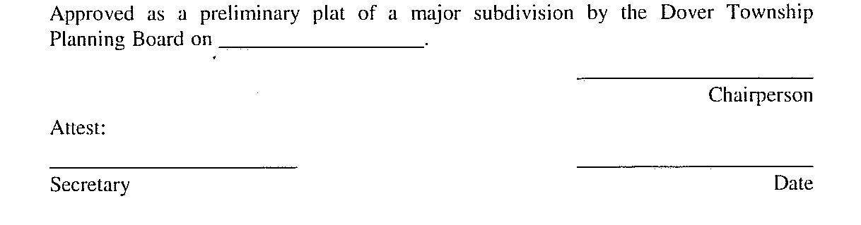
shall be endorsed on the preliminary plat, and the original reproducible thereof shall be provided to the Planning Board by the applicant. Said original shall be signed by the Chairperson and Secretary or Assistant Secretary of the Planning Board after they receive certification from the Administrative Officer that all conditions of approval have been satisfied. After signature the preliminary plat shall be reproduced as provided for in ,
E. Applicant's rights upon approval. Approval of a preliminary plat shall confer upon the applicant all the rights set forth in N.J.S.A. 40:55D-49 and
F. Improvements not to be installed. Approval of a preliminary plat shall not confer upon the developer the right to undertake any clearing, grading and/or to install any improvements prior to final plat approval unless it shall be determined by the Planning Board and the Township Engineer that said clearing, grading and/or installation of improvements would not hinder future development or create physical or aesthetic problems in the event that further development of the site plan is not undertaken and that required inspection fees have been paid, and adequate performance guaranties have been posted to provide for the cost to the Township of performing work that may be necessary to protect adjacent property owners and the public interest in the event that such clearing, grading and/or installation of improvements is not completed and/or further development of the site is not undertaken. Such performance guaranties shall include but are not limited to the cost to the Township of providing erosion control facilities, seeding or' otherwise stabilizing the site, drainage facilities necessary to protect off-tract areas from flooding, screening or fencing that may be required and all improvements to be undertaken which are within public rights-of-way or easements.�

