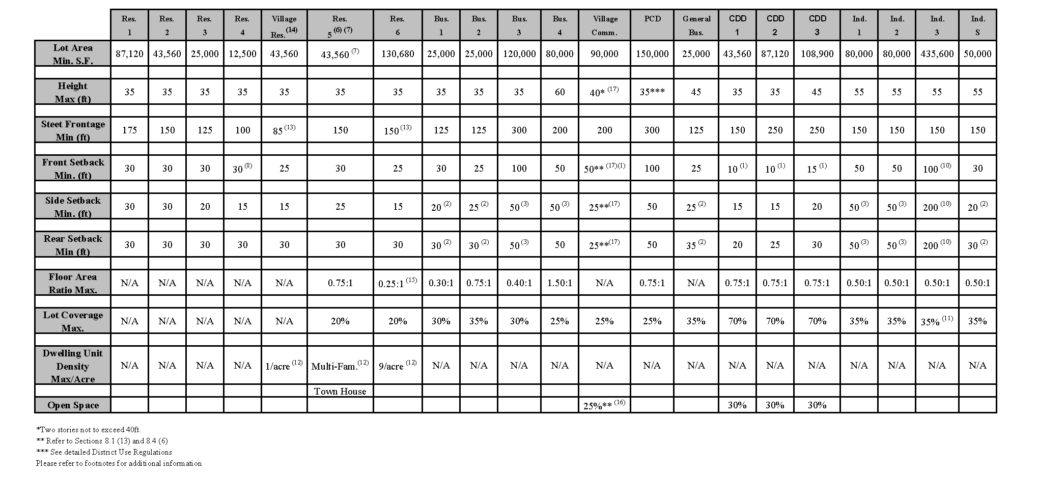
MAP AMENDMENTS�
Article 42. Rezone 110 Sutton Street, North Andover bounded and described as set forth in exhibits, from Industrial-S to General Business .�
Exhibit A:�
110 Sutton Street as being shown as Parcel 1 and Parcel 2 on a plan entitled Plan of Land Recorded for Robert C. and Nancy Carberry and owned by KLC Realty Trust, May 12th 1995, and recorded in the Essex County North Registry of Deeds Land Court Section at Book 92, Page 381.�
Parcel 1: A certain parcel of land, situated in North Andover, and being a certain lot of land with all the buildings thereon, situated on the northerly side of Sutton Street, in said North Andover, and bounded and described as follows:�
Northerly: By Land of William Kruschwitz, now or formerly, eight-four 21/100 (84.21) feet;�
Easterly: By Land Now or Formerly of Habdel T. Fary, One Hundred and seventy-five (175) feet;�
Southerly: By the Northerly line of Sutton Street, one hundred fifteen (115) feet and;�
Westerly: By Land Now or Formerly of Theodore and Lillian Lavalle, on hundred forty-seven and 40/100 (147.40) feet.�
�
Being Lot three as shown on a plan of land of Patrick Donovan, entitled Plan of Sutton Street, North Andover, MA., Engineer Ralph B. Brasseur, C.E. Recorded as Plan No. 1833, with the North Essex Registry of Deeds.�
Parcel 2: That certain parcel of land, with the buildings thereon, situated in North Andover, with the adjacent portion of the bed of the Shawsheen River to the thread of the stream in Lawrence as follows:�
Southeasterly: By Ashland Street on hundred six (106) feet;�
Southwesterly: By lands now or formerly of Fred C. Ertinghausen and of Thomas B. Kittredge et al measuring on the upland three hundred and twenty five (325) feet;�
Northwesterly: By the Shawsheen River and�
Northeasterly: By land now or formerly of James B. Ewart measuring on the upland three hundred and fifty eight (358) feet.�
All of said boundaries, except the river line, are determined by the court to be located as shown on Plan No. 5118A, drawn by Horace Hall Smith, Engineer, dated October 1, 1914, as modified and approved by the court, filed in the Land Registration Office, a copy of a portion of which is filed with Certificate of Title No. 456, Book 2, Page 293.�
Said parcels shown as Map 17, Parcel 9 on the most recent Assessor Map containing 52,712 square feet of land, more or less according to said plan.�
Article 43. Rezone - Chickering Road from R-4 to Business 1. Rezone a certain tract or parcel of land situated in the Commonwealth of Massachusetts, County of Essex and Town of North Andover located on the westerly side of Chickering Road and the southerly side of Farrwood Avenue being more particularly bounded and described as follows:�
Beginning at a point on the westerly sideline of said Chickering Road at land now or formerly of Trustees of Reservations, said point being the southeast corner of the within described premises.�
Thence by land of said Trustees and by a stone wall S89-37-39W three hundred three and sixty-five hundredths (303.65) feet to a drill hole at a stonewall corner;�
Thence N02-17-46E three hundred eight and forty hundredths (308.40) feet to the southerly sideline of said Farrwood Avenue;�
Thence by the southerly sideline of said Farrwood Avenue N90-00-00E (Due East) two hundred ninety-eight and fifty-four hundredths (298.54) feet to a granite bound at a point of curvature;�
Thence continuing by the southerly sideline of said Farrwood Avenue along a curve to the right having a central angle of 114-28-25, a radius of twenty-five and no hundredths (25.00) feet and an arc length of thirty-nine and ninety-six hundredths (39.96) feet to a point on the westerly sideline of said Chickering Road.�
Thence by the westerly sideline of said Chickering Road S24-28-25W three hundred forty-six and twenty-seven hundredths (346.27) feet to the point of beginning.�
Said tract or parcel of land contains 112,467 square feet or 2.582 acres more or less.�
ARTICLE 42 - MAP AMENDMENT�
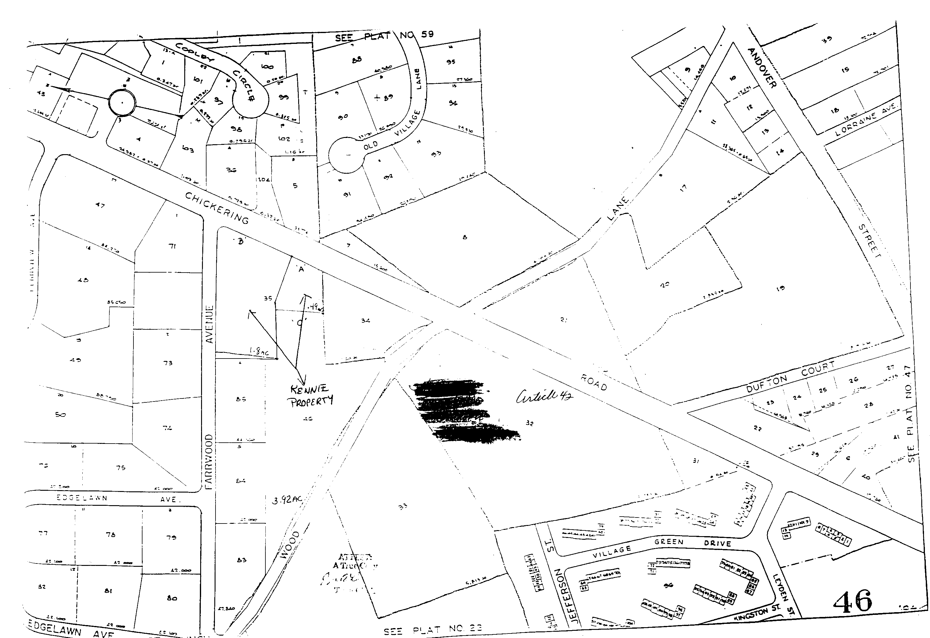
ARTICLE 42 - MAP AMENDMENT ATM 1998�
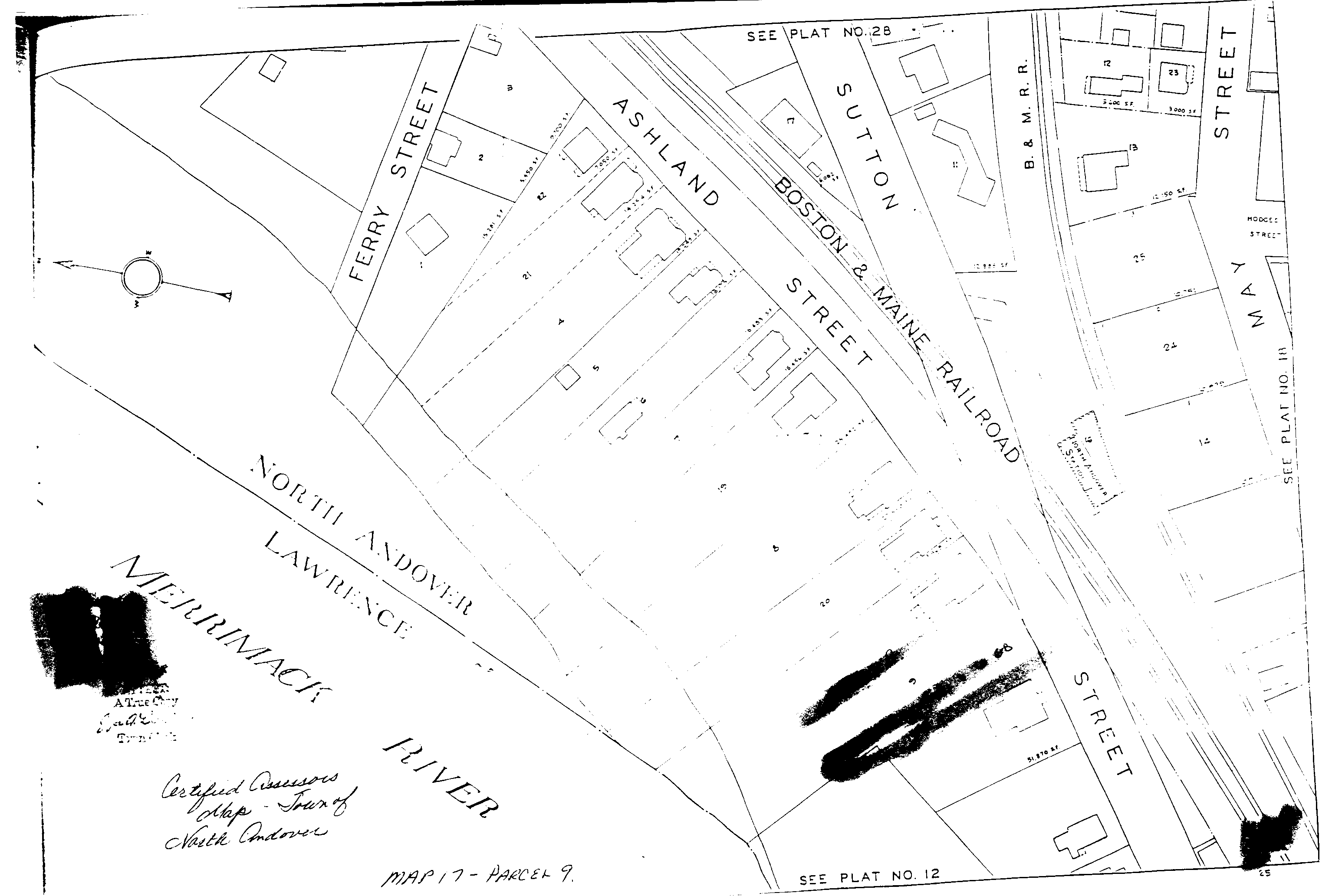
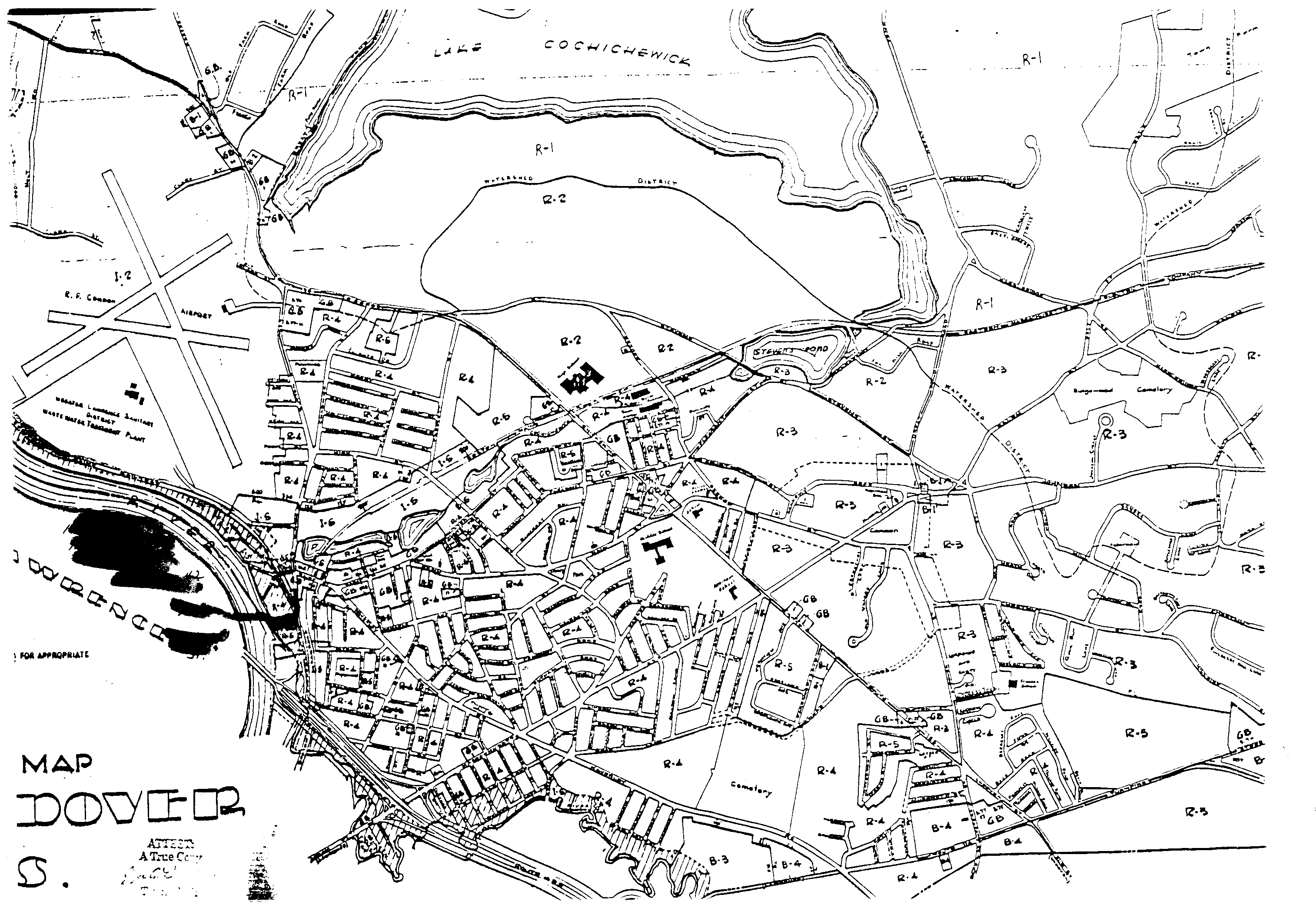
ARTICLE 43 - MAP AMENDMENT ATM 1998�
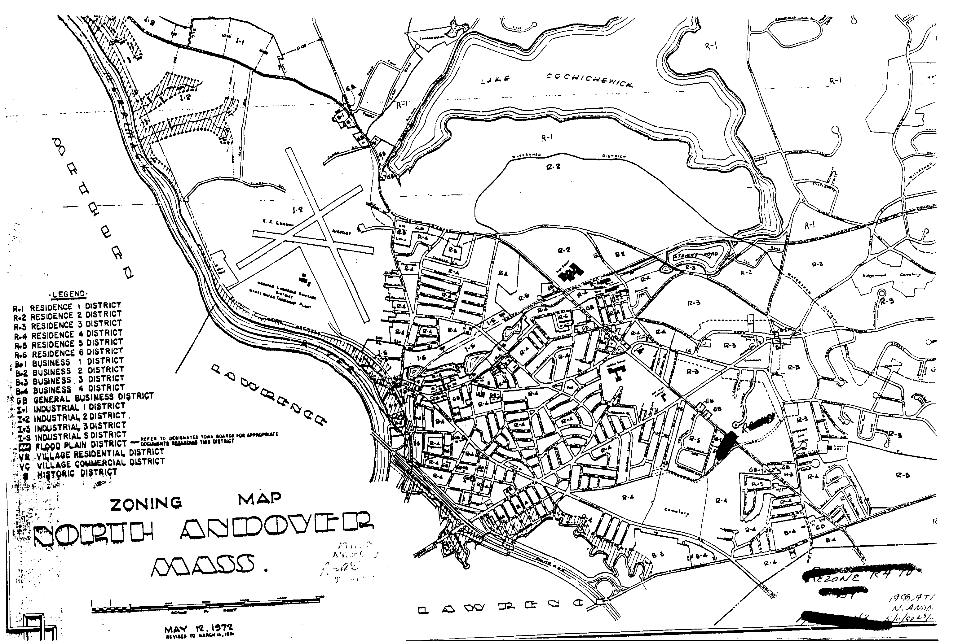
Amended ATM 5/4/99, APPROVED 7/27/99�
ARTICLE 31. Rezone Portions of Route 114 From R6 to Village Commercial. To see if the Town will authorize the rezoning of properties along Route 114 from residential use (R6) to business use (VC Village Commercial). The purpose of this Article is to promote safety and welfare concerns and to encourage the most appropriate use of the land. The land recommended for rezoning approval by the petitioners is as follows:�
1. 651 Turnpike Street as further described in the Essex North Registry of Deeds in Book 3794, Page 278 containing 45,000 sq.ft. more or less.�
2. 643 Turnpike Street as further described in Essex North Registry of Deeds in Book 4520, Page 23 containing 21,875 sq.ft. more or less.�
3. 633 Turnpike Street as further described in the Essex North Registry of Deeds in Book 3665, Page 329 containing 21,875 sq.ft.�
A portion of the property known as Holbrook Realty Trust as further described in the Essex North Registry of Deeds in Book 3911, Page 183 containing an area described as follows: A line running from the right of way of Route 114 south 6 degrees 31 minutes and 48 seconds east for an approximate distance of 70 feet, then turning, north 85 degrees 45 minutes and 13 seconds east for an approximate distance of 191 feet, then turning, north 44 degrees 4 minute and 12 seconds east for 180 feet, then intersecting with a line at a right angle and running 450 feet to the north to another line intersecting at a right angle running for 350 feet along the northern property line of N/F Parker and Kohl connecting back to the right of way of Route 114.�
The rezoning shall be to amend the Zoning Map for the aforementioned properties from R6 to VC.�
Amended ATM 5/4/99, APPROVED 7/27/99�
ARTICLE 33. Rezone Portion of Osgood Street From Industrial 1 to Business 1 - Forgetta Property. Voted by two-third vote declared by the moderator that only the following three parcels be rezoned from the current zone I-2 to B-1.�
The first parcel is located at 1284 Osgood Street as further described as Lot B, in the Essex North Registry of Deeds in Book #2954 Page 250 as shown on Plan #11303 Registry of Deeds.�
The second parcel is located at 1292 Osgood Street as further described as Lot A and Plan #6210 both shown on Plan #11303 in the Essex Registry of Deeds a plan of land in North Andover, both parcels containing approximately 161,035 square feet, recorded October 5, 1988.�
The second parcel is located at 1292 Osgood Street as further described as Lot A and Plan #6210 both shown on Plan #11303 in the Essex North Registry of Deeds a plan of land in North Andover, both parcels containing approximately 161,035 square feet, recorded October 5, 1988.�
The third parcel is located at 1320 Osgood Street as further described on Plan #3433 entered in the North District Essex County, March 11, 1957, a lot containing approximately 50,232 square feet.�
PARCEL I�
Beginning at a stone bound at land of Stanley Stefanowich; thence running in a northerly discretion on the westerly side of Osgood Street nine hundred (900) feet to a stake at other land of Walter H. Hayes, thence running in a westerly direction five hundred forty (540) feet more or less to a point in a stone wall; thence in the same direction across said stone wall two hundred seventy (270) feet to a monument in a second stone wall at land of said Stanley Stefanowich; thence turning and running in a southeasterly direction by said stone wall seven hundred twenty seven (727) feet more or less to a bound by land of said Stanley Stefanowich; thence in an easterly direction still by land of said Stanley Stefanowich formerly of Walter H. Hayes two hundred ten (210) feet to the point of beginning.�
PARCEL II�
Beginning at the northeasterly corner thereof on Osgood Street at land now or once of Leon H. Bassett and running thence southerly by said road to land now or once of Antonio Forgetta; thence running in a westerly direction five hundred forty (540) feet, more or less, by said land of Forgetta to a point in a stone wall; thence in the same direction across said stone wall two hundred seventy (270) feet, more or less by said land of Forgetta to a monument in a second stone wall at land now or once of Stanley Stefanoweich; thence running in a northerly direction by land now or once of Hackett and of French to a stake and stones at land now or once of James A. Montgomery; thence easterly by said land of Montgomery 16 rods; thence southerly four rods, more or less, thence easterly 10 rods, more or less, to land now or once of Bassett; thence southerly on said Bassett land about 10 rods; thence easterly by land of said Bassett to said Osgood Street to the point of beginning. Excepting thereto the land taken by the City of Lawrence for the airport.�
Amended ATM 5/4/99, APPROVED 7/27/99�
ARTICLE 34. Rezone Portion of Route 114 From B1, I1 and R3 to Village Commercial. To see if the Town will vote to rezone the following adjacent parcels of land from Business-1, Industrial-1 and Residential-3 to Village Commercial, said parcels being lots 6, 7, 38, 40, 56 and 57 as shown on Plan of Land in North Andover, MA, to accompany this petition for zoning change, prepared for Atlantic Realty Trust, dated March 12, 1999.�
The legal description being: Six (6) parcels of land located on the north side of Route 114 (Salem Turnpike) beginning at the northwest corner, at the intersection of Saville Street and the Salem Turnpike, running:�
Easterly 314.50 +/- along the sideline of Saville Street, thence;�
Northerly 50.00 +/- along the sideline of Saville Street, to land of Greenwood Associates, thence;�
Southeasterly 681.90 +/- along land of Greenwood Associates to land of Bartle, thence;�
Southwesterly 132.90 along land of Bartle to a point, thence;�
Southeasterly 189.43 along land of Bartle to a point at land of Magnum Realty Trust, thence;�
Southerly 475.64 along land of Magnum realty Trust to a point, thence,�
Westerly 237.74 along land of Magnum Realty Trust to a point at Route 114 (Salem Turnpike), thence�
Northerly 810.22 along the Salem Turnpike to the point of beginning.�
Said property consists of lots 56, 38, 57, 40, 6, and 7 as shown on Town of North Andover Assessors Map #98D and is shown on a Plan of land in North Andover, MA to accompany zoning petition of Atlantic Realty Trust 1 =40' March 12, 1999, Merrimack Engineering Services, 66 Park Street, Andover, MA 01810.�
Motion is hereby made to amend Article 34 of the 1999 Annual Town Meeting Warrant as printed to exclude Lots 6 and 7 therein which lots are recorded at the North District of Essex Registry of Deeds, Registered Land Department (Land Court) at Book 56, Page 357. Said lots containing .96 acres, more or less.�
The remaining four (4) parcels of land have the following legal description:�
See plan of land entitled Plan of Land in North Andover, Prepared for Constance Aleci dated January 31, 1984 and recorded in the North District of Essex County Registry of Deeds as Plan No. 9402.�
LOT NO. 1 - said parcel contains 92,104 square feet of land, more or less, and is recorded in said Registry of Deeds at Book 4671, Page 165.�
LOT NO. 2 - said parcel contains 80,256 square feet of land, more or less, and is recorded in said Registry of Deeds at Book 4671, Page 165.�
LOT NO. 3 - said parcel contains 88,379 square feet of land, more or less, and is recorded in said Registry of Deeds at Book 4671, Page 165.�
See plan of land entitled Plan of Land Located in North Andover, Mass. prepared for OPTRX Realty Trust, William J. Dalton, Trustee, Richard F. Kaminski and Associates, Inc., surveyors and recorded with the North District of Essex Registry of Deeds as Plan No. 9841.�
LOT NO. 1 - contains 3.956 acres of land, more or less, and is recorded in said Registry of Deeds at Book #4671, Page 162.�
ARTICLE 31 MAP CHANGE R6 TO VC�
ARTICLE 33 MAP CHANGE Forgetta I1 to B1�
ARTICLE 34 MAP CHANGE B1, I1 & R3 to VC�
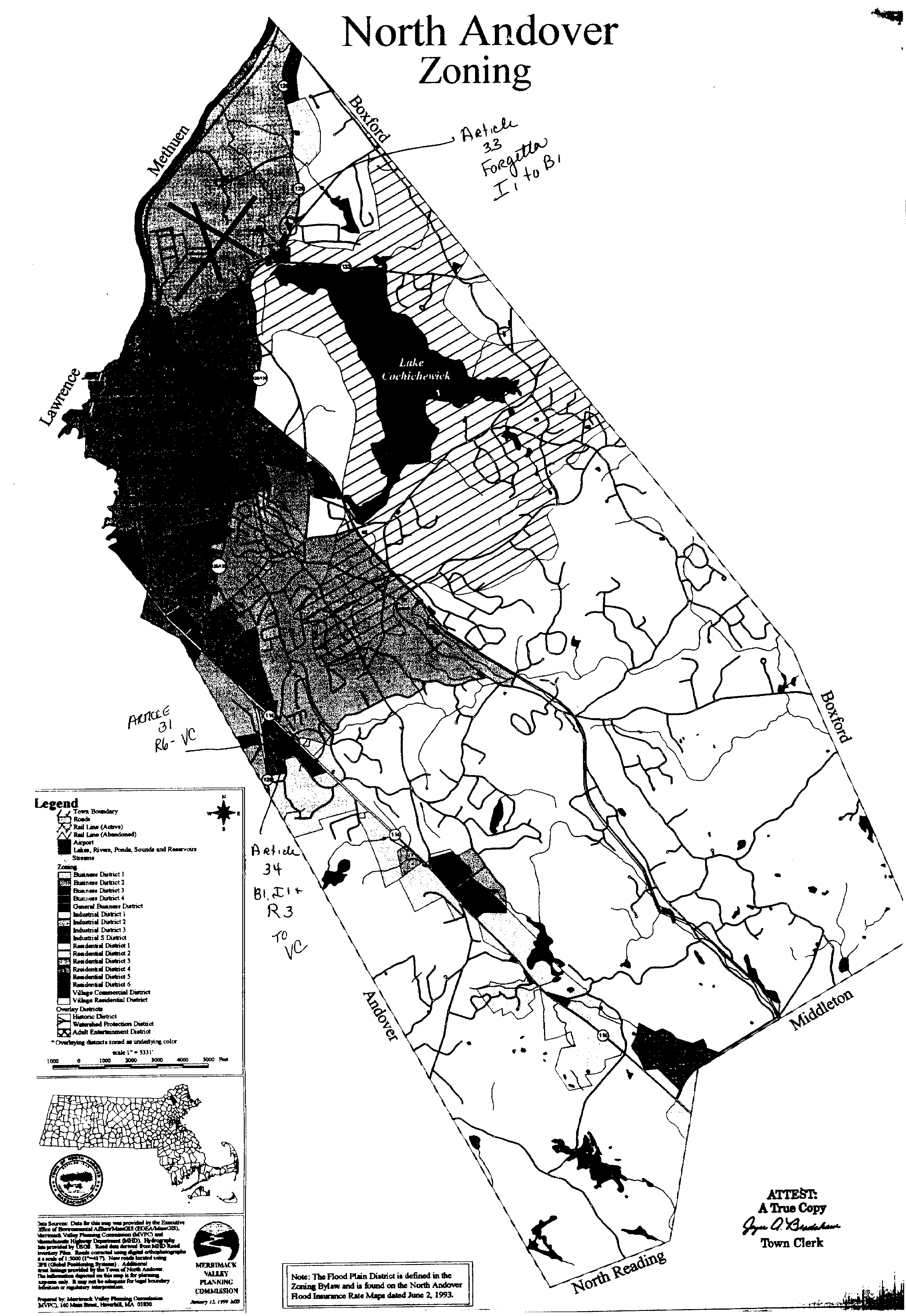
ARTICLE 31 & 34�
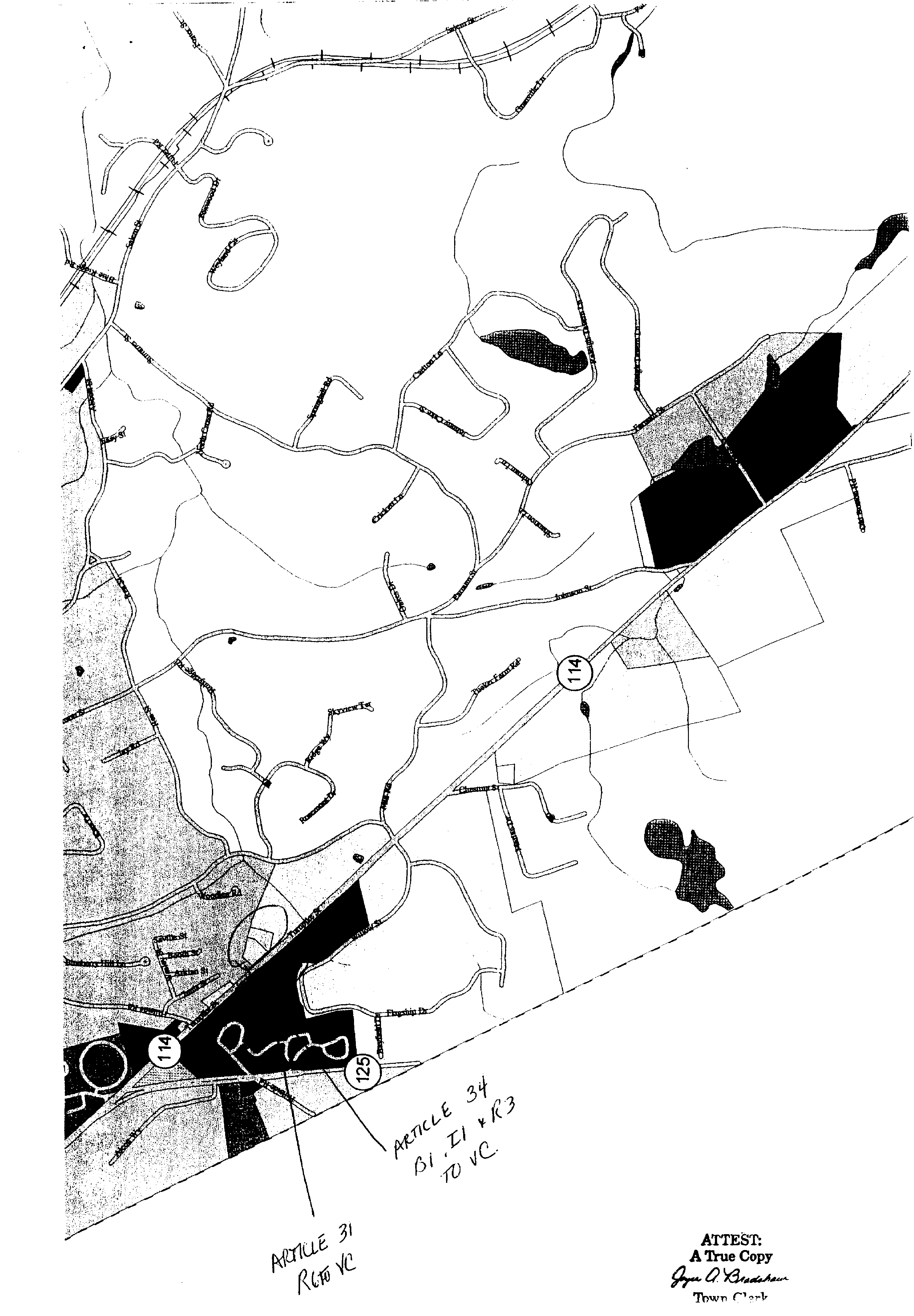
ARTICLE 33�
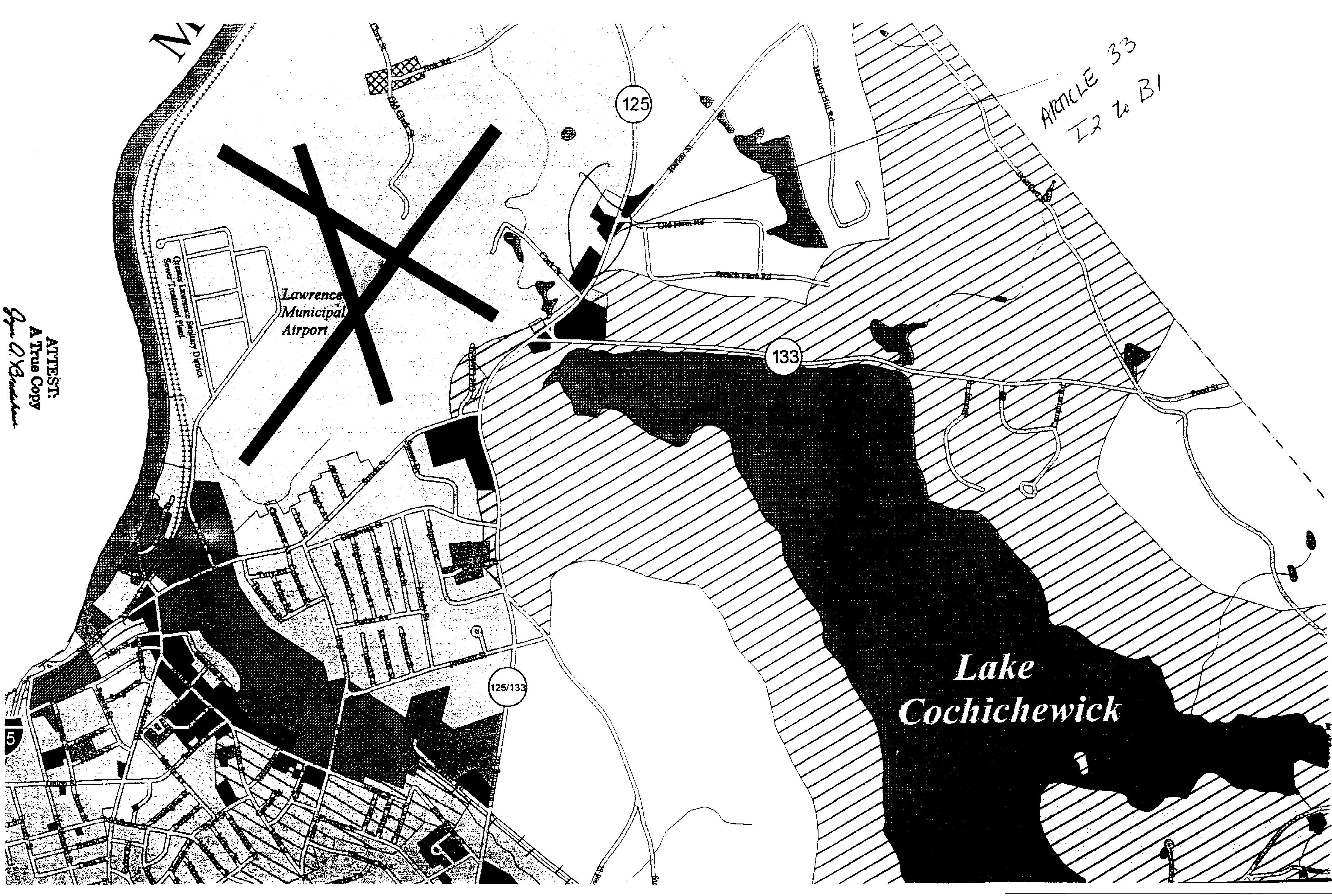
ATM 5/13/00, approved 10/12/00�
ARTICLE 29. Rezone Portion of Osgood Street - Map 35 Parcel 9-1210 Osgood Street. Business 1 (B2) should read Business 2 (B2); and further to amend the Zoning designation of the following parcel from Industrial (2) (I2) to Business 2 (B2), more specifically 1210 Osgood Street, Map 35, Parcel 9, containing 3.1 acres more or less that being:�
ARTICLE 29�
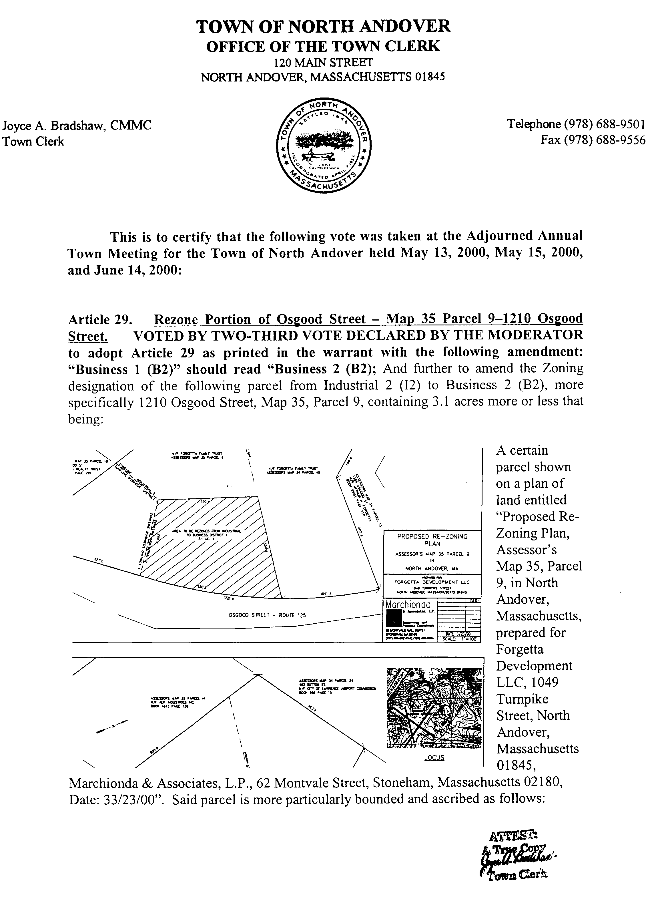
A certain parcel shown on a plan of land entitled Proposed Re-Zoning Plan, Assessor's Map 35, Parcel 9, in North Andover, Massachusetts, prepared for Forgetta Development LLC, 1049 Turnpike Street, North Andover, Massachusetts 01845, Marchionda & Associates, L.P., 62 Montvale Street, Stoneham, Massachusetts 02180, Date 3/23/00. Said parcel is more particularly bounded and ascribed as follows:�
Beginning at a point, said point being the intersection of the Business 1/Industrial 2 Zone line as it intersects the westerly sideline of Osgood Street as shown on said plan; thence�
Northerly along the Westerly sideline of Osgood Street a distance of approximately 530 feet to the common boundary line between Assessor's Map 35, Parcel 9, and Assessor's Map 34, Parcel 49; thence�
Westerly a distance of 350 feet, more or less, along the boundary line between Assessor's Map 35, Parcel 9, and Assessor's Map 34, Parcel 34, to a point; thence�
Southerly a distance of 300 feet, more or less, to a point along the intersection of Business District 1/Industrial 2 Zone line as shown on said plan; thence�
Easterly a distance of 250 feet, more or less along the common boundary line of the Business 1/Industrial 2 Zone to the point of beginning.�
Containing 3.1 acres, more or less.�
ATM 5/13/00, approved 10/12/00)�
ARTICLE 31. Rezone Portion of Route 114.�
Parcel #2 is further defined in a deed recorded with the Essex North Registry of Deeds in Book 4158, Page 216; and,�
Parcel #3 is further defined in a deed recorded with the Essex North Registry of Deeds in Book 2259, Page 207, and is shown on a plan recorded as Plan #10376 of 1986.�
To amend the Zoning designation of the following parcel as shown on the below portion of the assessor map and as described in more detail below, from Village Residential (VR) to Business 4 (B4).�
�
ARTICLE 31�
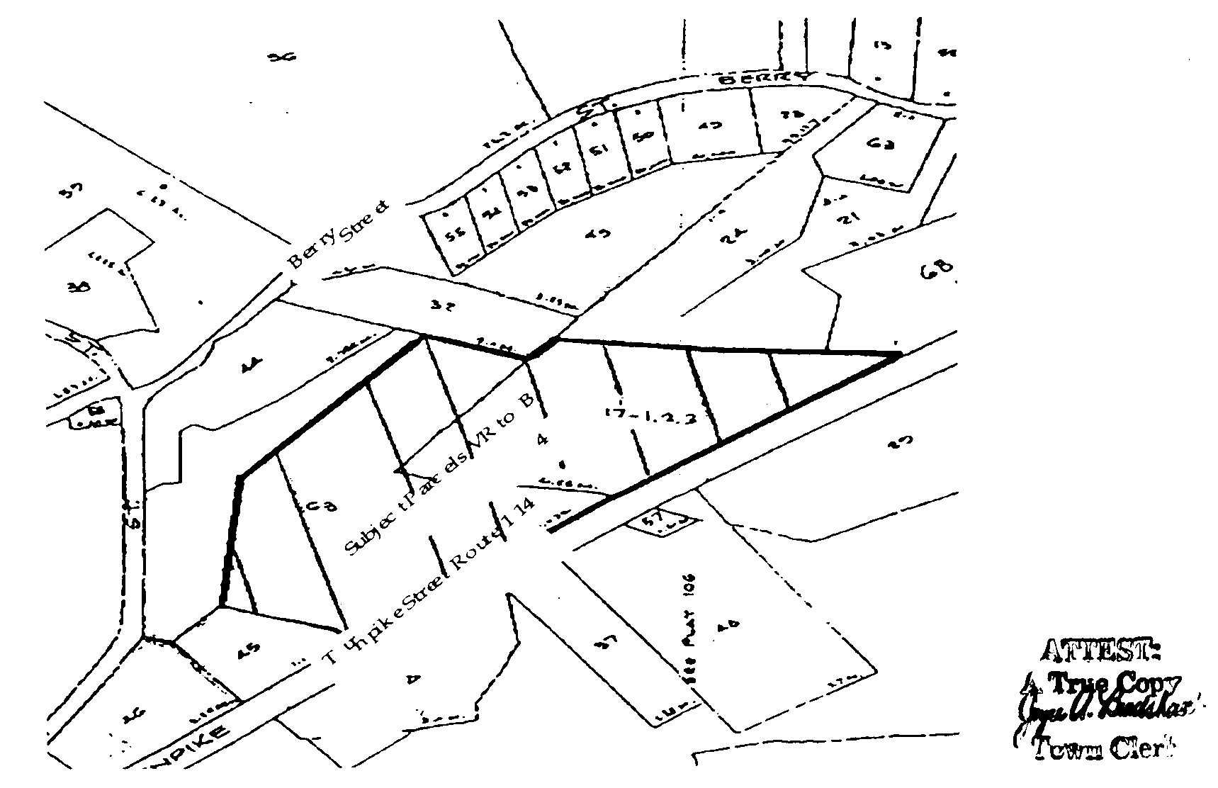
A portion of Parcel #2, Map 106D, Parcel 63, further describes as follows:�
The land in North Andover, with all the buildings thereon, bounded and described as follows:�
Beginning at a point along the northern right-of-way line of Route 114 which is a common point of turn between lands of One Hundred Fourteen Trust and lands of John W. Hagerty; thence proceeding northerly along a stone wall on said common line N 26 degrees 13 minutes 40 seconds E for a distance of 60.84 feet to a point; thence proceeding northerly along a stone wall on said common line N 12 degrees 33 minutes 52 seconds W for a distance of 113.53 feet to a point; thence proceeding northerly along a stone wall on said common line N 04 degrees 48 minutes 05 seconds E for a distance of 136.62 feet to a point, thence proceeding easterly N 73 degrees 34 minutes 34 seconds E for a distance of 350.00 feet to a point; thence proceeding easterly S 69 degrees 00 minutes 45 seconds E for a distance of 633.17 feet to a point on a stone wall along the westerly line of lands now or formerly of the Houghton estate; thence proceeding southerly along a stone wall on said common line 02 degrees 59 minutes 14 seconds W for a distance of 300.52 feet to a point of turn which is along the northerly line of lands now or formerly of Sal Sapienza; thence proceeding westerly along a stone wall on said common line between lands of One Hundred Fourteen Trust and lands now or formerly of Sal Sapienza N 65 degrees 10 minutes 05 seconds W for a distance of 455.18 feet to a point of turn; thence proceeding southerly along a stone wall on said common line S02 degrees 04 minutes 54 seconds W for a distance of 108.02 feet to a point; thence proceeding southerly along a stone wall on said common line S 14 degrees 28 minutes 11 seconds E for a distance of 103.81 feet to a point; thence proceeding southerly along a stone wall on said common line S 17 degrees 21 minutes 23 seconds E for a distance of 56.77 feet to a point; thence proceeding southerly along a stone wall on said common line S 13 degrees 32 minutes 05 seconds E for a distance of 134.33 feet to a point; thence proceeding southerly along a stone wall on said common line S 04 degrees 58 minutes 14 seconds E for a distance of 57.09 feet to a point; thence proceeding southwesterly along a stone wall on said common line S 64 degrees 53 minutes 10 seconds W for a distance of 27.55 feet to a point which lies on the northerly right-of-way of Route 114; thence proceeding northwesterly along said Route 114 right-of-way line along a curve having a radius of 4,840.00 feet for an arc distance of 247.48 feet to a point of curvature; thence proceeding northwesterly along said right-of-way line N 55 degrees 17 minutes 29 seconds W for a distance of 440.83 feet to the Point of Beginning, said parcel having an area of 9.29 acres, plus or minus.�
Parcel #3, 1980 Turnpike Street, consisting of 6.55 Acres, Map 106D, Parcels 17.1, 17.2 and 17.3, further described as follows:�
A certain parcel of land situated in said North Andover, on the Easterly side of the State Highway, locally known as Turnpike Street, shown on a Plan of Lane entitled As-Built Condominium Site Plan, Elm Square Industrial Condominiums in North Andover, MA. Prepared for Elm Square Builders by Di-Prete-Marchionda & Assoc., Inc., Engineers, scale 1 = 40'. Said parcel is bounded and described as follows:�
NORTHERLY 26.97 feet by land now or formerly of Trust Construction Corp. �
WESTERLY by said land now or formerly of Trust Construction Corp. by a wall 460.55 feet;�
NORTHEASTERLY by said land now or formerly of Trust Construction Corp. and Berry Street Trust by a wall 548.22 feet; �
EASTERLY, by land now or formerly of Jean Paul Proulx by a wall 737.85 feet; �
SOUTHERLY by land of said Proulx 9.09 feet; �
SOUTHWESTERLY by said State Highway, 774.88 feet.�