(4) [Added 8-21-79 by Ord. No. 79-ZC-92] Old Town Hall. Certain parcels of land, together with the buildings thereon, located on the north side of Main Street, generally between Stewart Avenue and Gibson Avenue, and on the south side of Main Street in the vicinity of Stewart Avenue and Nassau Road, more specifically described by the following number designations as derived from the official Tax Map for the Town of Huntington:
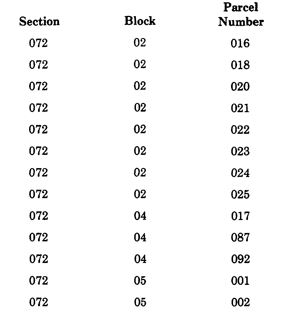
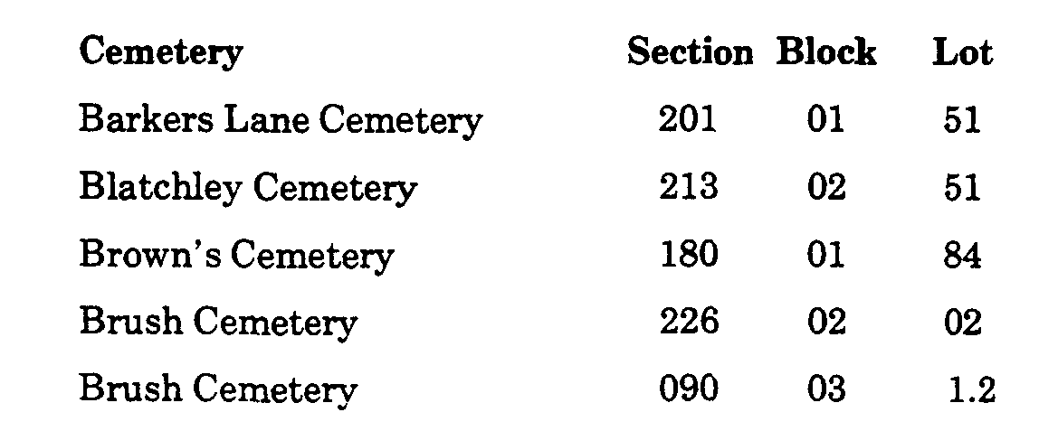
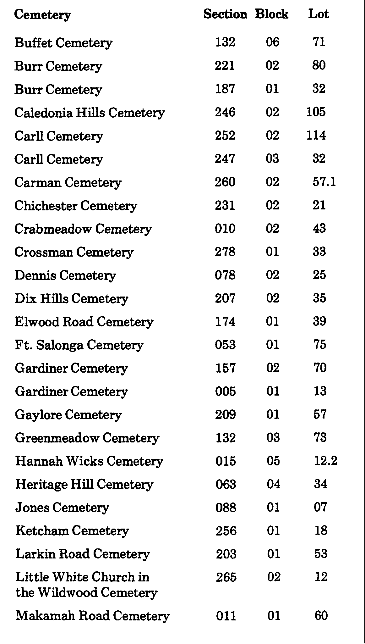
(5) [Added 7-22-80 by Ord. No. 80-ZC-94] Certain cemeteries in the Town of Huntington as more particularly described below. All sections, blocks and parcel numbers referred to herein appear on the Tax Map of the County of Suffolk and are wholly within District 0400, said map being the official Tax Map for the Town of Huntington, which is on file in the office of the Assessor of the Town of Huntington: