
The following procedures shall be observed by all applicants, developers, and their agents.�
A. The review process for the plans shall be completed within the time limits established by the Pennsylvania Municipalities Planning Code. The official date of filing (the date the time period begins) shall be consistent with the Planning Code. The applicant may agree to waive or extend the time requirement in writing.�
B. The presentation of a preliminary plan and final plan shall each be a separate submission. The maximum review period authorized by the Municipalities Planning Code may be required for the preliminary plan and final plan.�
�
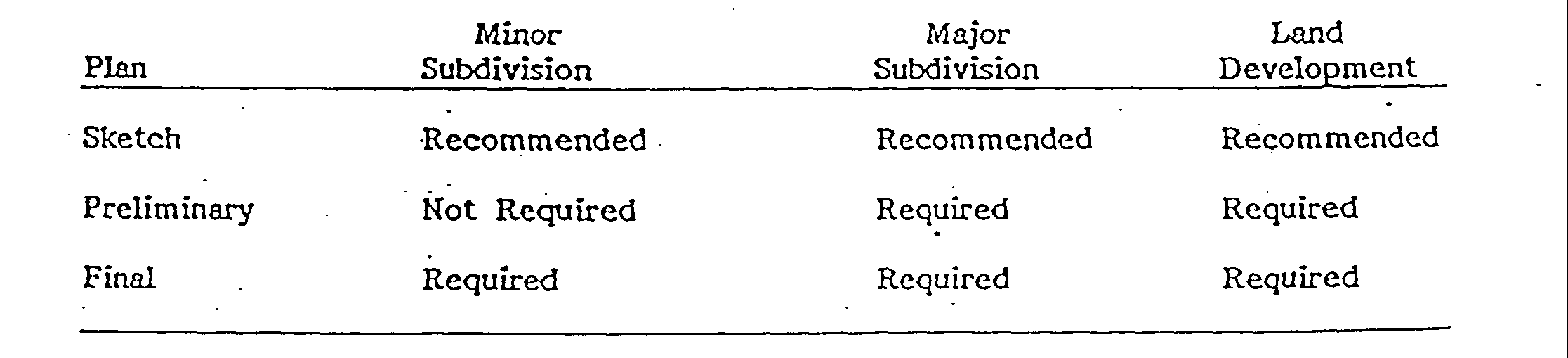
C. The submission-of a substantially revised preliminary or final plan in the opinion of the Township shall constitute a new and separate submission. A substantially revised plan must be accompanied by a complete application form. all required information and fees. With a substantially revised plan, the applicant must submit a written withdrawal of the previously submitted plan D.1 The separate stages. of approval normally require the submission of Preliminary Plans and Final Plans. These plans differ in their purpose and required level of detail. The tables below indicate the required plans for the different types of submissions.�
D. Any individual or entity submitting required plans for a major subdivision or a land development shall notify all individuals or entities who own real estate within five hundred (500) feet of the proposed major subdivision or land development of the pendency of such major subdivision or land development proposal in writing on a form approved by the Township. Such notice shall be made by regular mail to the landowner's last known address. The address on the tax rolls shall be considered the last known address. Such notice shall be mailed within five (5) days of the submission of the first required plan. Verification of mailing, including a copy of the names, addresses and tax parcel numbers of each person to whom notice was mailed, shall be given to the Township within fifteen (15) days of the submission.�
E. The owner of the -parcel of land to be subdivided or developed shall submit a Written statement granting the governing body, its authorized agents and representatives, the Planning Commission. and the representatives of the County and municipal departments and agencies having responsibility for review and/or approval under. this Ordinance the right to enter the parcel of land for the purpose of inspection and enforcement of the requirements. terms and conditions imposed herein.�
F. All plans and applications shall be submitted to the Township Secretary. Plans and applications shall not be deemed submitted until they are accepted by the Township Secretary as being in proper form and accompanied by the proper filing fee. The Township shall have the sole responsibility to forward the plans to -other reviewing agencies- Plans delivered to any reviewing agency by the owner, developer or his agent are not a basis for Township action.�
G. Plan Review By Adjacent Municipalities�
1.. Applications for tracts of land along the municipal boundary shall submit one additional set of plans which shall be forwarded to the adjacent municipality for its comments.�
2. The Township may solicit comments from an adjacent municipality even if the plan is not on the boundary of the Township, where a plan, in the opinion of the Township, affects the adjacent municipality. When comments are solicited from adjacent municipalities, the Planning Commission and the Board of Supervisors shall review the reports from the adjacent municipality as part of the plan review process.�
G. For any replanning or resubdivision of land, the same procedure, rules and regulations shall apply as prescribed herein for an original subdivision or land development.�
H. Preliminary approval of the site plan must be obtained for the entire proposed development. Final approval may be obtained section by section, but such development sections shall be specified on the preliminary plan and must be numbered in the proposed order that they are to be developed. Such order of development must be adhered to, and if changes are required, plans must be re-filed and reviewed and approved. Approved preliminary plans, however, shall be subject to changes in the Township Zoning Ordinance in accordance with the provisions of the Pennsylvania Municipalities Planning Code.�
Although it is not a prerequisite for approval of a final plan, an applicant may and is encouraged to submit a sketch plan as the basis for informal discussion. A sketch plan should bear the label "Sketch Plan" and is not an official document and involves no obligation on the part of the Township. It is strongly suggested that the applicant use the sketch plan step which will be a definite advantage to the applicant and the Township. A sketch plan will be reviewed by the township expeditiously and will not be subject to a time limit.�
A. Fee. The sketch plan step is not a formal application and, therefore, no fee is required by the Township. The Bucks County Planning Commission may also participate at the sketch plan stage. Review by the Bucks County Planning Commission does require payment of a fee.�
B. Purpose. The purpose of the sketch plan is to enable the applicant advantageously to make use of the services of the Solebury Township Planning Commission and possibly the Board of Supervisors to help him analyze the problems of the development more adequately for its sound co-ordination with the community.�
This informal discussion can simplify official actions and save unnecessary expense and delay by giving guidance to the development at a stage when potential points of difference can be more easily resolved.�
C. Application Procedure. The applicant should submit the required copies of the sketch plan and supporting information and any required application forms to the Township Secretary. (See, "SUGGESTED INFORMATION FOR APPLICANTS FOR SUBDIVISION AND LAND DEVELOPMENT")�
The Township Planning Commission shall initially review the sketch plan submission and advise the applicant how the proposed subdivision or land development may conform or fail to conform with the requirements of this Ordinance and other applicable ordinances. The applicant may attend a meeting of the Planning Commission to discuss the proposal. The Planning Commission shall communicate its comments and recommendations to the applicant by mail at the address provided on the application by the applicant.�
Similarly, the Board of Supervisors may conduct a review and discuss the plan with the applicant if requested. The review of a sketch plan is advisory only and the opinions expressed by the members of the planning commission and/or supervisors expressed during sketch plan review are not binding.�
Note: The sketch plan is not a requirement and, therefore, will not receive an official approval. The amount of scope, concept, information, etc. contained in any sketch plans submitted and reviewed by the Township must be developed in the preliminary plan stage to meet all the requirements of governing Township ordinances.�
D. Data Recommended for Sketch Plan Stage. Although the amount of information submitted at this stage is the option of the applicant, it should be recognized that well researched information can minimize expense at the preliminary plan stage and simplify the preliminary plan review.�
1. Site Survey�
a. Name of the proposed subdivision or land development or identifying title.�
b. Name and address of the owner of record and all equitable owners of the property, any authorized agent, and the applicant.�
c. Name of the surveyor responsible for the property survey.�
d. Municipality in which the subdivision or land development is located.�
e. Northpoint, date and scale (written and graphic).�
f. Tax map lot numbers.�
g. A location map for the purpose of locating the site at a scale not less than eight hundred (800) feet to the inch, showing the relation of the tract to adjoining property and to all streets, roads, zoning districts, and municipal boundaries existing within sixteen hundred (1,600) feet of any part of the property.�
h. The names of owners and tax map numbers of land immediately adjacent or across contiguous highways, streets and roads, and the names of proposed or existing subdivisions and land developments immediately adjacent or across contiguous highways, streets and roads.�
i. All existing highways, streets and roads on, adjacent to, or within four hundred (400) feet of any part of the tract, including name, right-of-way width and cartway width.�
j. All existing buildings and their uses, bodies of water, sewers, water mains, culverts, petroleum or petroleum product lines, gas lines, electric and telephone lines, fire hydrants, all other utilities and other significant man-made features on or within five hundred (500) feet of the tract.�
k. All existing property lines, easements and rights-of-way, and the purposes for which the easements have been established.�
1. Site boundaries (metes and bounds).�
m. Total acreage of the tract to the thousandth of an acre and in hundredths of square feet.�
n. List the date of all references to any subdivision or land development which increased or decreased the size of the subject tract since July 5, 1967.�
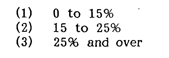
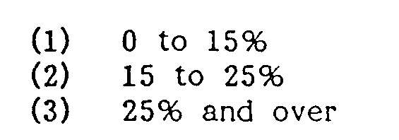
o. Existing contours at vertical intervals of two (2) feet for land with average natural slope of four percent (4%) or less, and vertical intervals of five (5) feet for more steeply sloping land.�
p. USC & GS bench mark(s) to which contours refer, including the description and location of the bench mark(s).�
q. Water supply, wells, bodies of water, sewage or sewage disposal systems on adjacent properties within one hundred (100) feet.�
2. Natural Features Map�
The following information should be shown superimposed upon a copy of the survey map.�
a. Floodplain areas.�
The portion of land, if any, within the Floodplain District of Solebury Township and the identification of the land within the Floodplain District which shall include areas subject to inundation by waters of the 100 year flood. The basis for the delineation of this District shall be the current Flood Insurance study for the Township prepared by the Federal Insurance Administration. In those areas of the Township which are not included within the aforementioned Flood Insurance Study, the Floodplain District shall be defined as that area including all soils mapped by the Soil Survey of Bucks and Philadelphia Counties, Pennsylvania, prepared by the Soils Conservation Service, as alluvial soils, including but not limited to, Alton Gravelly Loam, flooded; Bowmansville Silt Loam; Hatboro Silt Loam; Marsh; Pope Loam and Rowland Silt Loam.�
b. Floodplain soil areas�
c. Slope areas�
d. Forests�
e. Streams�
�
f. Lakes and ponds�
g. Wetlands�
h. Rock outcroppings�
i. Direction and distance to the nearest and serving sewage treatment plant(s) and information as to accessibility and capacity for this project. �
j. The boundaries of the various soil types and identification key as indicated in the Soil Survey of Bucks and Philadelphia Counties, Pa., with a description of each soil type and limitations of the soils for on-site sewage disposal.�
k. Limestone areas - See Section 4.02 D. 13.�
1. Name of the engineer or other professional person responsible for the Natural Features Map.�
3. Site Plan of Proposed Project�
a. Name of the proposed subdivision or land development or identifying title.�
b.- Name and address of the owner of record and all equitable owners of the property, any authorized agent, and the applicant.�
c. Name and address of the engineer, surveyor, architect and landscape architect responsible for the plans.�
d. Zoning requirements, including:�
i. Applicable district�
iii. Required and proposed lot sizes, yard and buffer requirements. �
iv. Required and proposed open space and impervious surface ratios.�
v. Any variances, conditional uses or special exceptions granted.�
e. A location map for the purpose of locating the site at a scale no less than eight hundred (800) feet to the inch, showing the relation of the tract to adjoining property and to all streets, roads, zoning districts and municipal boundaries existing within sixteen hundred (1,600) feet of -any part of the property.�
f. North point, date and scale (written and graphic).�
g. Total acreage of the tract in thousandth of an acre and in hundredths of square feet.�
h. Site boundaries (metes and bounds).�
i. All existing highways, streets and roads on, adjacent to, or within four hundred (400) feet of any part of the tract, including name, right-of-way width and cartway width.�
k. Site Capacity Calculations : All measurements used for these calculations shall be indicated for each resource on the Natural Features Map.�
1. Proposed general street layout.�
m. Proposed general lot layout.�
n. Types and locations of proposed buildings.�
o. Number of units of each type proposed.�
p. Open space areas. q- Recreation areas.�
r. Buffer yards. Sketches of building plans and elevations for land developments in the Highway Commercial and Residential Development Districts.�
s. A written report or narrative of the scope of the proposed project which will be used as the basis for the detailed development of the plan. The purpose of the report is to inform the Township of the intent, purpose and desire of the developer. The report would be helpful if it contained, but would not be limited to, information on the type(s) of structures, population (including age groups of occupants), water system, sewage system, surface drainage system, erosion control, recreation, rubbish handling, lighting, resource protection, landscaping, proposed type of construction and facing materials.�
A. Purpose�
The purpose of the preliminary plan stage is to ensure that the proposed subdivision or land development will be in strict compliance with the requirements of, this Ordinance and other applicable ordinances.�
B. Application Procedure�
1. The applicant shall submit the required number of copies of the preliminary plan (See "SUGGESTED INFORMATION FOR APPLICANTS FOR SUBDIVISION AND LAND DEVELOPMENTS"), and supporting information along with any required completed application forms and fees to the Township Secretary. The date of receipt shall be marked on each copy.�
2. The applicant shall submit the five (5) completed copies of the Planning Module for Land Development to supply necessary information for the�
Sewage Facilities Act (Act 537) reviewing agencies.�
3. No preliminary plan shall be accepted by the Township unless the appropriate fee in accordance with Article 10 Section 1001. (current fee schedule adopted by resolution by the Board of Supervisors) shall be paid in cash or certified check at the time of submission to the Township.�
4. The preliminary plan shall be clearly labeled as a preliminary plan.�
5. Where any revision is made, or when the plan is a revision of a previously approved plan, solid lines shall show the currently proposed features. A symbol and reference number shall identify the aspect revised on the field of the drawing. All revisions shall be noted in a revision block and listed by symbol and reference number. An explanation of each revision shall be included in the revision block.�
6. Within the review period as specified by the Municipalities Planning Code for the review process, the Board of Supervisors shall:�
b. Review the accompanying data and impact statements submitted under the requirements of Section 4.02 D.8. and prior to granting preliminary approval, specify improvements appropriate and necessary to lessen specific identified negative impacts.�
c. Review any reports submitted by the Township Planning Commission and other reviewing agencies.�
d. Listen to the applicant's presentation if requested.�
e. Render its decision in writing. It shall be sent to the applicant by mail at the address provided by the applicant on the application form. The decision shall be communicated to the applicant personally or mailed to him within the time limits as specified by the Municipalities Planning Code.�
f. When the application is not approved in terms as filed, the decision shall specify the defects found in the application and describe which have not been met and shall, in each case, cite the provisions of the statute or ordinance.�
g. Approval of the preliminary plan shall not constitute approval of the final plan or authorize the sale. of - lots or construction of buildings.�
7. When the applicant is requesting a modification to a provision or provisions of this ordinance, a written request shall accompany the plan submission. The request shall cite the section(s) of the ordinance to be modified, the extent of modification and the reasons for the modification. Refer to Section 2.00, "Hardship".�
C. Size and Scale of Plans�
1. Plans shall be drawn on sheets eighteen (18) inches by twenty-four (24) inches; twenty-four (24) inches by thirty-six (36) inches; or thirty-six (36) inches by forty-eight (48) inches. All sheets comprising a submission shall be on one size. Sheets should be large enough to clearly show all required features but at a scale not less than I" = 100'. Plans showing proposed construction such as grading, piping and road construction shall be at a minimum scale of one inch equals 50 feet. (4/l/86)�
2. The Site Survey Map. the Natural Features Map and the Site Plan shall be drawn at a scale of fifty (50) feet to one (1) inch or one hundred (100) scale shall be used for other feet to one (1) inch. An appropriate documents submitted.�
3. The submission shall include a copy of the site plan for the entire property on a single sheet at an appropriate scale that will fit the maximum sheet size submitted.�
4. The plan shall be so prepared and bear an adequate legend to indicate clearly which features are existing and which are proposed.�
5. Each sheet shall be numbered and shall show its relationship to the total number of sheets.�
D. Required Information and Documents�
1. A Certified Site Survey containing the following information shall be submitted:�
a. Name of the proposed subdivision or land development or identifying title.�
b. Name and address of the owner of record and all equitable owners of the property, any additional agent, and the applicant.�
c. Name of the professional land surveyor responsible for the property survey in accordance with Act 367 of 1979.�
d. Municipality in which the subdivision or land development is located.�
e. Northpoint, date and scale (written and graphic).�
f. Tax map lot numbers.�
g. A location map for the purpose of locating the site at a scale of not less than eight hundred (800) feet to the inch, showing the relation of the tract to adjoining properties and to all streets, roads, zoning districts and municipal boundaries existing within sixteen hundred (1.600) feet of any part of the property.�
h. The names of owners of land immediately adjacent or across contiguous highways, streets and roads, -and the names of proposed or existing subdivisions and land developments immediately adjacent or across contiguous highways, streets and roads.�
All existing highways, streets and roads on, adjacent to, or within four hundred (400) feet of any part of the tract, including name, right-of-way width and cartway width.�
All existing buildings and their uses, bodies of water, sewers, water mains, 'culverts, petroleum or petroleum product lines, gas lines, electric and telephone lines, fire hydrants. all other utilities and other significant man-made features on or within five hundred (500) feet of the tract.�
k. All existing property lines, easements and rights-of-way, and the purpose for which the easements have been established.�
1. Pursuant to Act 287 of 1974 all underground utility lines shall be shown on the plan. The type of line, the utility company owning the line, the size of the line, and the width of any right-of-way or easement shall be shown.�
m. Site boundaries (bearings in degrees, minutes and seconds and distances to the hundredth of a foot).�
n. Total acreage of the tract to the thousandth of an acre and in hundredths of square feet.�
o. List the date of all references to any subdivision which increased or decreased the size of the subject tract since July 5, 1967.�
p. Existing contours at vertical intervals of two (2) feet for land with average natural slope of four percent (4%) or less, and vertical intervals of five (5) feet for more steeply sloping land. �
q. USC & GS bench mark(s) to which contours refer, including the description and location of the bench mark(s).�
r. Water supply, wells, bodies of water, sewage or sewage disposal systems on the tract and on adjacent properties within one hundred (100) feet. For all subdivisions where the lots are to be served by other than individual wells and for a land development to be served by other than an individual well, one of the following shall be submitted prior to final plan approval:�
1) A Certificate of Public Convenience from the Pennsylvania public Utility Commission, or an application for a certificate;�
�
2) An agreement from a bona fide cooperative association of lot owners to supply water to all lots; or�
3) A commitment or agreement from the authority or utility to supply the water.�
s. Location of all existing monuments.�
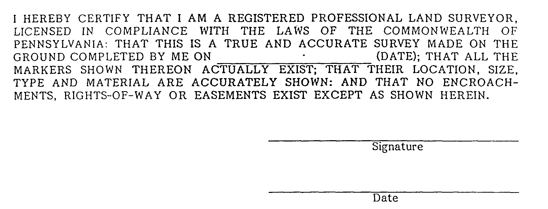
t. A certification by the registered surveyor which shall read as follows:�
2. Natural Features Map�
a. Flood Plain areas.�
The portion of the land, if any, within the Floodplain District of Solebury Township and the identification of the land with the Floodplain District which shall include areas subject to inundation by waters of the 100 year flood. The basis for the delineation of this District shall be the current Flood Insurance study for the Township prepared by the Federal Insurance Administration. In those areas of the Township which are not included within the aforementioned Flood Insurance Study, the Floodplain District shall be defined as that area including all soils mapped by the "Soil Survey of Bucks and Philadelphia Counties, Pennsylvania", prepared by the Soils Conservation Service, as alluvial soils, including but not limited to, Alton Gravelly Loam, flooded; Bowmansville Silt Loam; Hatboro Silt Loam; Marsh-, Pope Loam and Rowland Silt Loam.�
b. Floodplain soil areas.�
c. Slope areas�
d. Location of forest areas and the location of isolated trees of four (4) inches caliper or more.�
e. Streams�
f. Lakes and Ponds�
g. Wetlands�
h. Rock outcroppings�
i. Direction and distance to the nearest and serving sewage treatment plant(s) and information as to accessibility and capacity for this project.�
�
j. The boundaries of the various soil types and identification key as indicated in the Soil Survey of Bucks County and Philadelphia County, Pennsylvania, with a description of. each soil type and limitations of the soils for on-site sewage disposal.�
k. Limestone geology�
l. Name of the engineer or other professional person responsible for the Natural Features Map.�
3. Site Plan of Proposed Project�
The following information shall be provided.�
a. Name of the proposed subdivision or land development or identifying title.�
b. Name and address of the owner of record and all equitable owners of the property, any authorized agent and the applicant(s).�
c. Name and address of the engineer, surveyor, architect or landscape architect responsible for the plan.�
d. Data to show compliance with the performance standards of the zoning district of the Solebury Township Zoning Ordinance as amended.�
e. Number of lots proposed, numbered in consecutive order, proposed lot lines and dimensions, and any restrictions, covenants, etc., under which lots are to be sold.�
f. Zoning requirements, including:�
i. applicable district�
iv. required and proposed open space and impervious surface ratios�
v. any variance or special exceptions granted �
vi. minimum building setback lines (front, side, and rear) for each-lot �
vii. lot width requirements �
viii. buffer yards�
g. A restriction requiring all utilities to be underground.�
h. The location, width, length and suggested names of all proposed streets, roads, rights-of-way and easements.�
i. Location and dimension of parks, permanent open space areas, recreation areas, playgrounds, public buildings and other areas designed for appurtenant facilities, public use, or proposed to be dedicated or reserved for public use, together with the condition of such dedications or reservations. le shown:�
j. For land developments, the following shall�
i. building locations �
ii. parking facilities �
iii. service access �
iv. lighting�
v. types of buildings proposed�
vi. number of units of each type proposed �
vii. sidewalks and pedestrian walks �
viii. trash receptacles�
k. Where the preliminary plan submitted covers only part of the applicant's entire holding, a sketch of a feasible future subdivision of the unsubmitted part shall be furnished; and the street system of the unsubmitted part will be considered in the light of adjustments and connections with future streets in the part submitted.�
l. Municipality in which the subdivision or land development is to be located.�
m. Northpoint, date and scale (written and graphic).�
n. Tax map lot numbers.�
o. A location map for the purpose of locating the site at a scale not less than eight hundred (800) feet to the inch, showing the relation of the tract to adjoining property and to all streets, roads, zoning districts, and municipal boundaries existing within sixteen hundred (1,600) feet of any part of the subject property.�
p. The names of owners and tax map numbers of land immediately adjacent or across contiguous highways, streets and roads, and the name of proposed or existing subdivisions or land developments immediately adjacent or across contiguous highways, streets and roads.�
q. All existing highways, streets and roads on, adjacent to, or within four hundred (400) feet of any part of the tract, including name, right-of-way widths and cartway width.�
r. All existing buildings and their uses, bodies of water, sewers, water mains, culverts, petroleum or petroleum product lines, gas lines, fire hydrants, and other significant man-made features on or within five hundred (500) feet of the tract. Existing structures whether to remain or to be demolished, shall be shown.�
s. All existing property lines, easements and rights-of-way shall be indicated. The purpose for which the easements have been established shall be specified.�
t. Tract boundaries showing bearings and distances shall be shown.�
u. Total acreage of the tract in thousandths of an acre and hundredths of square feet shall be shown.�
w. The site capacity calculations shall be included. Al I area measurements used for these calculations shall be indicated for each resource on the Natural Features Map.�
x. Existing contours and proposed final contours shall be shown existing contours shall be shown with dashed lines and proposed contours shall be shown with solid lines.�
4. Landscaping and Grading Plan Containing the following information:�
a. Existing contours and proposed final contours shall be shown.�
Existing contours shall be shown with dashed lines and proposed contours shall be shown with solid lines.�
b. Plant materials, botanical and common names, sizes, quantities and locations.�
c. Intended treatment of all disturbed and undisturbed areas: grass seed, sod, ground cover, natural, etc.�
5. Site Utility Plan(s), Including profiles and details for the following:�
a. Sanitary sewer systems�
b. Storm water control system�
c. Water supply system�
d. Fire protection system�
e. Lighting system (no profile required)�
f. Underground electric service, telephone, gas, and cable television.�
6. Dedicated Street Plans including profiles and details.�
7. Soil Erosion and Sedimentation Control Plan and Storm Water Management Plan for the construction phase of the project.�
8. Required Data to Accompany Preliminary Plan�
a. Public Sewage Facilities if applicable. (See Section 4.02 D.12)�
b. Public Water Supply System if applicable.�
c. Traffic Impact Study (See Section 5.24)�
d. Water Feasibility Study (See Section 5.24)�
e. Methods of assuring responsibility for the maintenance of resource protection lands, open space, recreation lands, parking lots and authorized private streets. Methods of maintenance shall incur no costs to the Township.�
f. Documentation and Specifications on the plan detailing compliance with the requirements of Section 6.19 of this ordinance regarding the provision of land for recreation and/or the payment of a fee in lieu of dedicating land.�
**Webmasters Note: The previous subsection has been amended as per Ordinance No. 2000- 182.�
9. Sketches of building plans and elevations for land developments in the Highway Commercial and Residential Development Districts.�
10. A written report or narrative of the scope of the proposed project which will be used as the basis for the detailed development of the plan. The purpose of the report is to inform the Township of the intent, purpose and desire of the developer. The report shall contain but would not be limited to, information on the type of structures, population (including age groups of occupants), water system, sewage system, surface drainage system, erosion control, recreation, rubbish handling, lighting, resource protection, landscaping, proposed type of construction and facing materials, etc.�
11. A resource protection map which illustrates: (1) all natural Features required in Section 904 of the Solebury Township Zoning Ordinance and (2) a preliminary regrading plan which illustrates all disturbance of the identified natural feature areas. The amount of each natural feature disturbed shall be indicated and illustrated on the resource protection map.�
�
12. Evaluation of Sewage Facilities�
The applicant shall submit the following information for review to insure that the proposed method of sewage collection, treatment and disposal is adequate to serve the proposed subdivision or land development. The evaluation at the preliminary plan stage must establish that each proposed lot, dwelling or building will be serviced by an appropriate sewage system, thereby avoiding the necessity of major revisions of the plan at the final plan stage. For individual on-lot systems, a lot by lot evaluation is required.�
a. Procedure�
i. With the preliminary plan application, the applicant shall submit five (5) completed copies of the Planning Module for Land Development as indicated in Section 402.B.2. and any additional information required in 402.D.12.c. (4 copies for Bucks County Department of Health; I copy for Township files).�
ii. The Township Secretary shall distribute the data above to the appropriate reviewing agencies. �
iii. The Solebury Township Planning Commission and Engineer shall review any reports submitted by the appropriate reviewing agency and may include these considerations in the Commission's recommendations to the Board of Supervisors. �
iv. The Board of Supervisors shall review any reports submitted by the Planning Commission and Engineer and the reviewing agencies and may consider these in their actions on the preliminary plan application.�
v. All applicants and/or property owners must submit written documentation from the Bucks County Department of Health stating whether any existing on-lot sewage disposal system is permitted or is subject to a rural residence exemption together with their application.�
b. Carbonate (Limestone) Geology�
Proposed on-lot sewage -systems shall meet the requirements of the Bucks County Department of Health "policy and procedures, then in effect, for the issuance of on-lot sewage permits over limestone" for sites located within or within two hundred (200) feet of areas identified as carbonate (limestone)' geology in the Conservation and Management Practices for Buckingham and Durham Carbonate Valleys, February, 1985, prepared by the Bucks County Planning Commission and International Explorations, Inc regardless of lot size.�
c. Systems Consistent with Sewage Facilities Plan�
Where the proposed sewage system(s) are consistent with the Solebury Township Sewage Facilities Plan (Act 537), the applicant shall submit the Planning Modules for Land Development as a supplement to the official sewage facilities plan.�
�
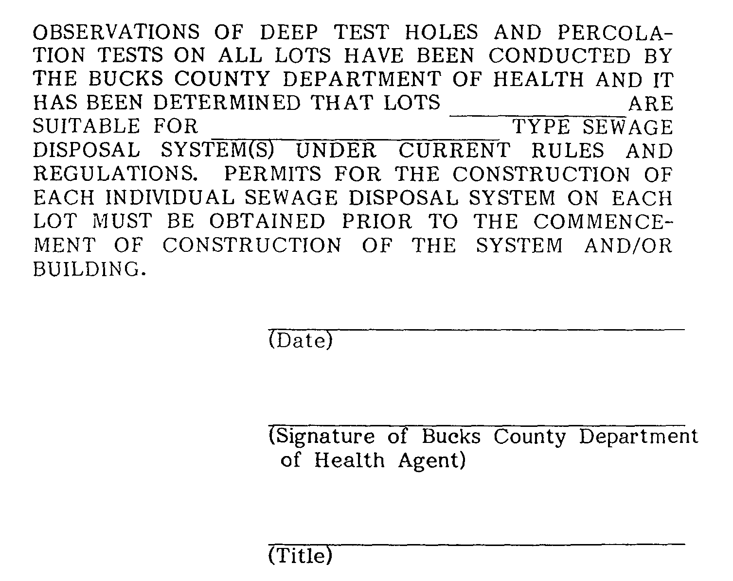
i. For on-lot systems with flows up to 10,000 gallons per day and which are not within, or within 200 feet of limestone geology as defined in b. above, the following certification shall appear on the plan, and be signed by an authorized agent of the Bucks County Department of Health.�
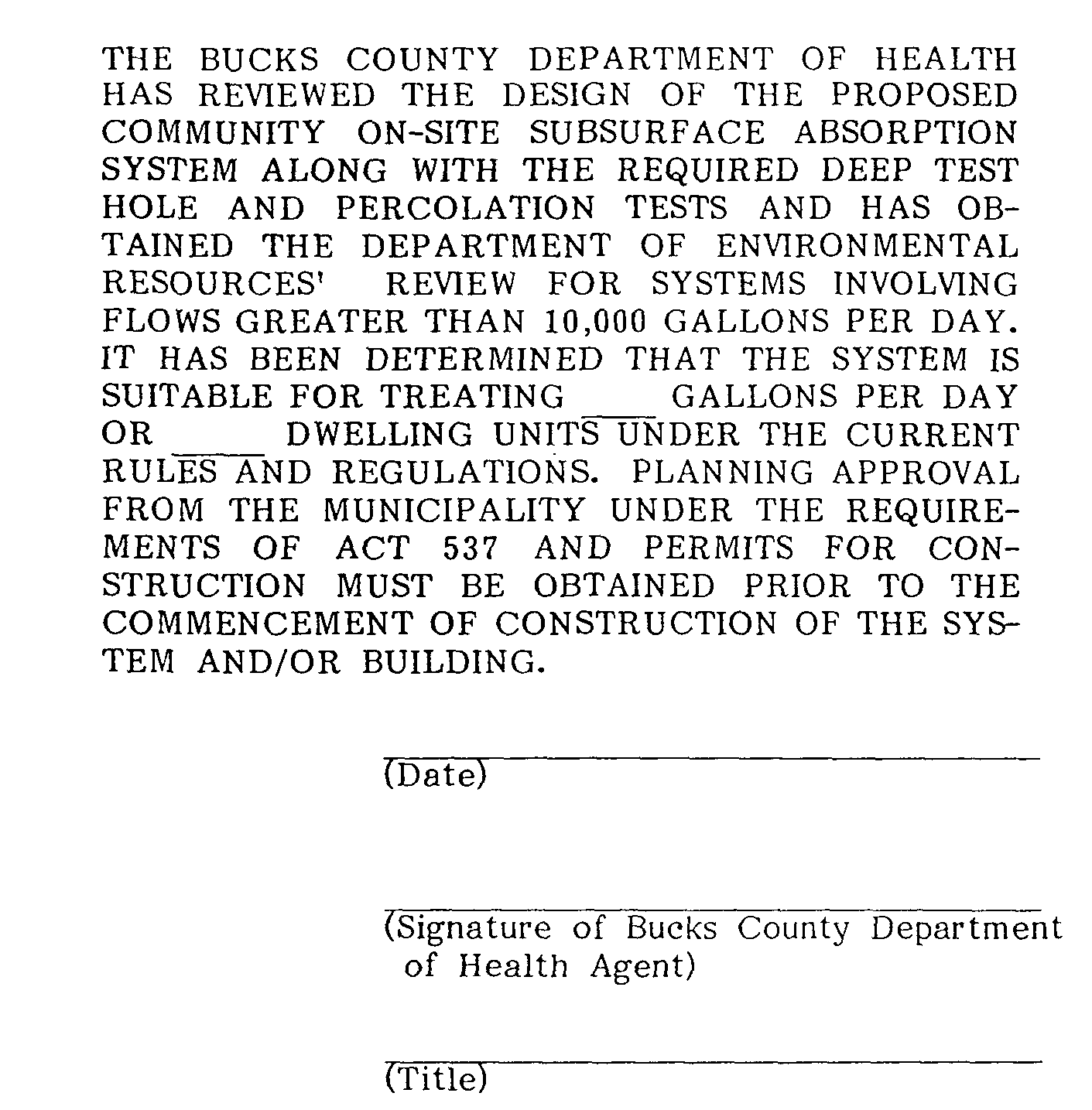
ii. For on-site systems with flows greater than 10,000 gallons per day the system must receive approval of the Planning Modules from the Bucks County Department of Health and the Pennsylvania Department of Environmental Resources. The following information shall be provided by the applicant:�
a. type of system�
b. schematic layout of system�
c. location of system�
d. capacity of system�
e. proposed maintenance of system�
f. proposed ownership of system�
h. easements relating to the system�
i. the plan shall contain a title block as follows, signed by an authorized agent of the Bucks County Department of Health.�
iii. Public collection, treatment and disposal service. The proposed system(s) must receive approval of the Planning Modules for Land Development from the Bucks County Department of Health and the Pennsylvania Department of Environmental Resources. The applicant shall. provide written certification from the servicing sewer authority that capacity will be available for the proposed subdivision or land development.�
d. Systems Not Consistent With Sewage Facilities Plan�
Where the proposed sewer system(s) are inconsistent with the Solebury Township Sewage Facilities Plan (Act 537), the applicant shall submit a request for revision to the Sewage Facilities Plan which shall include the Planning Modules for Land Development and comprehensive analysis of alternative methods of sewage collection, treatment and disposal. However, the revision will be reviewed and must be approved by the Solebury Township Board of Supervisors, Bucks County Department of Health and the Pennsylvania Department of Environmental Resources. If the revision to the sewage facilities plan is not approved as requested, the applicant shall resubmit or revise the preliminary plan proposal to be consistent with the adopted Solebury Township Sewage Facilities Plan. A comprehensive analysis of alternative sewage systems shall include, but not be limited to, the following:�
i. A detailed wastewater alternative analysis report to include, but not be limited to, the following information:�
Detailed soils investigation as it relates to the suitability of the tract of ground for waste disposal. �
ii. Detailed geologic and hydrogeologic investigations to determine the ability of the tract to supply water to the proposed development and to address the effect that the proposed wastewater facility will have on ground water.�
iii. A technical environmental and economic comparison of the following wastewater alternatives:�
a. Individual on-lot waste disposal systems�
b. Community on-lot waste disposal systems�
c. Community lagoon system with spray irrigation�
d. Package plant with spray irrigation�
e. Such other waste disposal system as the applicant proposes or the Board of Supervisors may require. �
iv. Preliminary plans of the type of systems to be utilized in the development shall be submitted.�
The preliminary waste disposal plan shall include the following information, but will not be limited to:�
a. type of system�
b. system location�
c. system capacity�
d. proposed system maintenance�
e. proposed system ownership�
f. location of all existing and proposed wells within one-quarter mile of the system�
g. schematic layout of the system�
i. easements relating to the system�
v. If the requested revision to the Solebury Township Sewage Facilities Plan is approved, the proposed sewage system(s) shall be evaluated as required by Section 402.D.12.d. of this Ordinance.�
vi. If the requested revision to the Solebury Township Sewage Facilities Plan is not approved, the proposed method of sewage collection, treatment and disposal must be changed to be consistent with the Sewage Facilities Plan and shall be evaluated as required by Section 402.D.12.d. of this Ordinance.�
13. Carbonate (Limestone) Geology�
a. Definitions�
�
�
b. For sites located within or within two hundred (200) feet of areas identified as Carbonate (Limestone) Geology in the Conservation and Management Practices for Buckingham and Durham Carbonate Valleys, February, 1985, prepared by the Bucks County Planning Commission and International Explorations, Inc. applicants shall determine the location of the following and submit a map indicating:�
i. sinkholes �
ii. closed depressions �
iii. disappearing streams �
iv. ghost lakes�
v. surface pinnacles �
vi. lineaments �
vii. -fracture traces �
viii. fissures �
ix. faults�
x. surface drainage channels �
xi. test borings, if required (see Section 5.25)�
xii. location of boundaries of carbonate geology �
xiii. all plan requirements and data required by the current Bucks County Department of Health policy and procedure for the issuance of on-lot sewage permits.�
E. Required Information for-Mobile Home Parks - In addition to the preceeding information, the following is required for an application for a mobile home park.�
1. That the parcel of lot for which application is made is held in single and separate ownership.�
2. The placement, location and number of mobile home lots and mobile home pads on a layout map of the parcel.�
3. The location and dimension of all driveways, pedestrian ways, curbs, sidewalks, and access roads with notation as to type of impervious cover.�
4. The location and dimension of all parking facilities.�
5. The location, dimensions and arrangement of all areas to be devoted to lawns, buffer strips, screen planting and recreation.�
6. Location and dimension of all buildings existing or proposed to be built and all existing forests and individual trees of over four inch caliper.�
7. Proposed provisions for handling of storm water drainage, street and on-site lighting, water supply and electrical supply in the form of written and diagrammatic analysis with calculations and conclusions prepared by a registered professional engineer.�
8. Proposed provisions for treatment of sanitary sewage together with proof that the treatment and disposal of such sewage meets with and has -the approval of the agency of the Commonwealth having jurisdiction over such matters.�
9. All open space lands shall be so designated including the responsibility for the open space on the plans. The plans shall contain the following statement: "Open space lands may not be separately sold, nor may such lands be further developed or subdivided," and 'a restrictive covenant that runs with the land in favor of the Township shall be filed.�
10. The plans shall designate the use of the open space, the type of and responsibility for maintenance to be provided, and a planting plan and schedule.�

