
A. Required documents. Prior to issuance of a certificate of completeness or scheduling of a minor site plan for consideration by the Planning Board, the Administrative Officer shall determine that the following has been submitted in proper form: [Amended 2-9-1982 by Ord. No. 2068]�
�
(1) Application for fnal approval by the Ocean County Planning Board.�
(2) Application for Dover Municipal Utilities Authority approval.�
(3) Application for a land disturbance permit.�
(4) Application for Bureau of Fire Prevention approval.�
(5) Application for a tree removal permit, where required.�
(6) Application for a floodplain encroachment permit, where required.�
(7) Application for a municipal and/or state wetlands permit, where required.�
(8) Other submittals that may be required by the Planning Board or federal, state or local law.�
(9) The application for development for a minor site plan shall include a request for the granting of any variances required or other approvals required from the Planning Board.�
(10) Required application fees.�
(11) Ten copies of a plat 'and attachments meeting the requirements set forth below. [Amended 5-22-1984 by Ord. No. 2244-84; 9-24-1996 by Ord. No. 3196-96; 12-9-2003 by Ord. No. 3843-03]�
(12) Two copies of a survey of the property in question prepared within 12 months of the application submission date. The copies shall include the signature and embossed seal of the professional land surveyor responsible for preparation of the survey. [Added 12-9-2003 by Ord. No. 3843-03]�
B. Plat requirements.�
(1) General requirements.�
(a) Any minor site plan presented to the Planning Board for its approval shall be drawn, signed and appropriately sealed by an architect, professional engineer, land surveyor and/or professional, planner licensed to practice in the State of New Jersey.�
(b) Site plans shall not be drawn at a scale smaller than one inch equals 50 feet nor larger than one inch equals 10 feet.�
(c) The site plan shall be based on a monumented, current, certified boundary survey. The date of the survey and the name of the person making same shall be shown on the map. If 12 months or more has passed since the date of (or date of last recertification of) the survey, it shall be recertified and, if necessary, brought up-to-date.�
(2) Title block. The title block shall appear on all sheets and shall include:�
(a) Title of "Minor Site Plan."�
(b) Name of the development, if any.�
(c) Tax Map sheet, block and lot number of the site, as shown on the latest Township Tax Map, the date of which should also be shown.�
(d) Date of original and all revisions.�
(e) Names and addresses of owner and developer, so designated.�
(1) Name(s), signature(s), address(es) and license number(s) of engineer, architect, land surveyor or planner who prepared the plat and their embossed seal.�
(g) If the site plan contains more than one sheet, each sheet shall be numbered and titled.�
(3) A schedule shall be placed on the site plan indicating:�
(a) The acreage of the tract and site (the portion of the tract involved in the site plan).�
(b) The floor area of the existing and proposed building, listed separately.�
(c) The proposed use or uses and the floor area devoted to each use.�
(d) The zone in which the site is located.�
(e) Proposed and required lot dimensions and front, rear and side setbacks.�
(f) Proposed and required off-street parking spaces.�
(g) Square footage and percentage of the site retained in unoccupied open space.�
(4) North arrow and written and graphic scales.�
(5) Sufficient spot elevations (United States Coast and Geodetic data) and/or contour lines to indicate the proposed system of surface drainage and the relationship of proposed grading to the land surrounding the site.�
(6) The tops of the banks and boundaries of the floodways and flood hazard areas of all existing watercourses, where such have been delineated, or the limits of alluvial soils where the boundaries of floodways and flood hazard areas have not been determined, and/or such other information as may assist the Planning Board in the determination of floodway and flood hazard area limits.�
(7) Paving and right-of-way widths of existing streets within 200 feet of the site.�
(8) The boundary, nature and extent of wooded areas, swamps, bogs and ponds within the site and within 200 feet thereof. Where required for a tree removal permit, on-site specimen trees, as defined in Chapter 471, Trees, of the Code of the Township of Dover, shall be located on the site plan.�
(9) (Reserved)�
(10) All existing structures on the site and within 200 feet, including the use thereof, indicating those to be destroyed or removed and those to remain.�
(I I) Location, use, finished grade level, ground coverage, frst floor and basement elevations, front, rear and side setbacks of all buildings and other pertinent improvements.�
(12) Existing and proposed public easements or rights-of-way and the purposes thereof.�
(13) Zone boundaries and Tax Map sheet, lot and block numbers and names of owners of all properties within 200 feet of the site.�
(14) A key map adequately showing the location of the site with reference to surrounding areas, existing streets, the names of all such streets and any zone boundary or Township boundary which is within 500 feet of the subdivision. [Amended 2-9-1982 by Ord. No. 2068]�
(15) The capacity of off-street parking areas and the location and dimensions of all access drives, aisles and parking stalls.�
(16) The location and size of proposed loading docks.�
(17) Location of curbs and sidewalks.�
(18) Cross section(s) showing the composition of pavement areas, curbs and sidewalks.�
(19) Exterior lighting plan, including the location and drawn details of all outdoor lighting standards and fixtures and a notation on the plat indicating conformance or nonconformance with the minimum design standards of the Dover Township Land Use and Development Regulations. [Amended 2-9-1982 by Ord. No. 2068]�
(20) Landscaping and screening plan showing the location, type, spacing and number of each type of tree or shrub and the location, type and amount of each type of ground cover to be utilized.�
(21) Location of signs and drawn details showing the size, nature of construction, height and content of all signs.�
(22) Drawn details of the type of screening to be utilized for refuse storage areas, outdoor equipment and bulk storage areas.�
(23) Floor plans and building elevation drawings of any proposed structure or structures, or existing structures to be renovated.�
(24) Written description of the proposed operations in sufficient detail to indicate the effects of the use in producing traffic congestion, noise, glare, air pollution, fire hazards or safety hazards. The written description of the use, the number of shifts to be worked, the number of employees in each shift, the number of vehicles to be stored or parked on the site and provisions to be made for site maintenance.�
(25) Such other information as the planning Board and/or Planning Board Engineer may request during site plan review.�
C. (Reserved)�
D. (Reserved)�
E. Conditions of approvals. Any approval of an application for development for a minor site plan granted by the Planning Board shall be subject to the following conditions being satisfied prior to signing of the site plan or issuance of a development permit: [Amended 2-9-1982 by Ord. No. 2068]�
(1) Installation and approval of, or posting of performance guaranties for the installation of, those improvements which are necessary to protect adjacent property and the public interest in the event that development of the site was not completed.�
(2) Proof of payment of any outstanding real estate taxes. [Added 6-11-1985 by Ord. No. 2329-85]�
�
(3) Ocean County Planning Board approval, if not previously granted.�
(4) Bureau of Fire Prevention approval, if not previously granted.�
(5) Dover Sewerage Authority approval or waiver of sewer requirements, if not previously granted.�
(6) Submission of additional prints of the site plan and attachments for distribution, if required.�
(7) Payment of required reproduction fee.�
(8) Filing of an appropriate instrument with the Ocean County Clerk consolidating the lots constituting the site, if required.�
(9) Publication of a notice of the decision by the applicant.�
(10) Any other conditions which may be imposed by the Planning Board or which may be required by federal, state or local law.�
(11) When improvements are required in public rights-of-way, evidence of a comprehensive general liability insurance policy in an amount not less than $300,000 per occurrence, identifying and saving harmless the Township of Dover and its agencies, employees and agents from any liability for any acts of the developer or his agents, contractors or employees in the implementing of the approved site plan. The insurance policy shall provide for 30 days notice to the Township prior to cancellation. It shall be a violation of this chapter for any property owner, developer or builder to carry on the construction of the site without having current valid evidence of insurance on file. [Added 5-22-1984 by Ord. No. 2244-84]�
F. Certification. In the event that the application for development for a minor site plan is approved, a certification to that effect in this form: [Amended 9-24-1996 by Ord. No. 3196-96]�
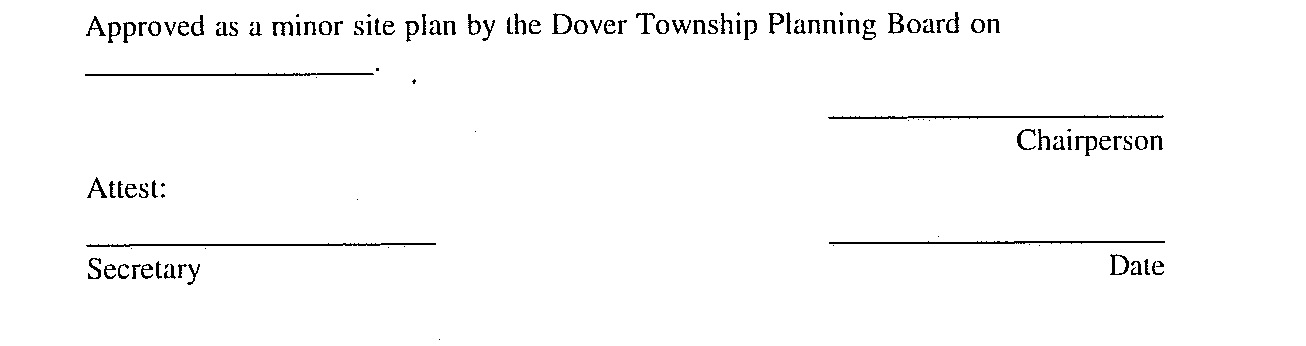
shall be endorsed on the site plan, and the original reproducible thereof shall be provided to the Planning Board by the applicant. Said original shall be signed by the Chairperson and Secretary or Assistant Secretary of the Planning Board after they receive certification from the Administrative Officer that all conditions of approval have been satisfied. After signature, the site plan shall be reproduced as provided for in § 348-6.4 of this chapter, and the signed original shall be returned to applicant.�
G. Effect of approval. The approval of a minor site plan shall expire two years after the date of approval or within such further lime as provided in accordance with § 348-3.17(2)(c), if a building permit or, where a building permit is not required, a certificate of occupancy has not been obtained. [Amended 5-13-1992 by Ord. No. 2911-92]�
A. Submission optional. Applicants are encouraged to submit a sketch plat of a major subdivision during the early design stages containing that information necessary to form a basis for discussion of alternatives for development. A detailed review of a sketch plat will minimize the necessity of major revisions in the more detailed preliminary plat submission. Application fees paid at the sketch plat submission stage will be deducted from the required application fees at the preliminary plat stage if submittal of the preliminary plat is made within one year from the date of sketch plat approval.�
B. Required documents. Prior to issuance of a certificate of completeness or scheduling of a sketch plat of a major subdivision for public hearing before the Planning Board, the Administrative Officer shall determine that the following have been submitted in proper form: [Amended 2-9-1982 by Ord. No. 2008]�
(1) Application fees.�
(2) Eight copies of a plat and attachments meeting the requirements set forth below (to the extent that the Planning Board determines such information is necessary to evaluate the proposal and discuss alternatives). [Amended 5-22-1984 by Ord. No. 2244-84; 9-24-1996 by Ord. No. 3196-96]�
C. Plat requirements.�
(1) General requirements. The sketch plat shall be based on a land survey, a deed plotting, the current Tax Map or other suitable base map and shall be drawn at a scale not less than 100 feet to the inch for subdivisions up to 100 acres in size and not less than 200 feet to the inch for subdivisions over 100 acres in size and shall show or be accompanied by the information specified below.�
(2) Title block. The title block shall appear on all sheets and shall include:�
(a) Title of "Sketch Plat-Major Subdivision."�
(b) Name of the subdivision, if any.�
(c) Tax Map sheet, block and lot number(s) of the tract to be subdivided as shown on the latest Township Tax Map, the date of which should also be shown.�
�
(d) Date of original and all revisions.�
(e) Names and addresses of owner and subdivider so designated.�
(f) Name(s), signature(s), address(es) and license number(s) of the engineer and/or land surveyor who prepared the map. The plat should bear the embossed seal of said engineer and/or land surveyor.�
(3) Detailed information.�
(a) A key map adequately showing the location of the site with reference to surrounding areas, existing streets, the names of all such streets and any zone boundary or Township boundary which is within 500 feet of the subdivision. [Amended 2-9-1982 by Ord. No. 2068]�
(b) A schedule should be placed on the map indicating the acreage of the tract, the number of lots, the zone, the minimum required lot areas, setbacks and dimensions.�
(c) Zone boundaries, Tax Map sheet, lot and block numbers and property lines of parcels within 200 feet of the land to be subdivided, including properties across the street, as shown by the most recent records of the Township, or of adjoining municipalities.�
(d) All existing streets, watercourses, floodplains, floodways and flood hazard areas within the proposed subdivision and within 200 feet of the boundaries thereof, both the width of the paving and the width of the rights-of-way of each street, existing public easements and Township borders within 200 feet of the subdivision.�
(e) All existing structures, an indication of those which are to be destroyed or removed, and the front, rear and side yard dimensions of those to remain.�
(f) The boundaries, nature and extent of wooded areas and the location of any other significant physical features, including swamps, bogs and ponds, within the proposed subdivision and within 200 feet thereof.�
(g) The layout of the proposed subdivision drawn in compliance with the provisions of this chapter.�
(h) All existing and proposed public easements or rights-of-way and the purposes thereof, and proposed streets within the proposed subdivision. The proposed streets shall show the right-of-way width(s).�
(i) If known, the maximum anticipated extent of the areas of excavation or embankment where any grade changes are proposed, including those for streets.�
(j) The existing directions of surface flow and the system of drainage of the subdivision and of any larger tract of which it is a part, together wit; information on how it is proposed to dispose of surface drainage.�
(k) The acreage of the drainage area or areas of each natural or man-made watercourse traversing the subdivision, including the area within the subdivision and the area upstream from the subdivision.�
(l) The locations of all stakes, if any, placed on the property to aid in on-site inspections.�
(m) North arrow.�
(n) Written and graphic scales.�
(o) The preliminary utility layouts showing the methods of connection and the courses of service.�
(p) Existing five-foot (or less) interval contours based on United States Coast and Geodetic Survey data (MSL=0) shall be shown extending a minimum of 100 feet beyond the boundary of the tract in question and shall be certified by a New Jersey licensed surveyor or professional engineer as to accuracy, except that where the slopes exceed 5%, a ten-foot interval may be used, and if the slopes exceed 10%, a twenty-foot interval is permissible. The source of elevation datum base shall be noted.�
(q) Such other information as the Planning Board Engineer or Planning Board may require or request.�
D. Conditions of approval. Any approval of an application for a sketch plat of a major subdivision granted by the Planning Board shall be subject to the following conditions being satisfied prior to signing of the plat:�
(1) Payment of required reproduction fee.�
(2) Submission of additional prints of the plat map and attachments for distribution, if required.�
(3) Any other conditions which may be imposed by the Planning Board.�
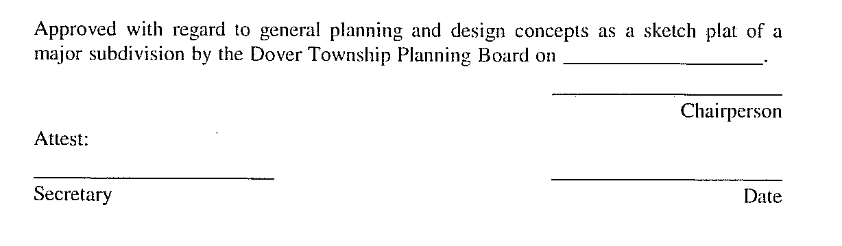
E. Certification. In the event that the application for development for a sketch plat of a major subdivision is approved, a certification to that effect in this form: [Amended 9-24-1996 by Ord. No. 3196-96]�
�
shall be endorsed on the sketch plat, and the original reproducible thereof shall be provided to the Planning Board by the applicant. Said original shall be signed by the Chairperson and Secretary or Assistant Secretary of the Planning Board after they receive certification from the Administrative Officer that all conditions of approval have been satisfied. After signature, the sketch plat shall be reproduced as provided for in § 348-6.4 of this chapter, and the signed original shall be returned to the applicant.�
F. Applicant's rights upon approval. Approval of a sketch plat shall confer upon the applicant, for a period of one year following the date of sketch plat approval by the Planning Board, the right to submit an application for development for a preliminary plat conforming to the approved sketch plat.�

