
[Amended 11-13-2001 by Ord. No. 2001-7; 10-2-2002 by Ord. No. 2002-5; 3-8-2006 by Ord. No. 2006-5; 3-8-2006 by Ord. No. 2006-6; 12-13-2006 by Ord. No. 2006-15] �
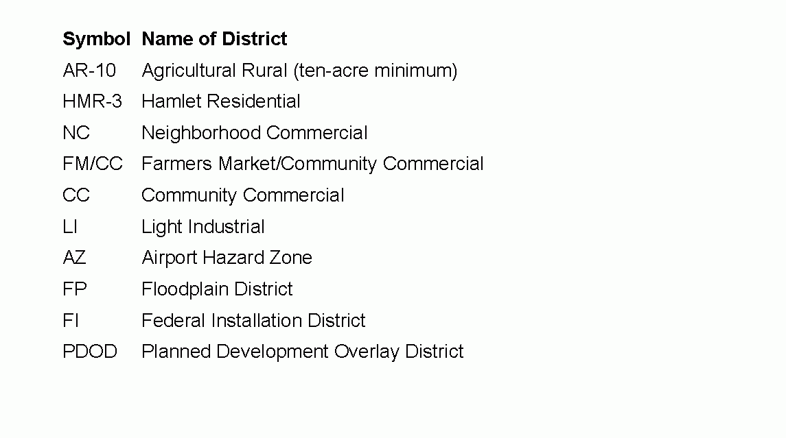
For the purpose of this chapter, the Township of Springfield is hereby divided into eight districts as follows: �
A. Adoption of Zoning Map. The areas within the Township limits as assigned to each district and the location of boundaries of the districts established by this chapter are shown upon the Zoning Map entitled Zoning Map, Springfield Township, Burlington County, dated November 2006, which map is a part of this chapter. The Zoning Map shall be kept on file with the Township Clerk. [Amended 11-13-2001 by Ord. No. 2001-7; 10-2-2002 by Ord. No. 2002-5; 3-8-2006 by Ord. No. 2006-5; 12-13-2006 by Ord. No. 2006-15] �
B. Boundary lines dividing lots. When a district boundary line, other than one located in a street, avenue, road or railroad right-of-way, divides a lot existing on September 1, 1988, the regulations and restrictions applicable to the less restricted district in which a portion of such lot is located shall apply to the portion of such lot located in the more restricted district for a distance of not more than 50 feet beyond such district boundary line. �

