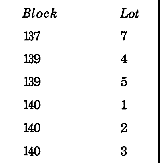
�
The location and boundaries of the districts are hereby established as shown on the document entitled, "Zoning Map of the Township of Mahwah, Bergen County, New Jersey, prepared by Lawler, Matusky & Skelly Engineers, dated March 14, 1995," which Zoning Map is hereby made a part of this Chapter. The map and all notations, references, and designations shown thereon shall be, and such, a part of this Chapter as if the same were all fully described as set forth herein.�
a. The Zoning Map of 1995 is deemed amended so that the following described property is rezoned from the R-80 Zone into the R-40 Zone:�
Description: All of lots 51, 54, 56, 57, 59 and 61 as shown on the Preliminary Subdivision Map of Darlington Assoc., Inc. entitled "General Plan of Rio Vista Mahwah" October 23, 1984 revised to March 27, 1986, Sheet 3 of 45.1�
b. The IP-120 zone district boundaries of the west side of Route 17 shall be enlarged to include all lots on the west side of Route 17 located in the GI-80 zone district at the time of adoption of this Ordinance. It is the intent of this paragraph to exclude General Industrial uses on the west side of Route 17.�

c. Lot 145 and Lot 146 in Block 1 presently in the POS Zone are rezoned in their entirety into the C-200 Zone District.�
d. Lot 109 in Block 40 (formerly Lot 19F in Block 45) and Lot 106 in Block 40 (formerly Lot 19 in Block 45) shall be in the R-5 Single Family Residential Zone District.�
e. Lot 107 in Block 40 (formerly Lot 19K in Block 45) and Lot 108 in Block 40 (formerly Lot 19B in Block 45) shall be in the B-10 Neighborhood Business Zone District.�
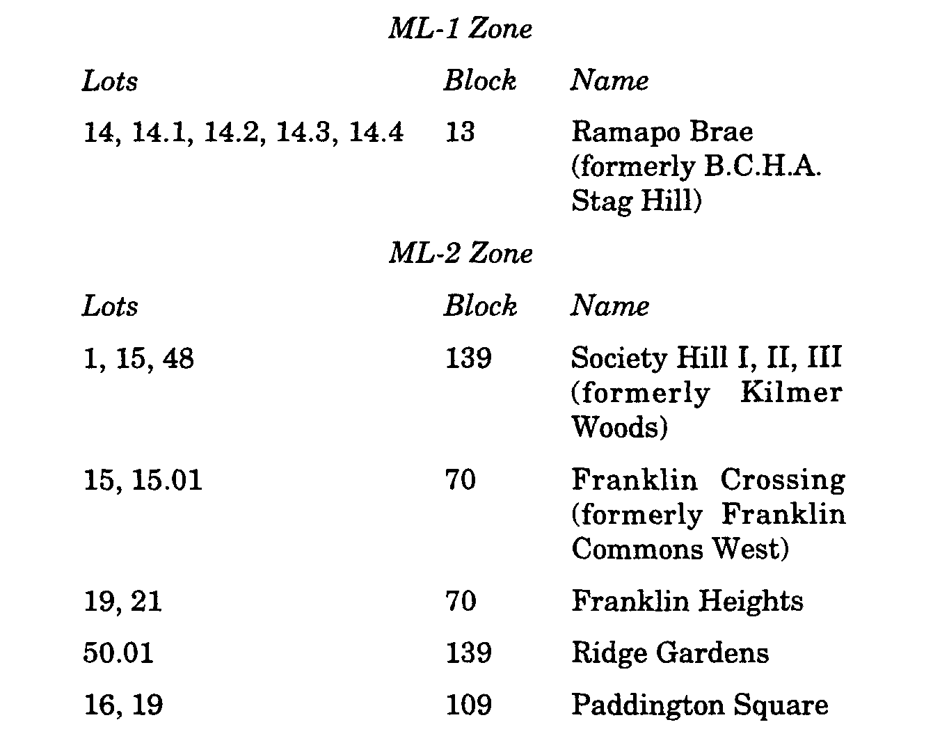
f. The following properties are in the ML-1 and ML-2 zones.�

g. The properties described as Block 183, Lot 1 and Block 26, Lots 10 and 11 located between the OP-200 Zone District, commonly referred to as the Crossroads property, and the Ramapo River is hereby redesignated in its entirety into the OP-200 Zone District.�
�