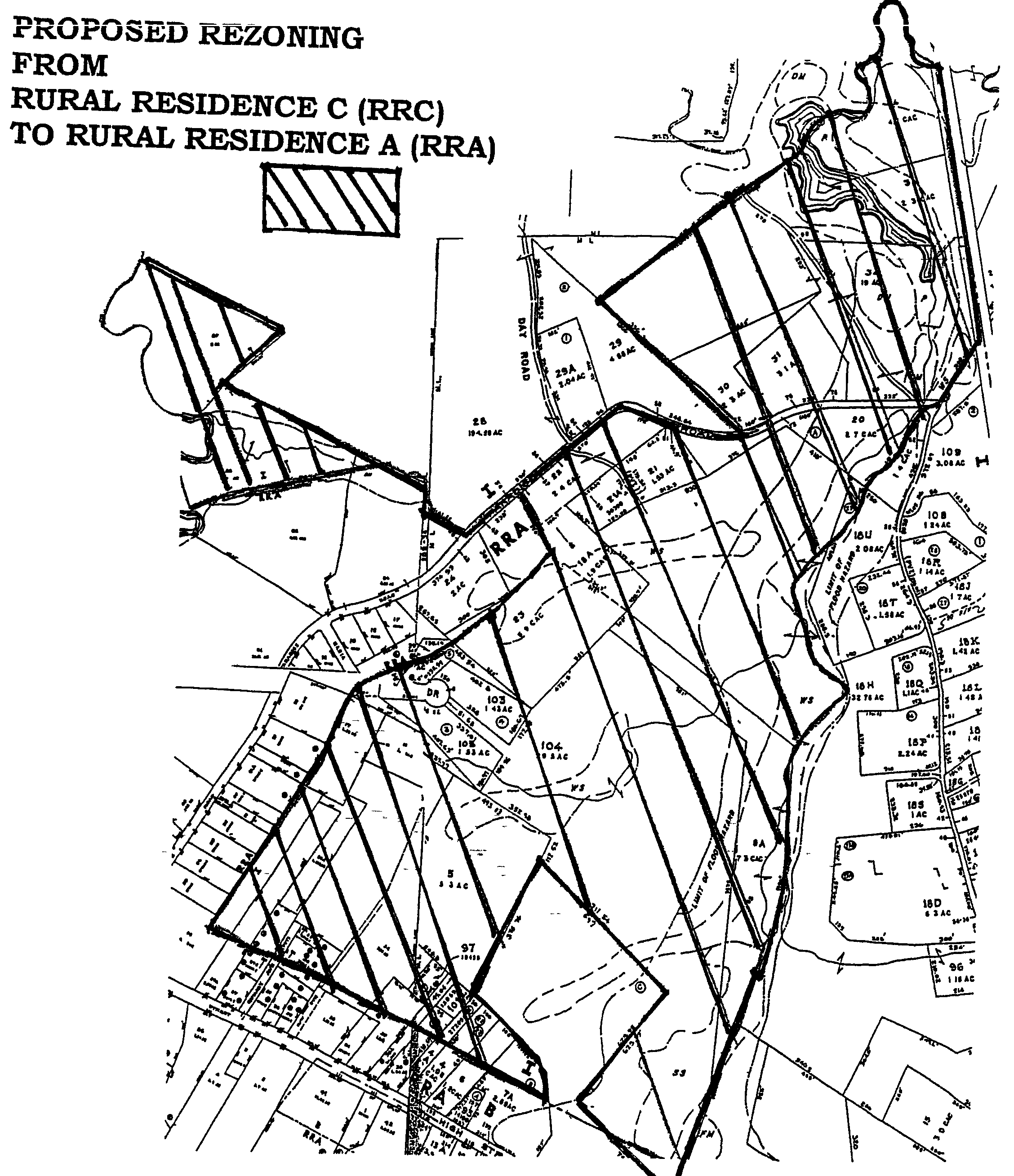
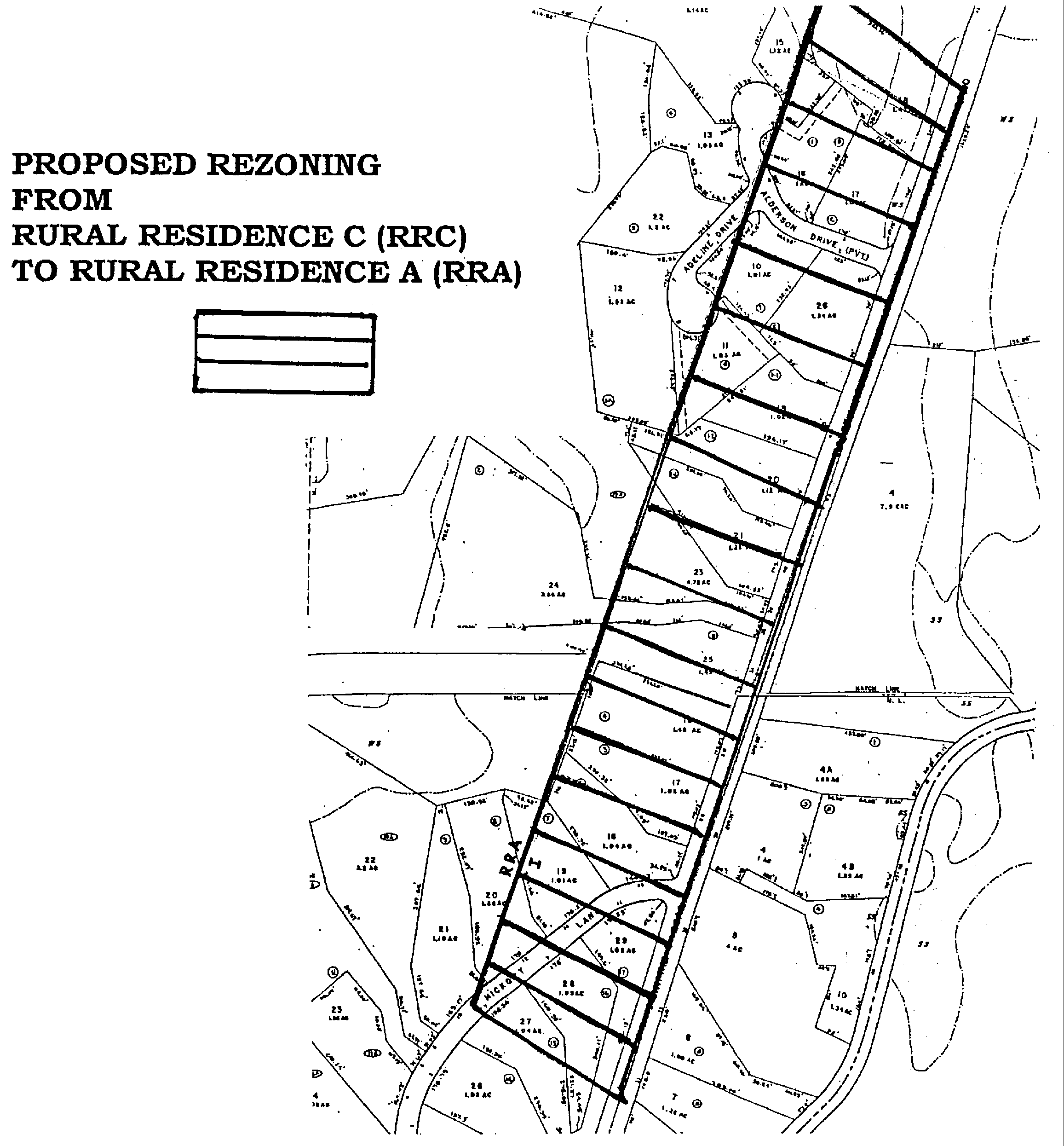
Rezoning all property located within the "Rural Residence C (RRC) District" to the "Rural Residence A (RRA) District", with the exception of four parcels identified as Lot 39 on Assessor's Map 13, and Lots 28, 29 and 29A on Assessor's Map 21, which shall remain in the RRC District; and�
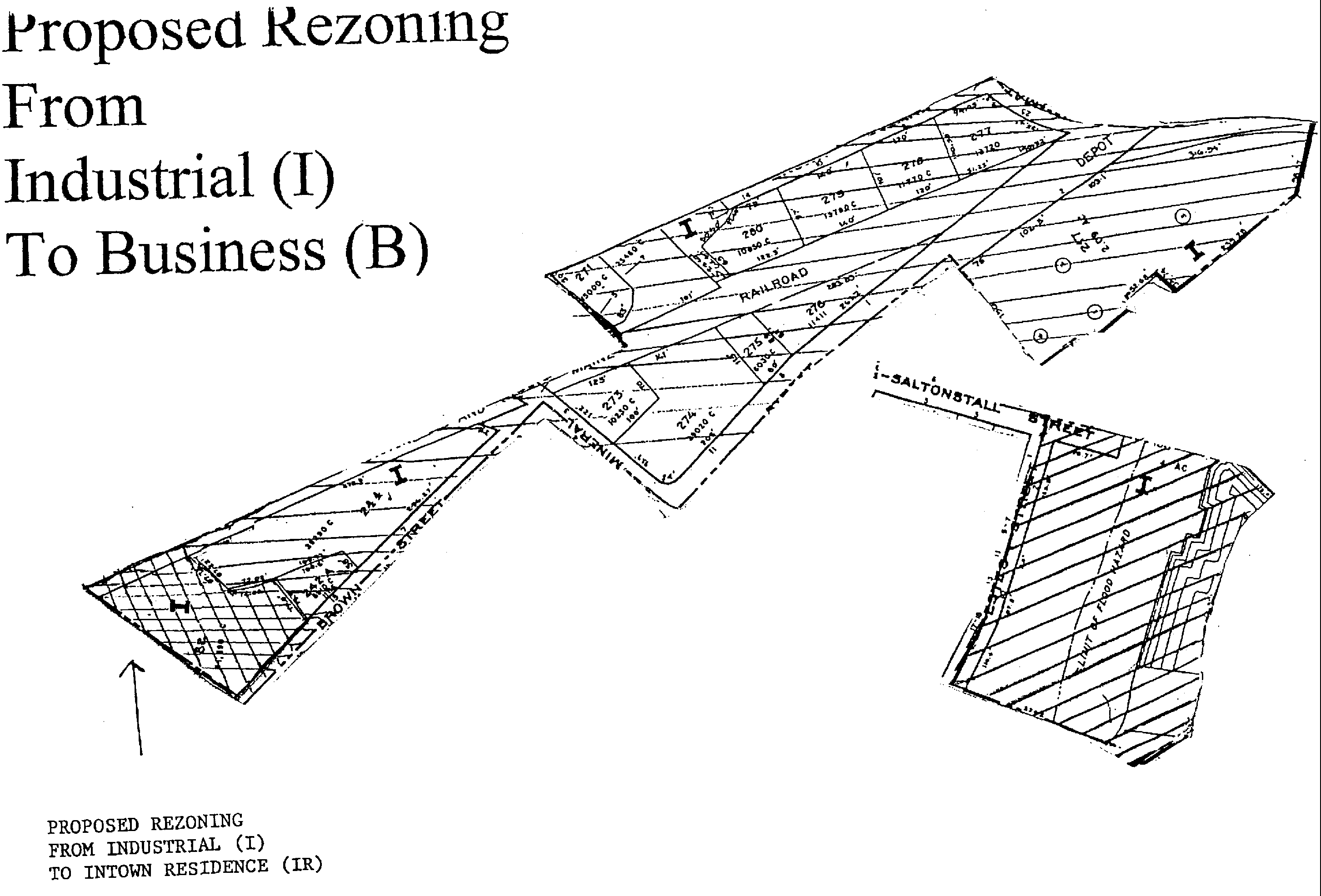
Rezoning the following areas from Industrial (I) to Business (B)�
The area beginning at the intersection of Saltonstall Street and Estes Street; thence southerly along Estes Street; thence easterly along southern-property line of Lot 186; then northerly along the Ipswich River, then westerly along the Sylvania Dam; thence westerly through Lot 186, thence westerly along Saltonstall Street, as shown on the map on the following page: said area is further defined as a portion of lot 186 on Assessor's Map 42A; and�
The area beginning at the intersection of Hammatt Street and Brown Square, thence westerly along Brown Square, to property line of Lot 270, thence southerly along the property line between Lots 270 and 271, thence westerly along Boston and Maine railroad way, thence southerly along western boundary of Lot 82, thence easterly along Brown Street, thence southerly along Mineral Street, thence easterly along Washington Street, thence southerly along property line between Lots 217 and 218; thence easterly along property line of Lots 203 through 207, and Lot 215, thence westerly along railroad way, through Depot Square; thence westerly along Hammatt Street, as shown on the map on the following page, said area is further defined as including the entirety of Lots 217, 242A, 244, 273--280, and portions of Lots 271, 272, and 281, Assessor's Map 41B, and�
Rezoning a portion of Lot 82 on Assessor's Map 30D from Industrial (I) to In-town Residence (IR), as shown on the following page: �
or to take any other action relative thereto. (Sponsor: Planning Board) �